May 2024

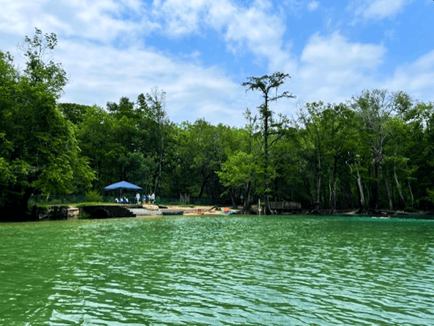
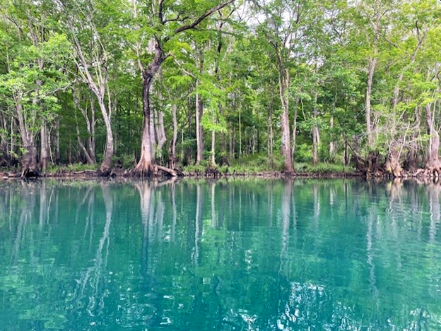
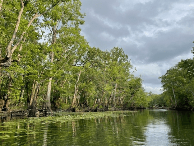
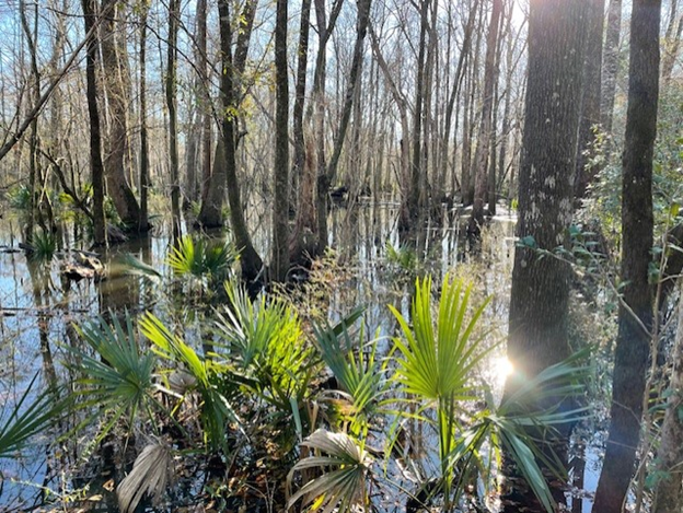
Holmes Creek in May.
The Holmes Creek springs were small but lovely, with startling shades of bright blue at each of their headsprings. The three springs that I visited on Holmes Creek were smaller than some of the other springs that I visited in other areas. Cypress and Beckton are second magnitude (2nd magnitude = discharge less than 65 million gallons/day) and Brunson Landing is third magnitude (3rd magnitude = discharge less than 6.5 million gallons/day). I also visited the third magnitude Hightower Spring just before dusk on my first day in the panhandle, but the water clarity was super low and my cameras were dying. Perhaps I will visit again someday. There are no first magnitude springs that I know of on Holmes Creek.
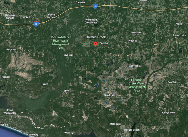
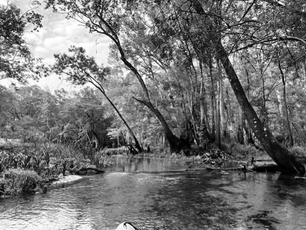
Holmes Creek is a tributary of the Choctawatchee River and flows into it from the east. Originating far to the north in Alabama, it meanders through agricultural land until it reaches the Choctawatchee. Springs dot the reach on either side of Vernon.
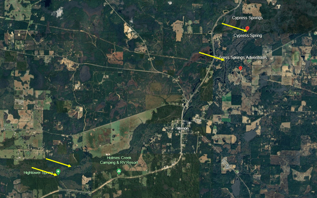
Google Earth images showing the landscape around Holmes Creek (top) and the locations of the springs that I visited (bottom). In north to south order, these springs were Cypress, Beckton, Brunson Landing, and Hightower.
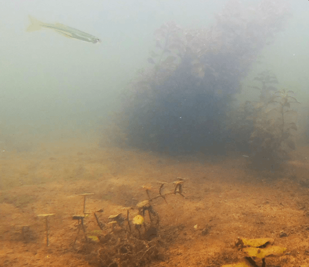
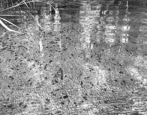
When I tried to visit the springs in February, all of the springs were the same shade of muddy brown. I think that I could have paddled through the forest to reach them. The water was so high that I think that Holmes Creek was continuous with the parallel-running Cypress Spring. I found the spring only by using the satellite feature on my phone and then finding the disturbance of the boil.
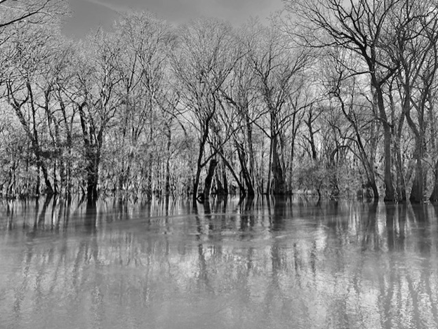
Cypress Spring in February with no shoreline due to flooding. The darker areas represent shadows from the trees as the water was all brown. The water appeared to be continuous with Holmes Creek.
Cypress Spring
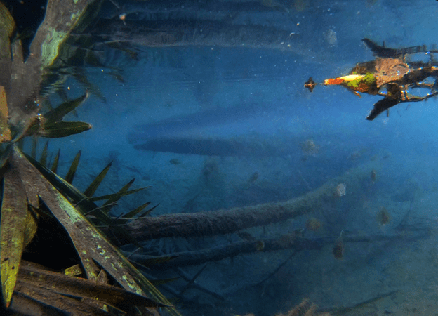
When I returned in May, I tried to visit Cypress Spring on a nice sunny afternoon. I was excited to see it as I had heard that the DEP uses it as their “low algae” site, so I was anticipating a lovely run. I floated down Holmes Creek from the Cotton Landing Recreation Area boat ramp and as I turned the corner to go up the run, I realized that I was headed straight for a powerboat parked in the run with people standing around it. A powerboat (and a party) might scare off the fish, so I decided to come back early the next morning. I returned after a storm passed through the area in mid-morning and I was happy to see that there were only four young adults swimming and enjoying the beauty of the headspring. The large, cobalt blue vent was glorious.

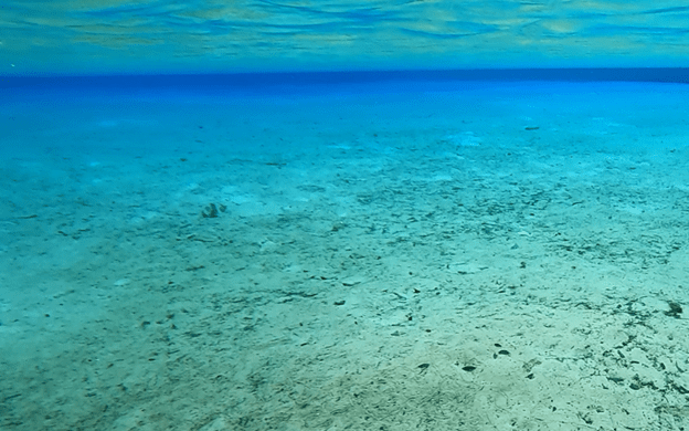
The Cypress Spring headspring.

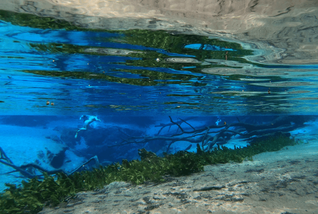
Underwater views of the main vent.
However, there were virtually no fish. The evidence of the heavy use of the spring was visible by the degraded bank and the wide expanses of sand on the bottom of the run. At the headspring, I only managed to film many fish (mostly shiners) in a spot tucked behind a tree. Some sunfish also milled around the underwater logs.
An ecotour outfit was setting up a tent and chairs for their clients who were paddling up later.
Wide expanses of sand on the bottom of Cypress Spring run (top), interspersed downstream with patches of plants littered with snails (bottom).
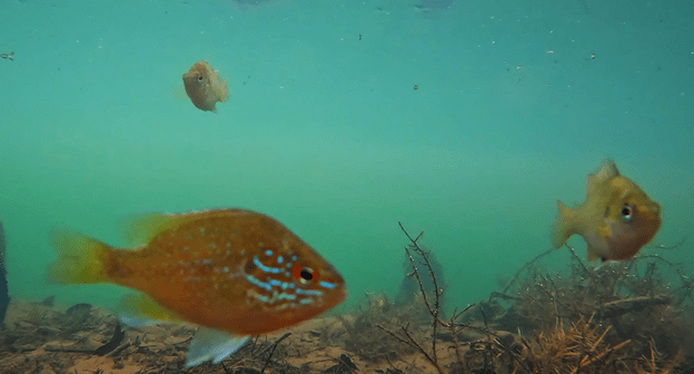
Downstream the water clarity declined, with stripes of murky brown parallel to the banks, perhaps due to the large storm the day before. However, I was still able to see some sunfish, a couple of largemouth bass (Micropterus salmoides), two species of shiners (likely redeye chub, Pteronotropis harperi, and weed shiners, Notropis texanus), a golden silverside (Labidesthes vanhyningi), and a blackspotted topminnow (Fundulus olivaceus).
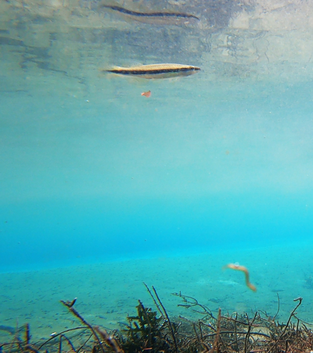
Shiners (top), a golden silverside (middle), and a blackspotted topminnow (bottom).
I also found a very cute turtle and a very healthy snail population.

Juvenile yellow belly slider (Trachemys scripta scripta).
A snail (Elimia sp.) feeding on algae and invertebrates growing on a leaf (at 2000x speed).
Becton/Beckton Spring
*I am not actually sure how this spring’s name is spelled as I have seen it both ways.*
When I got skunked by the large number of visitors at Cypress Spring, I decided to float down to Beckton Spring instead. Although I have read that this spring also can be popular, happily I was the only visitor that afternoon. Beckton sported a slightly more turquoise blue than Cypress Spring, but the water clarity at the headspring was much lower and sadly I was unable to see its vent in person or on video. However, Beckton Spring had nice beds of submerged plants and loads of snails.
Beckton headspring.
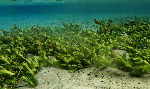
Healthy submerged plant populations in Beckton Spring.
Snails (Elimia sp.) and snail trails in the sand at Beckton Spring.
Along with a lot more submerged plants in the run, there appeared to be more fish at Beckton Spring than at Cypress Spring. Not surprisingly, there was some overlap between the species that I observed, given the close proximity of the two springs. I recorded a variety of sunfish, including some pretty dollar sunfish (Lepomis marginatus). In addition to the two shiner species that I saw at Cypress Spring (likely redeye chub and weed shiners), I observed some sailfin shiners (Pteronotropis hypselopterus) and another blackspotted topminnow at Beckton. And, of course, mosquitofish (Gambusia holbrooki) are everywhere.


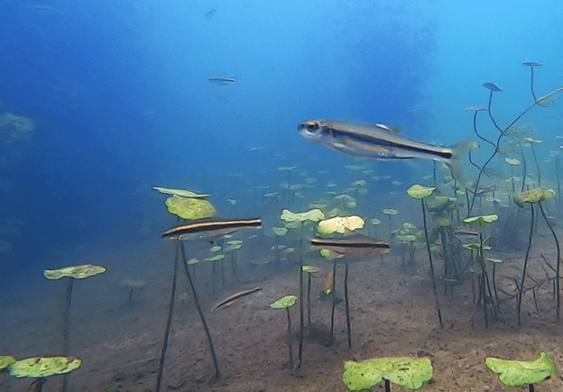
A dollar sunfish with spotted sunfish (Lepomis punctatus, top), a (likely) weed shiner with two sailfin shiners (middle), and a blackspotted topminnow (bottom). It is funny that this screenshot is very similar to the one that I took of a topminnow at Cypress Spring, but then topminnows typically cruise just under the surface of the water–hence the name.
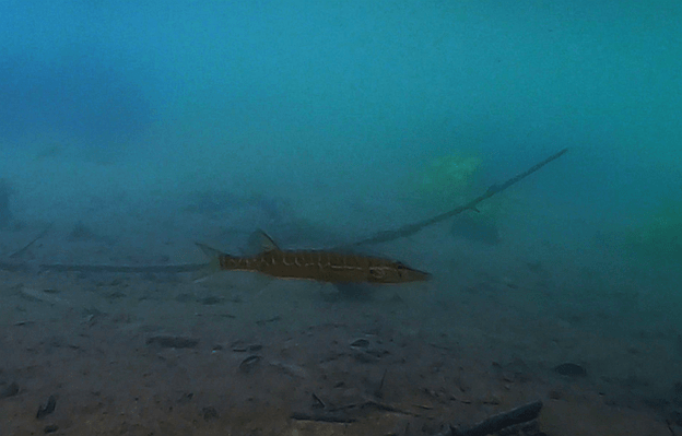
Beckton also had a narrow, shallow, sandy side channel that provided me with an individual from one of my favorite groups of fish: darters. I really want to label this one as a brown darter (Etheostoma edwini), but it is hard to see, so we will just call it Etheostoma.
The shallow side channel of Beckton Spring. The large headspring is upstream and off to the left.
A darter in the shallow, sandy, fast-flowing side channel of Beckton Spring.
I also met this nice juvenile southern water snake (Nerodia fasciata). It gave me a lot of time to get a camera in the water, watching me closely the entire time, but I flailed around too long trying to get close enough in the flow without scaring it with the paddle and it swam away–alas.
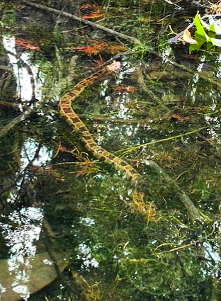
A southern water snake that gave up waiting for me.
Brunson Landing Spring
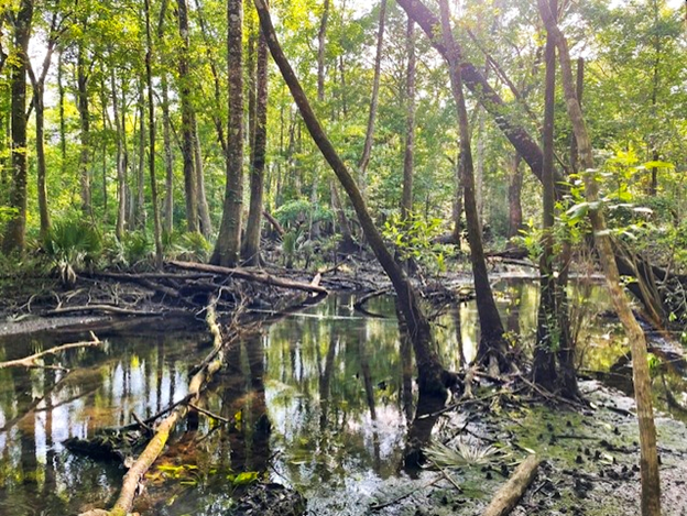
Brunson Landing was actually the first spring that I visited on both trips to the panhandle. On my first trip, in February, I pulled up late in the afternoon to a brown, fast-flowing Holmes Creek at the Brunson Landing boat ramp. I popped my boat in the water and promptly floated right past the entrance to the spring. It was so flooded back into the trees that it was impossible to see where the spring joined the creek. A couple of people in the parking lot clued me onto the existence of a trail to the spring, but even when I followed the obvious trail, I was unable to find the spring under the brown water.
Flooded forest in the vicinity of Brunson Landing Spring. The water was so high that I could not find the spring.
Upon my return in May, my short hike through the forest rewarded me with a gorgeous little gem in the forest. It seemed like the land just dropped away to produce this deep blue hole.
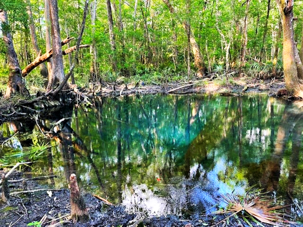
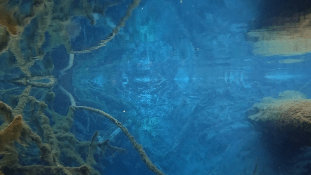
Brunson Landing headspring, both above (top) and below (bottom) the surface of the water.
The relatively deep headspring (~15 ft) led to a shallow little run that flowed into Holmes Creek. Perhaps because the run was so shallow just downstream of the headspring, there were few fish in my first couple of attempts at filming.

Brunson Landing run just downstream of the headspring above water (top) and below water (bottom).
A second small vent had more fish, but the diversity still was low and the view was a bit murky.
Brunson Landing second vent downstream of the main vent.
Close to the confluence of the spring with the river, however, I found a fair number of fish, even with the low water clarity. Several of these fish near the creek were piscivorous (fish eating): chain pickerel (Esox niger), bowfin (Amia calva), and largemouth bass (Micropterus salmoides).
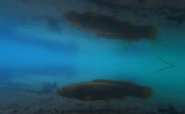

Several predatory fish near the confluence of Brunson Landing Spring with Holmes Creek: chain pickerel (top), bowfin (middle), and largemouth bass (bottom) with a spotted sunfish behind it.
Video of the cool undulating motion of a bowfin’s dorsal fin as it cruises down the Brunson Landing run toward Holmes Creek.
A tiny loggerhead musk turtle (Sternotherus minor) also passed in front of one of my cameras down near the confluence of the spring and the creek.
Loggerhead musk turtle living its life: swimming and crawling near the confluence of Brunson Landing Spring and Holmes Creek.
Like the other panhandle springs, I had trouble finding much water quality data for the Holmes Creek springs, even though I had heard that DEP has sampled at Cypress Spring. As expected, I saw little algae in the spring, but I also saw power boats zooming up and people standing in the run, all of which can dislodge algae and plants. I found some USGS data from the mid 2000s (https://waterdata.usgs.gov/nwis) that indicated that the Cypress spring discharge ranged from 75 to 95 cfs (making it just shy of a first magnitude spring). I also found some water quality data on the same site from 1972 and 1985 that suggested that the spring was on the cold side (20.5-21oC), with moderate dissolved oxygen (4.1-4.8 mg/L) and low conductivity (195-210 microS/cm) and nitrate concentrations (0.22 mg/L). A NWFWMD report that I found from 2006 (https://www.nwfwater.com/content/download/1340/11594/WRSR-2008-01.pdf) gave similar results: temperature = 20.4oC, dissolved oxygen = 4.72 mg/L, and conductivity = 220 microS/cm. These data are comparable to the data that I collected at the headspring: temperature = 20.6oC, DO = 4.98-5.31 mg/L, and conductivity = 226 microS/cm.
A water quality report from the Cypress Springs Utility District for 2023 (https://cssudpay.com/water-quality-report) suggested that the nitrate concentration has come up since 1985 (0.387-0.479 mg/L). This report attributed the nitrate contamination to fertilizer runoff, leaking septic, sewage, and erosion from natural deposits. Sounds about right.
The discharge and water quality data for Becton/Beckton Spring were even more scarce. I found data from one year (1972) on the USGS site for Becton/Beckton Spring. Those data suggested that Beckton had 1/3-1/2 the discharge of Cypress (33.2 cfs) and that it also was on the cold side (21.5oC), with low dissolved oxygen (2.5 mg/L), conductivity (275 microS/cm) and nitrate concentrations (0.2 mg/L). The NWFWMD document reported similar results: temperature = 20.8oC, dissolved oxygen = 4.01 mg/L, and conductivity = 271 microS/cm. My data suggested that the spring may have been a tad warmer and more oxygen-rich on my visit than in 1972: temperature = 22.8oC, DO = ~6 mg/L, and conductivity = ~240 microS/cm, all at the headspring. I suspect that the nitrate concentrations might be a little higher now, as appears to be the case in Cypress Spring.
Finally, there were no USGS data for Brunson Landing Spring. The NWFWMD document reported that the discharge = 5.86 cfs, temperature = 20.8oC, dissolved oxygen = 2.36 mg/L, and conductivity = 219 microS/cm. My data collection produced a similar temperature (20.9oC) and conductivity (~ 220 microS/cm), but lower dissolved oxygen (1.04-1.54 mg/L) at the headspring than the NWFWMD report.
