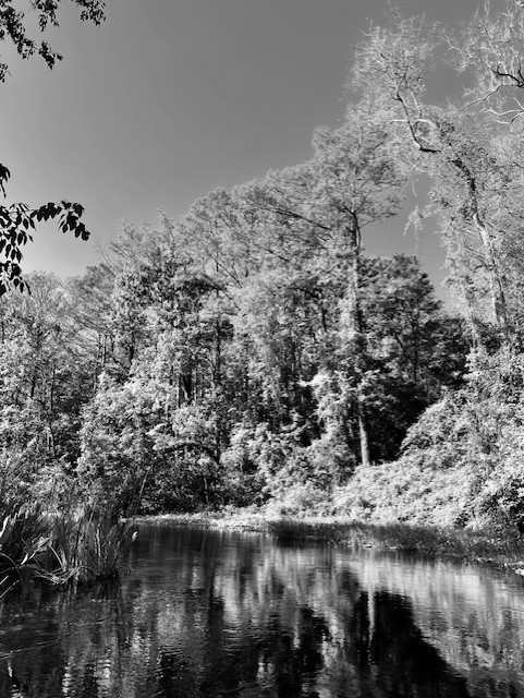
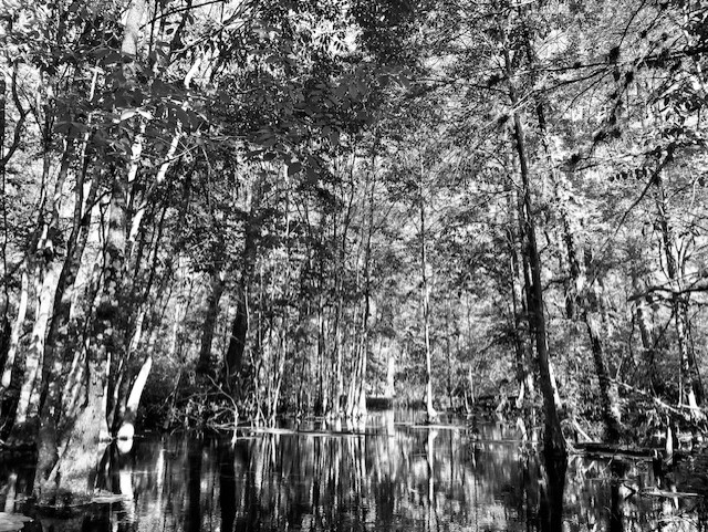
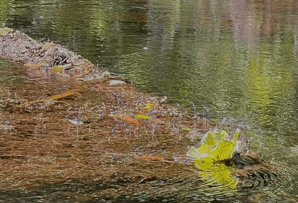
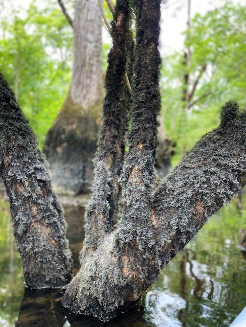
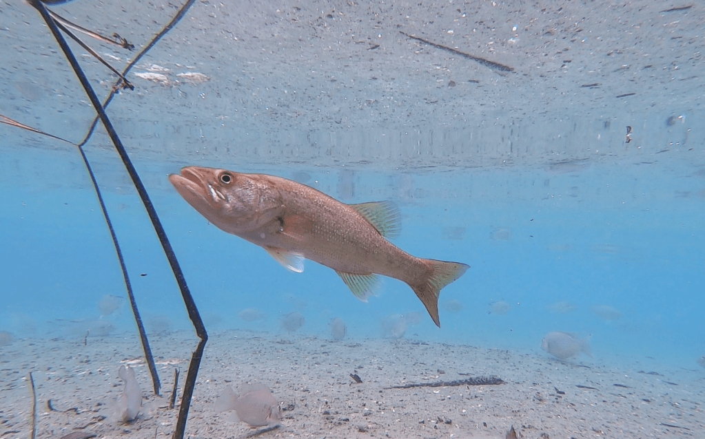
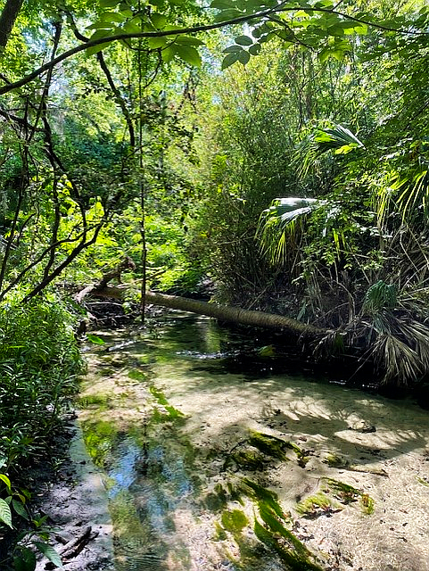
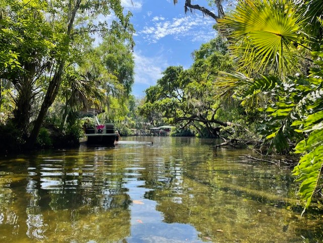
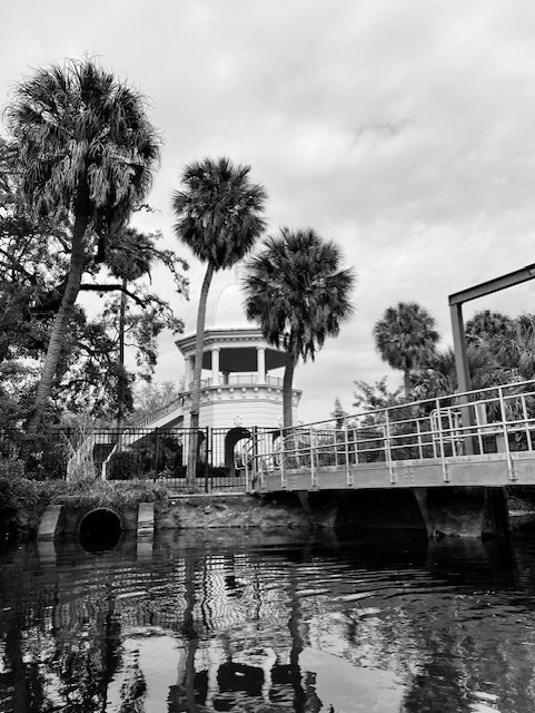
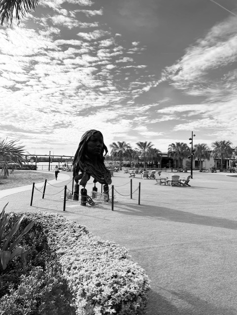
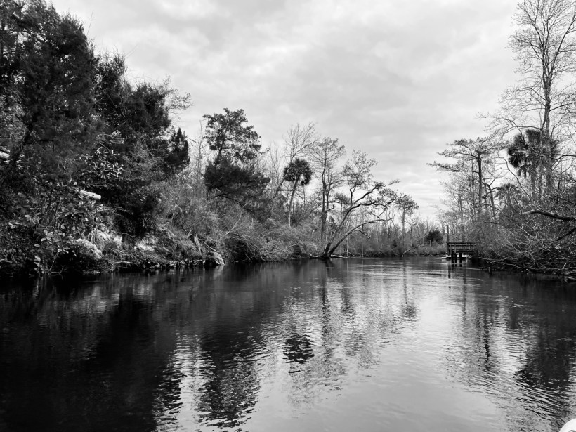
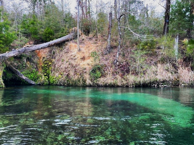
I started my fish-filming journey seven years ago in Rainbow Springs, so it seems appropriate that I end these posts there as well (at least for now!). With its clear, blue water and many, many vents spouting water and sand, it is a spring-enthusiast’s dream.
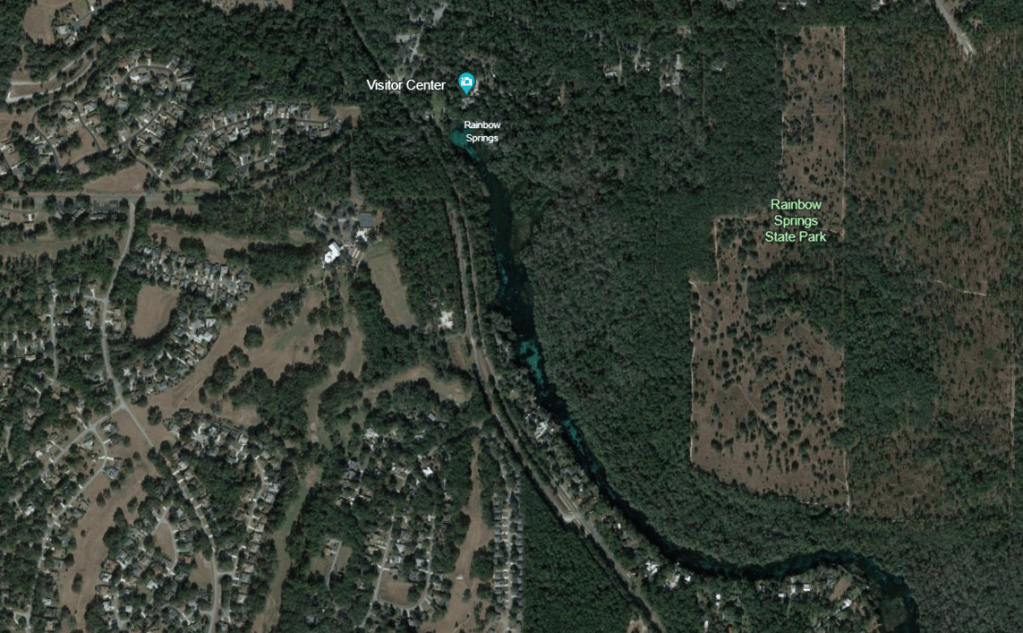
Rainbow Springs is in an agricultural/residential area southwest of Ocala. The closest town to Rainbow Springs is Dunnellon, which did not feel appear to have grown a great deal since I stayed there seven years ago, although I did not spend a lot of time there on either trip. The neighborhoods just north and west of the spring, on the other hand, seemed to have grown substantially in the intervening years.
Google Earth images of the landscape around Rainbow Springs and of the spring itself. The blue of the run is obvious even from these high elevation images. The darker areas are thick beds of plants.
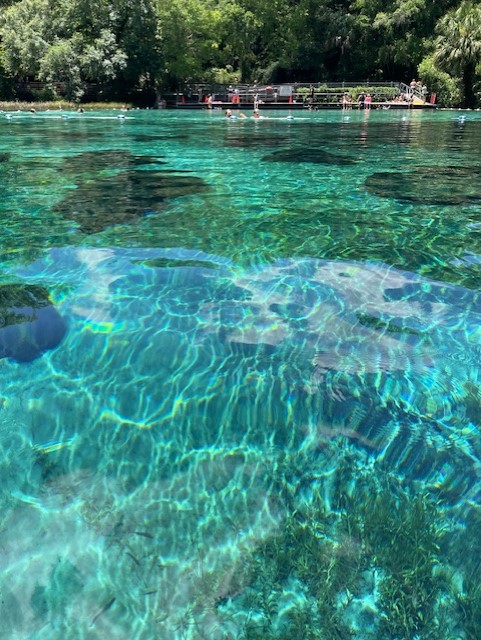
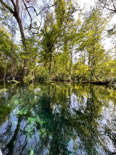
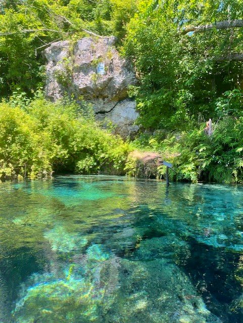
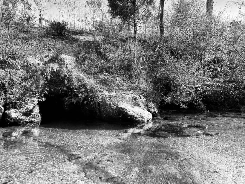
The headspring of Rainbow is actually a collection of smaller springs that collectively form a large blue pool, scattered with rocks and ringed by submerged and emergent plants.
View of the headspring pool, looking back toward the swimming area. It is a blue to which swimming pool owners aspire.
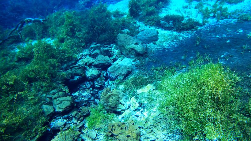
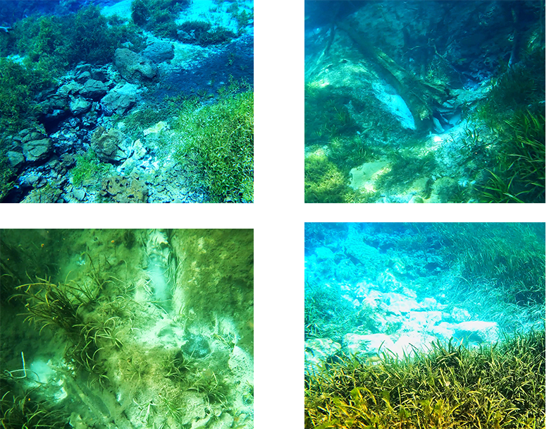
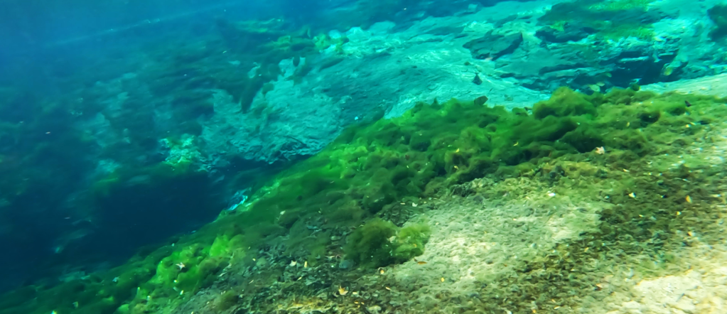
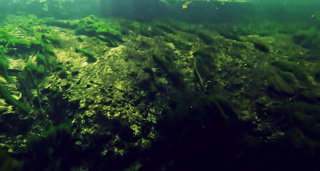
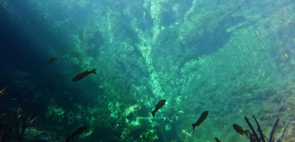
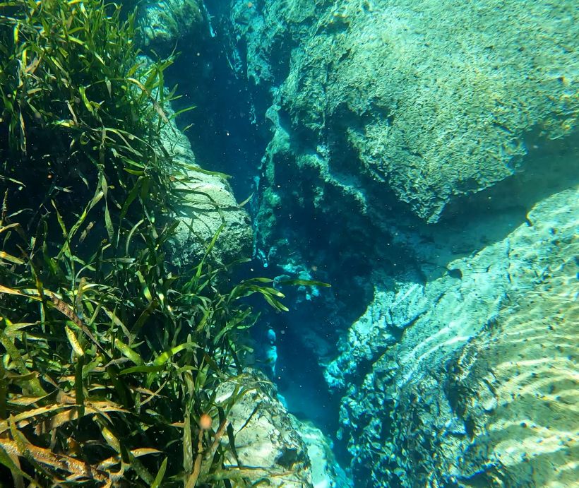
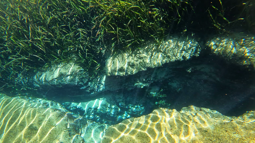
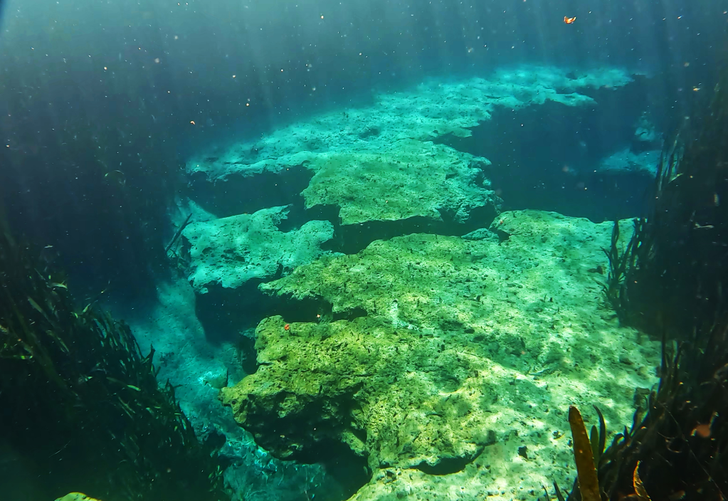
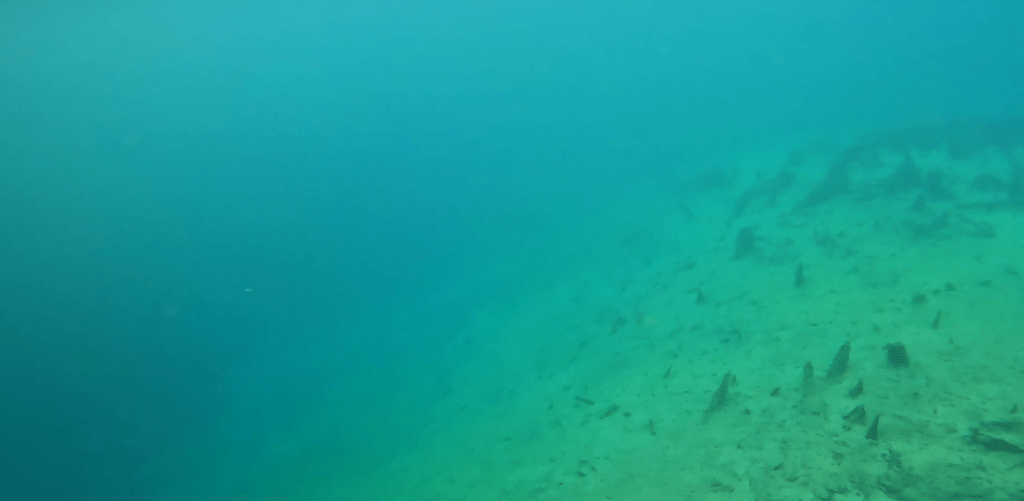
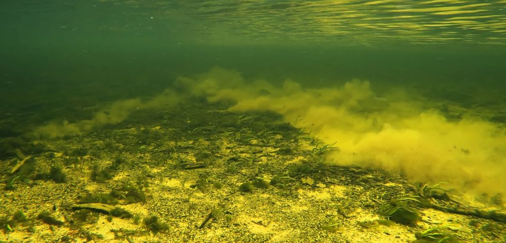
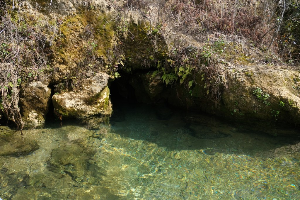
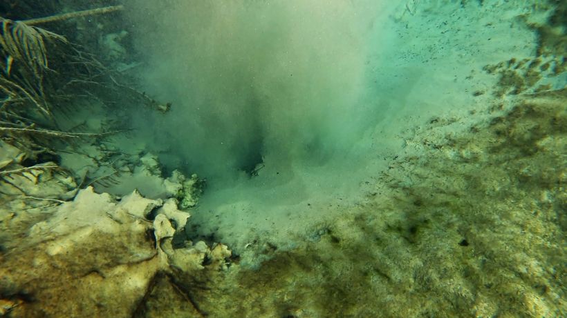
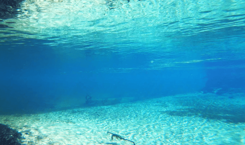
Underwater views of several vents or sand boils, starting with one of the headspring vents in the upper left-hand corner and ending with cloudy plumes coming from sand boils downstream in the lower left-hand corner.
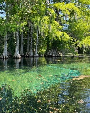
Filming fish is both easy and hard at Rainbow. The clear water makes the fish easy to see and identify, but its depth makes it hard to set cameras. The vistas are stunning.
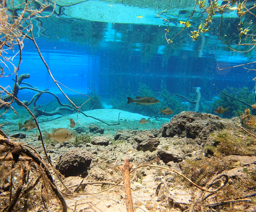
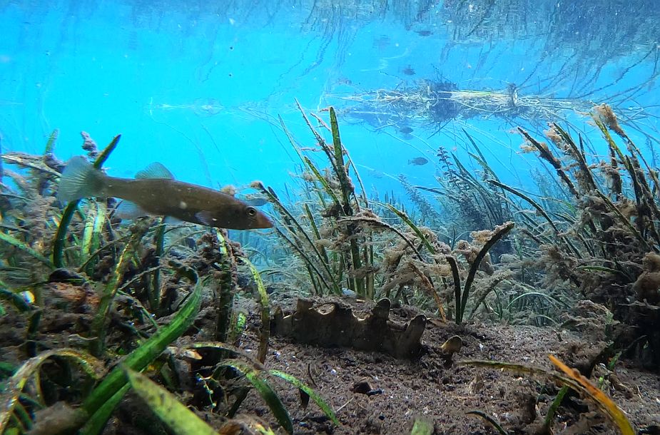
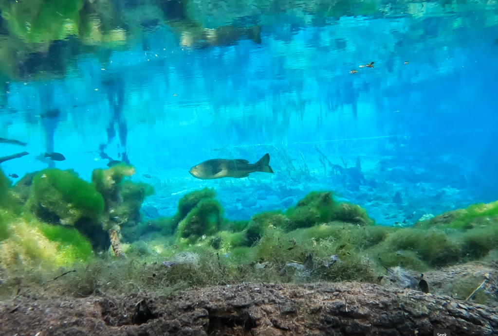
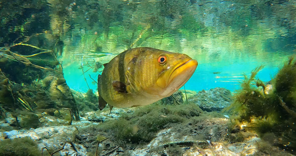
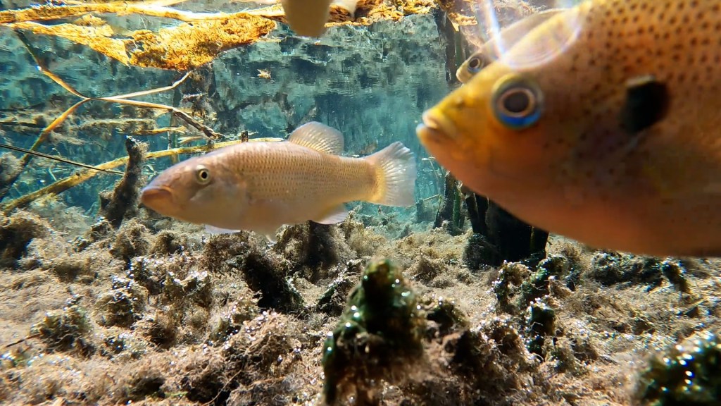
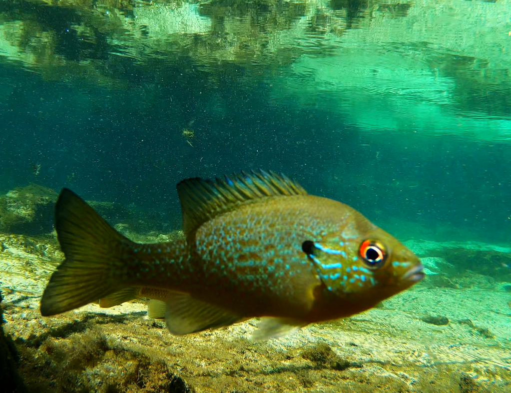
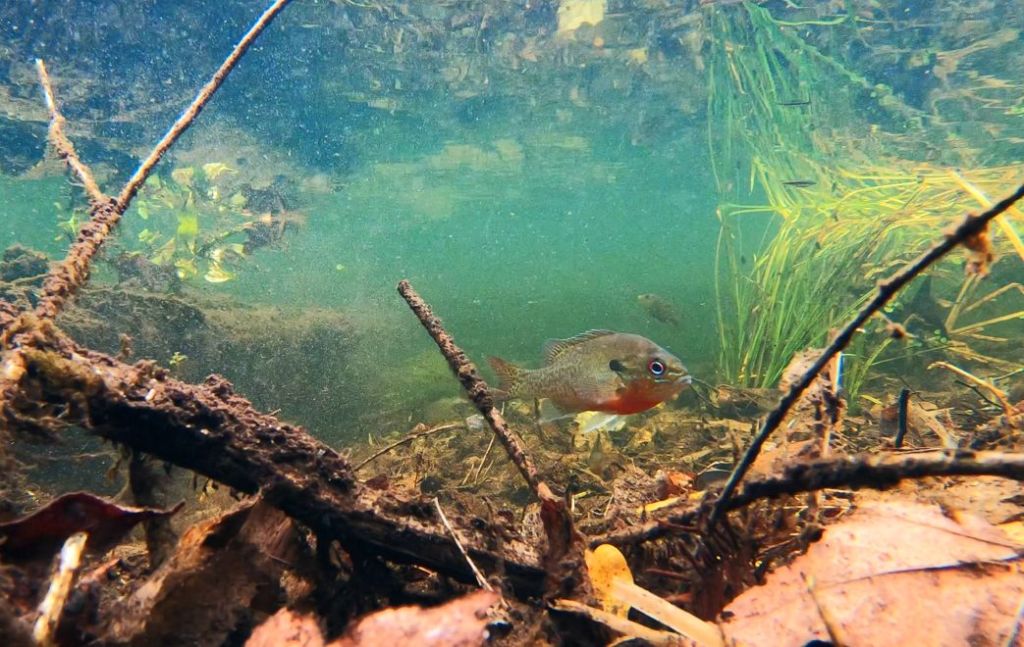
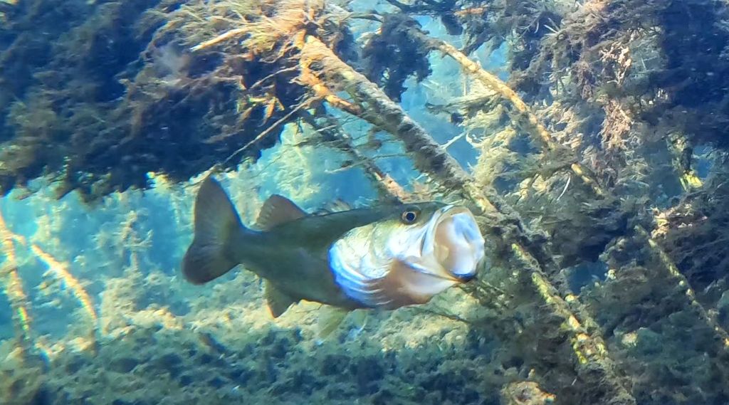
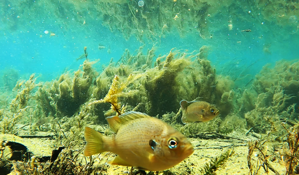
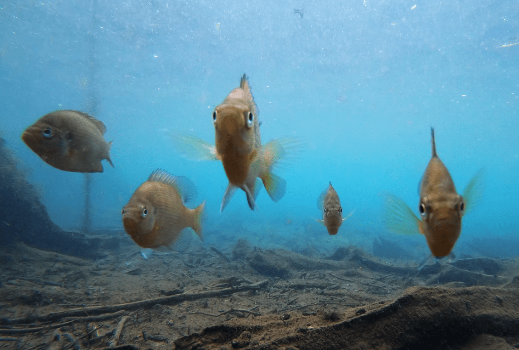
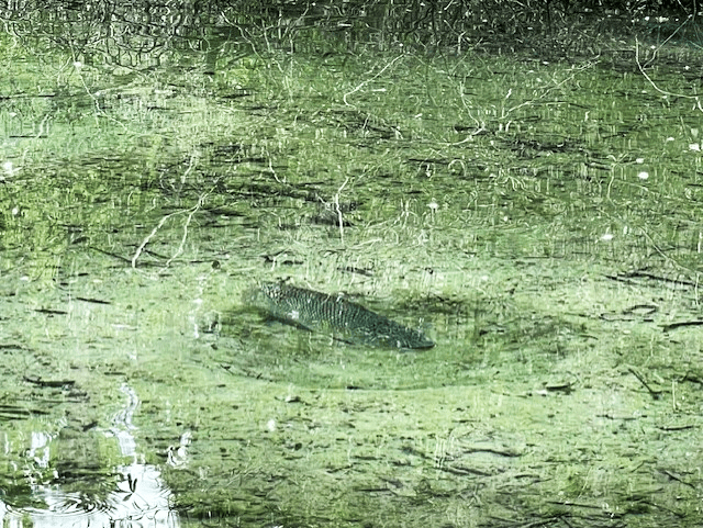
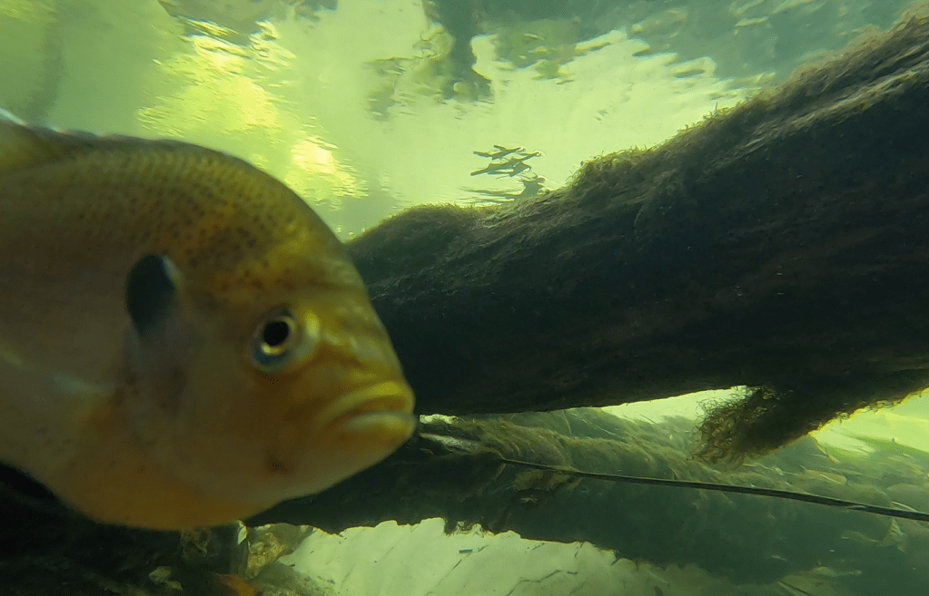
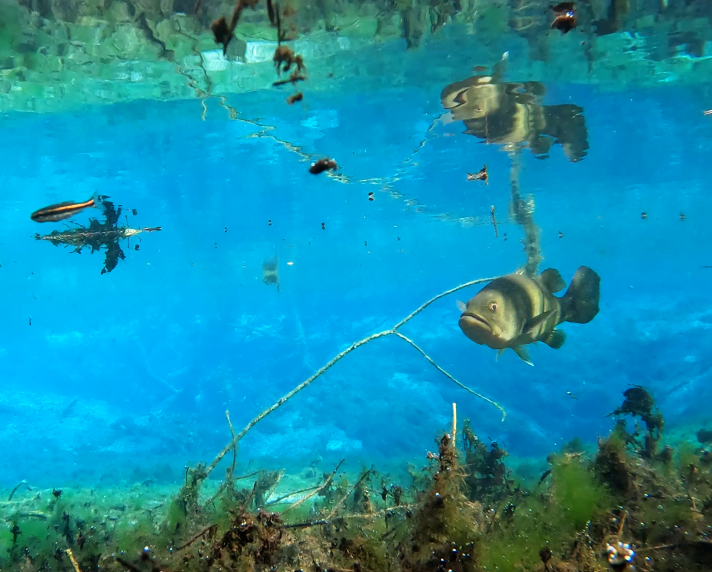
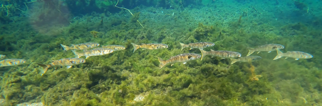
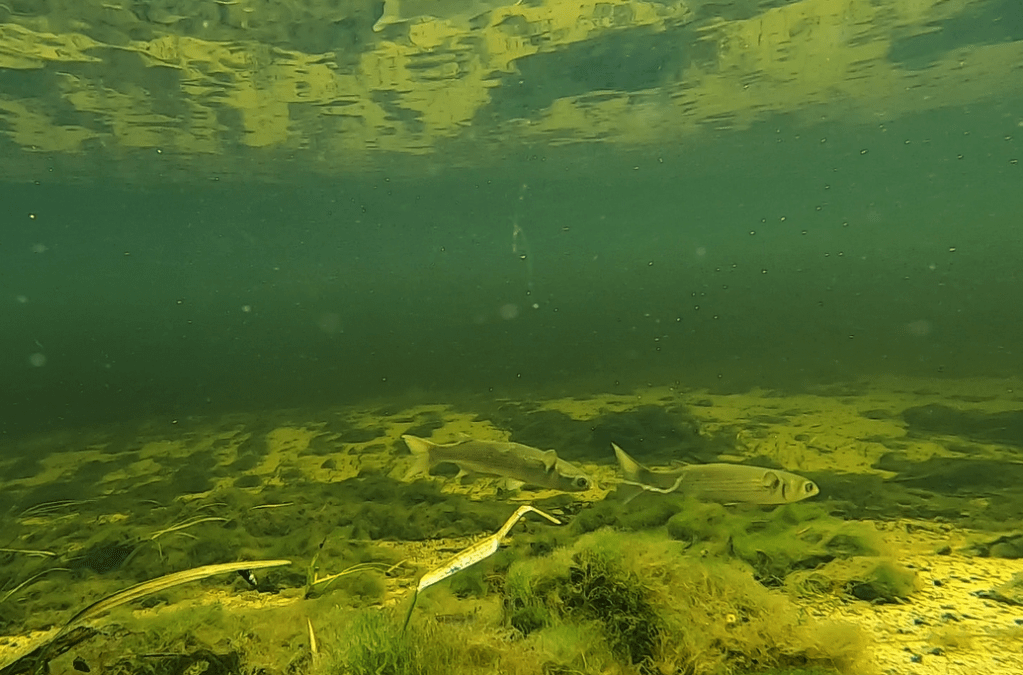
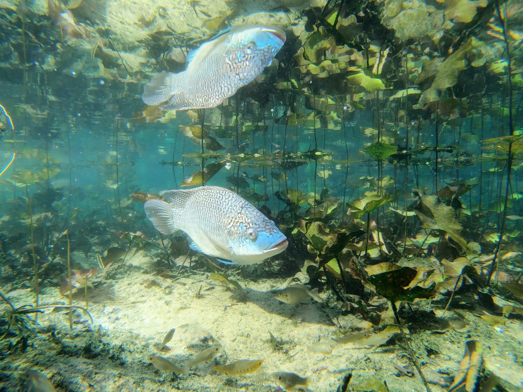
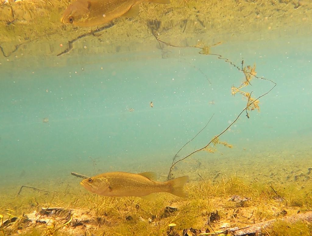
A largemouth bass (Micropterus salmoides), a redear sunfish (Lepomis microlophus), a redbreast sunfish (Lepomis auritus), and some bluegill sunfish (Lepomis machirochirus) up at the headspring.
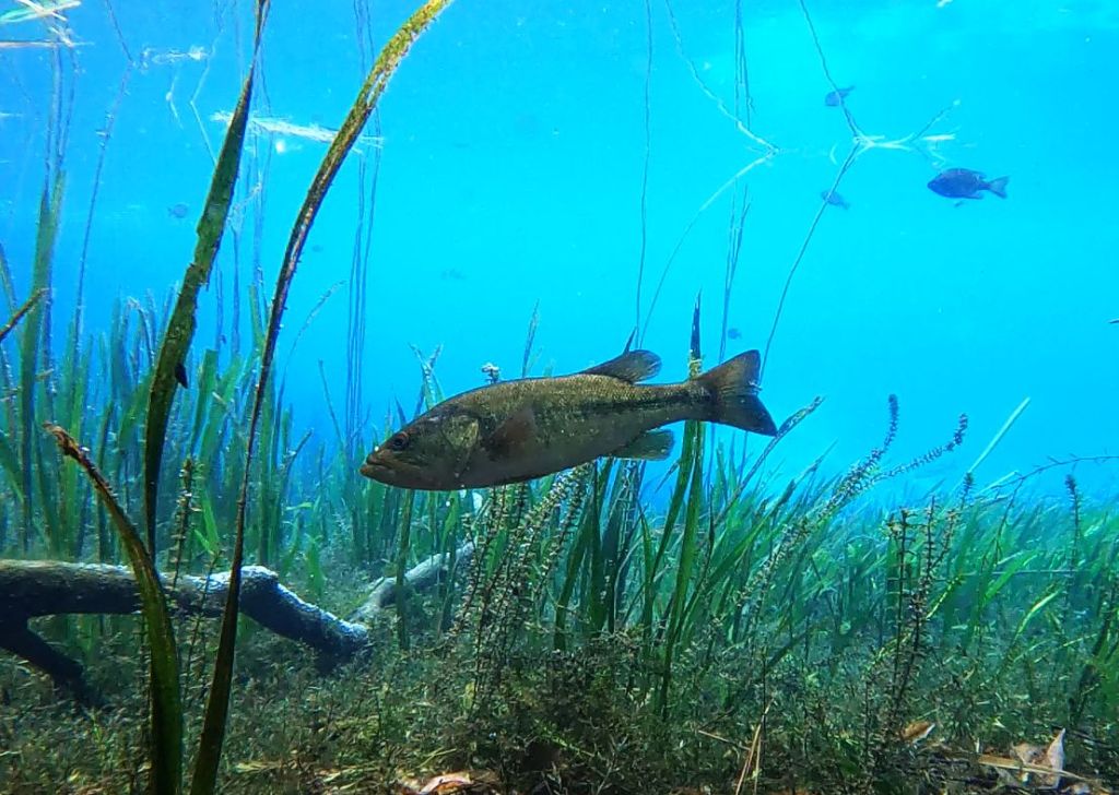
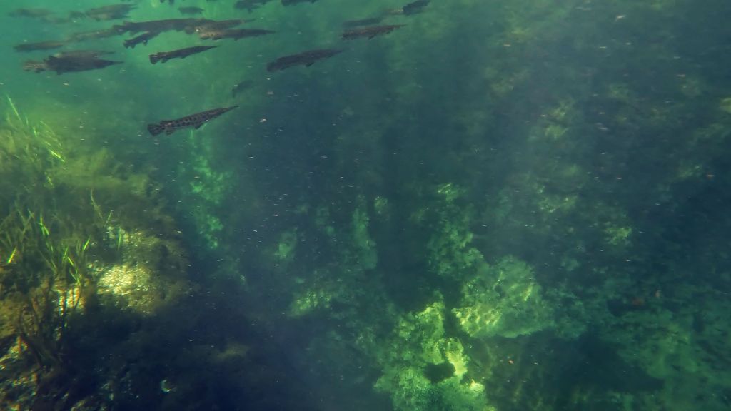
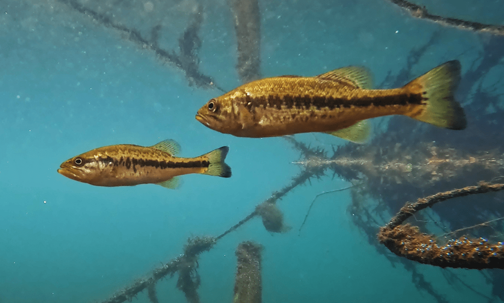
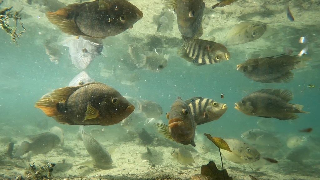
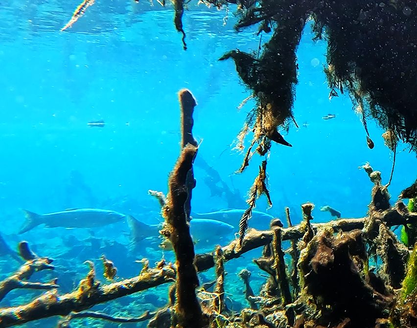
The number of predators in this spring was remarkable. I got at least one largemouth bass is virtually every video that I collected. I even managed to get a bass feeding on video. Just downstream from the canoe launch, a downed tree on the edge of a little bay provided structure for a whole host of longnose gar (Lepisosteus osseus). Interestingly, there were gar in that exact same spot seven years ago.
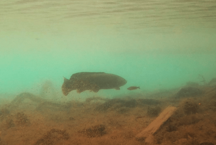
Some impressive predators: a largemouth bass cruising through the site (top) and a video of another feeding (bottom).
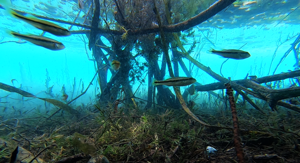
A gathering of longnose gar around a downed tree.
The smaller fish, like mosquitofish, shiners, and killifish, were harder to find in attractive poses on video. Given the large number of predators and clear water, they stuck to the areas with more plants, which obstructed my camera view.
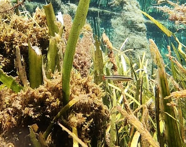
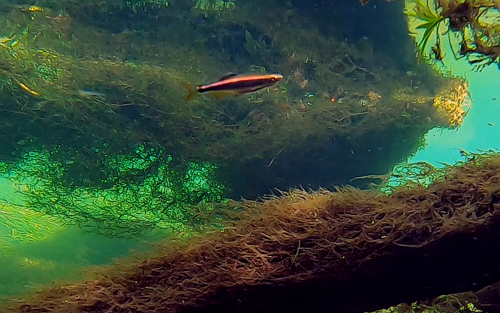
Two of the smaller fish species that I recorded: seminole killifish (Fundulus seminolis) and bluefin killifish (Lucania goodei). The red on the tail of the bluefin is just barely visible. They used to be called redfin killifish, but the males often get bright blue dorsal fins when they are breeding. Apparently, the blue is considered more dramatic than the red.
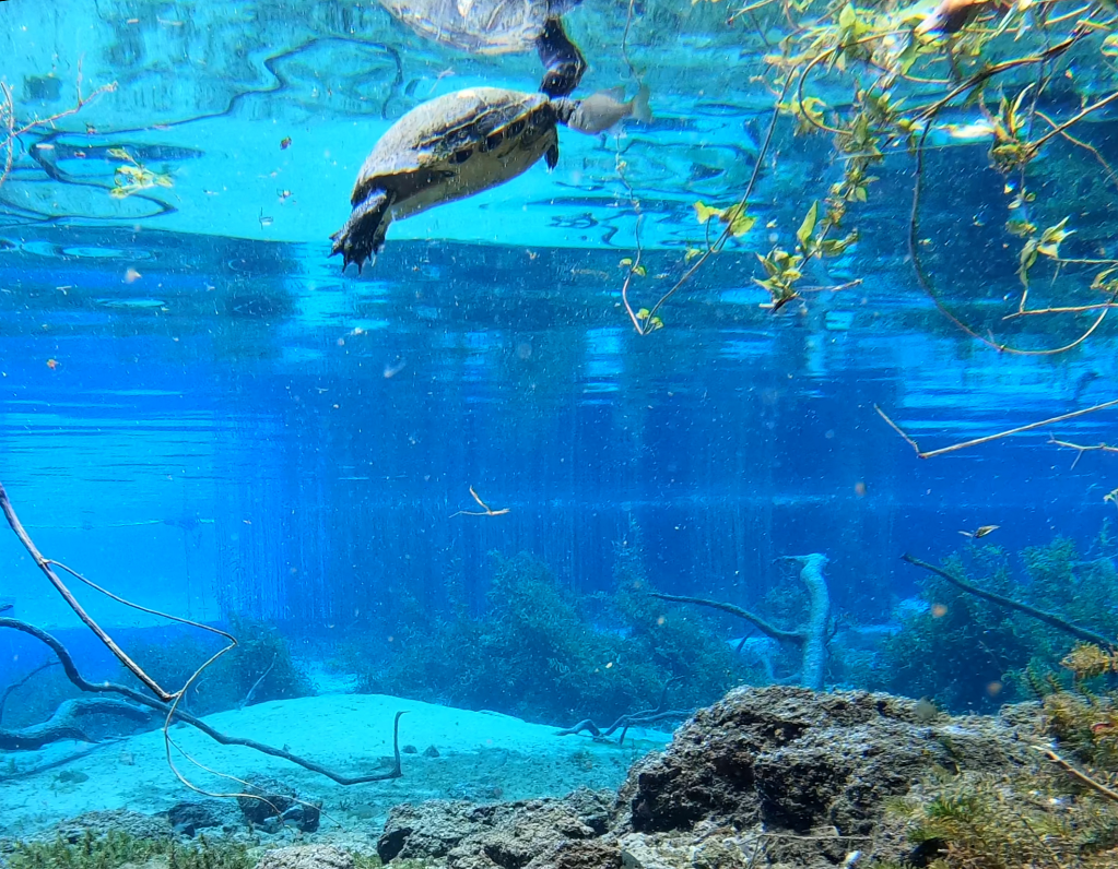
In addition to the number of predatory fish, the number and diversity of turtles was striking. The turtles favored the dense grasses that cover the east side of the run, which is a conservation area off limits to visitors. When I floated past that area, turtles were everywhere, resting on the grasses and swimming between them. However, I got turtles on video all along the run.
Three of the many turtles that I observed in Rainbow Springs, including on the bottom, a Florida softshell (Apalone ferox).
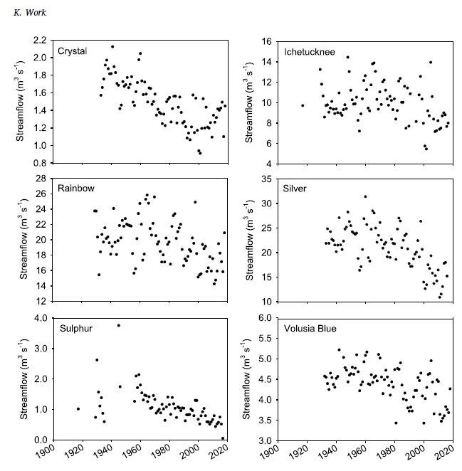
Rainbow Spring is enormous. The first vent alone discharges ~130-320 cfs and all of the subsequent vents add additional flow. When spring #6 adds its flow to the run just upstream of KP Hole, the discharge increases to 297-400 cfs. The 1995 USGS report that ranks the first magnitude springs of Florida puts Rainbow (at 711 cfs with the addition of still more vents downstream) in fourth after Spring Creek Springs, Crystal, and Silver Springs in descending order (https://pubs.usgs.gov/fs/1995/0151/report.pdf). The first two springs are a bit more marine, either on the coast or in the Gulf, so that leaves Rainbow competing with Silver for the biggest and clearest inland spring.
According to the SWFWMD Rainbow Springs dashboard (https://www.swfwmd.state.fl.us/projects/springs/rainbow/dashboard), the discharge of Rainbow Spring is a little higher than it has been in the last few years. The overall the trend has been downward for decades, not as steep a decline as some big Florida springs, but still.
Data on water quality for Rainbow Springs are hard to find. There is an Minimum Flow and Level plan, but it is not online. There is a Basin Management Action Plan (BMAP, https://publicfiles.dep.state.fl.us/DEAR/DEARweb/BMAP/Springs/RainbowSprings_Final_11302015.pdf), but it only gives the target concentration for nitrate. As a result, my conclusions are based on the SWFWMD Rainbow Springs dashboard and the little bit of data that I collected in 2017 and in 2024.
Rainbow Springs is on the warm side (23-24oC) and the dissolved oxygen is very high for a spring (5.85-7.94 mg/L). It was this spring that made me rethink what is “typical” for Florida springs as these values are more than an order of magnitude higher than the dissolved oxygen measurements that I typically take at the headspring of Volusia Blue. It would seem that the water is barely underground at Rainbow. The conductivity is predictably low (~180-380 microS/cm) for a spring a) far from the Gulf and b) without the underlying aquifer salt lens of some of the St. Johns River springs.
Nitrate concentrations, on the other hand, are quite high (more than 2.5 mg/L as compared to the BMAP target of 0.35 mg/L). Like many other Florida springs, the nitrate concentration has risen linearly in Rainbow Spring since the early 1990s at least (for many springs, the increase started in the 1970s). The BMAP attributed the high nitrate loading primarily to cattle and horse pasturelands. However, the rapid increase appears to have slowed and this trend seems to have occurred in other springs as well. Hopefully, we’re turning a corner there.
Apparently, Floridians like their Gum trees. Gum trees include sweetgum (Liquidambar styraciflua) and the tupelos (Nyssa spp.), which we have in Florida naturally, and eucalyptus, which we do not. There are actually some super fun gum trees that I just discovered five minutes ago, such as a lemon-scented gum (Corymbia citriodora), a rainbow gum (Eucalyptus deglupta), a scribbly gum (Eucalyptus haemastoma), and a salmon gum (Eucalyptus salmonophloia–there’s the fish in this digression! https://www.thespruce.com/twelve-species-of-gum-trees-3269664). [Hopefully, we’re keeping those fun gum trees in their homes.]
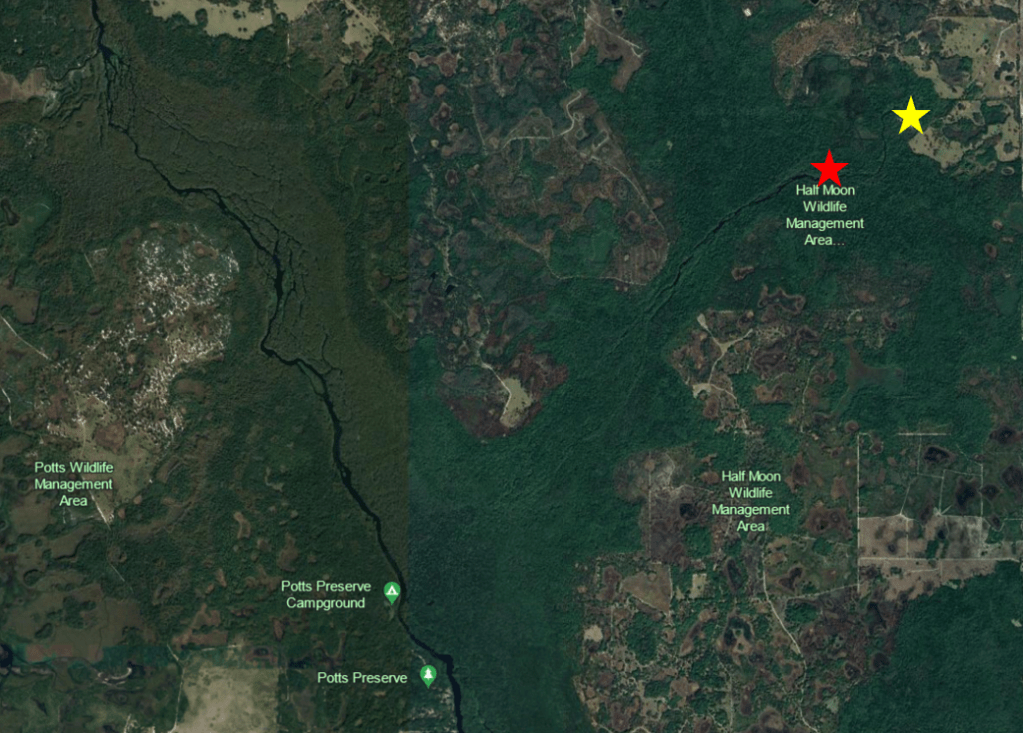
Floridians also like to name things Gum swamp. I titled this post as I did because “Gum” and some version of “slough” or “swamp” show up all over the state (a slough is essentially a flowing swamp). There’s the Gum Slough near Lake City that is a described by Apple Maps as a lake, but looks more like a wetland. There’s a Gum Swamp at the northern end of the Okeefenokee Swamp. There are Big Gum Swamp, Little Gum Swamp and Gum Swamp Creek at the southern end of the Okeefenokee. There’s a Gum Swamp southeast of Jacksonville. There’s Gum Root Swamp northeast of Gainesville. There’s a Gum Swamp that appears, on Google Earth, to connect the Manatee River and Myakka River watersheds. And there’s a Gum Swamp Branch just north of the Hardee Correctional Institution that, if I squint sideways, might connect with the Gum Slough on the Manatee River. And finally, there’s the Gum Swamp surrounding the headwaters of the topic of this post: Gum Slough spring that flows into the southern Withlacoochee River (and yes, we have two Withlacoochee Rivers as well).
Google Earth image of some of the “Gum” slough/swamps in Florida. The yellow star indicates the location of the Gum Slough that is the topic of this post.
The development pressure in the area is intense, with Ocala to the north and The Villages to the east. However, the land around the spring itself is still swamp, forest, and pasture. All of the land that abuts the spring is either wildlife management area or nonprofit. Visiting the headspring, which is owned by a nonprofit, feels very remote, a bit like you’re going back in time.
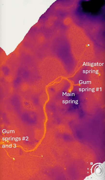
At least seven vents provide the majority of the flow for the spring, three at the start of the spring, three about a mile downstream, one more that I did not find, and perhaps even a few others that have only been seen on a SWFWMD lidar map (kind of like radar). I was told by one of the owners of the nonprofit that the flow from first three springs is equivalent to a second magnitude spring, but the addition of the other four springs downstream elevates the flow to a first magnitude spring.
Google Earth (top) and Google Map (bottom) images of the Gum Slough run. The locations of the two clusters of seven springs are represented by the stars in the top map. The bottom map shows the braided morphology of both the Withlacoochee River and Gum Slough.
Screenshot of a lidar image of Gum Slough from a SWFWMD video (https://www.swfwmd.state.fl.us/media/video/6042) about exploring the springs of Gum Slough. According to the video, the bright spots are springs. A couple of the lighter, unlabeled springs had runs that were too shallow and narrow to paddle.
Even with the substantial flow inputs, the spring is narrow and intimate in the upper mile or so. In fact, at low water, the spring can be so shallow in the upper reaches that kayaks need to be portaged in spots. I have not yet paddled lower Gum Slough, but given how braided it is and photos that I have seen, I think that it would feel intimate downstream as well.
Gum Slough just downstream of the first three springs in March.
Gum Main Spring
The Gum Slough main vent is represented by perforations in a large limestone pool. When I visited in January and March, algae blanketed both the floor of the main spring run and a lot of the eelgrass (Valisneria americana) just downstream, but the snails did not seem to mind. There were thousands upon thousands of snails, both on the eelgrass and on the exposed sand.
Gum Slough main vent (top) and the run downstream (bottom). The entry of Gum Slough Spring #2 is visible in the top right corner and dozens of snails can be seen in the lower left corner.
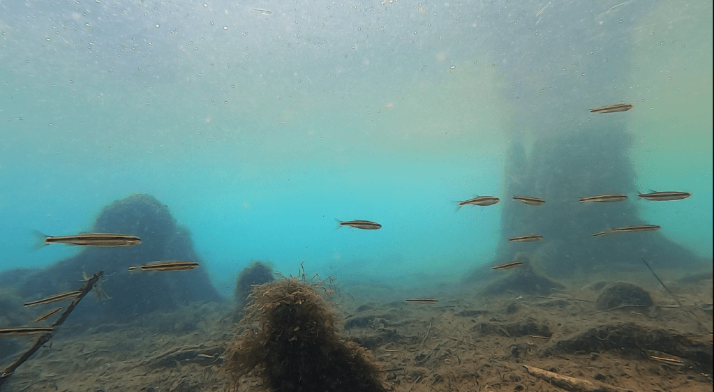
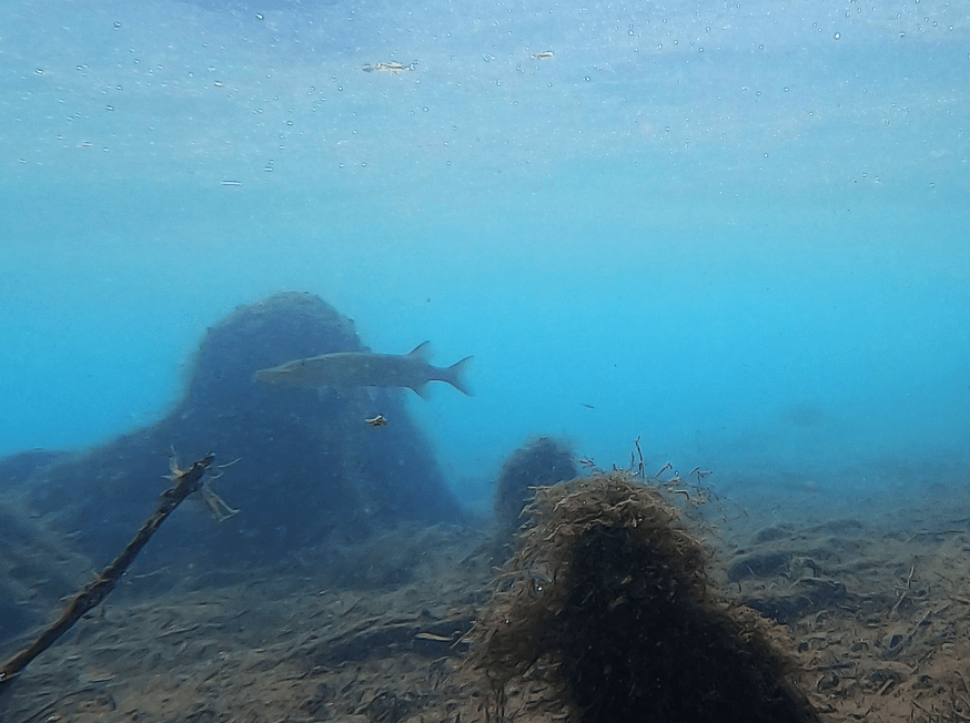
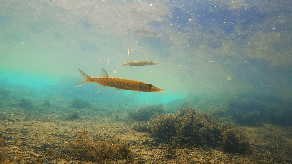
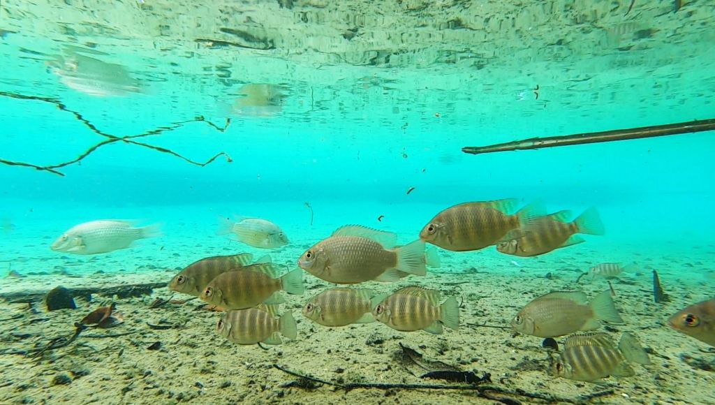
I recorded an impressive number of sizeable largemouth bass (Micropterus salmoides)–also, loads of sunfish, particularly spotted sunfish (Lepomis punctatus)–among the ten sites that I collected video. The clear water gave some good views of bowfin (Amia calva) as well. The rippling motion of their dorsal fins is a cool way to move.
A skinny largemouth bass at the headspring in March and a bowfin with a spotted sunfish just downstream in January. I mention the difference in sample time here because the algae is green the top photo and brown in the bottom photo.
From further downstream, a large and golden largemouth bass, a very large seminole killifish (Fundulus seminolis) with a spotted sunfish, and a pretty redbreast sunfish (Lepomis auritus, bottom).
Downstream where there was some structure, I found shoals of shiners, both adult (photo) and larval (video). Note the larval shiners streaming from one mass of plants to another. They slightly rerouted when the bass approached.
Gum Spring #1
The Gum Slough #1 vent was just meters away, but it looked completely different than the main spring, much more blue. The pool was much narrower, so the banks were steeper and the vent itself was obscured by plants.
Gum Slough Spring #1 vent (top) and its short and shallow run (bottom)
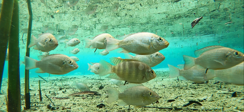
Like the main spring, Gum Slough #1 supported shiners, killifish, sunfish, bass, and turtles.
A largemouth bass near the edge of the Gum Slough #1 vent.
Spotted sunfish attacking a) food that is impossible to see (top) and b) my float (bottom).
Alligator Spring
Of the springs that I visited on Gum Slough, Alligator Spring was my favorite to paddle. The run was windy and tree canopy-covered with dappled sunlight falling on the water. Below water, the vent dropped off quickly, producing a limestone wall, although it was covered in algae.
Looking up Alligator Spring run toward the headspring.
Alligator Spring vent above water (top) and the limestone wall of the vent below water (bottom).
Alligator run was a bit more tannic than the other spring runs, but I observed the same suite of fish along its length as I did in the other two runs upstream.
Some impressive largemouth bass and colorful redbreast sunfish (Lepomis auritus) in Alligator Spring run.
Gum Slough springs #2-3.
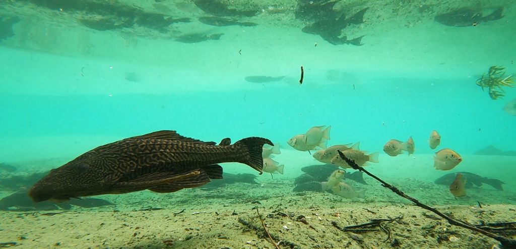
The downstream spring vents seemed much bigger than the upstream vents. And unlike the springs upstream, the downstream vents were right in the middle of the channel, rather than at the start of a run. An impressive number of large predators (largemouth bass, Florida gar, and bowfin), roamed these vents. While the largemouth bass cruised through singly or in pairs and the bowfin always were alone, at least 19 Florida gar hung over the vent of Gum Slough #4. I usually see Florida gar on their own, not in groups.
Gum Spring # 2 with a sunfish and a largemouth bass.
Gum Spring # 3 with several largemouth bass and a couple of sunfish.
Gum Spring # 4 with a boatload of Florida gar (Lepisosteus platyrhincus) near the surface. That group was the largest number of Florida gar that I have ever seen together.
Two impressive largemouth bass, one showing off its large mouth.
The Florida gar following each other around–mating?
Despite the large number of predators, I also observed a fair number of small fish like shiners and killifish, probably because I set my cameras back in the plants. Plants can provide cover from that large mouth on the largemouth.
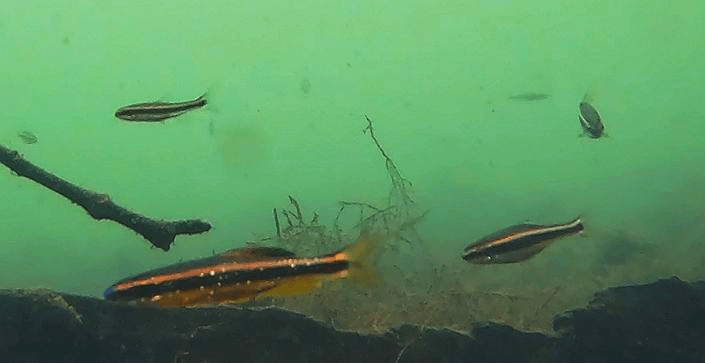
A metallic shiner (Pteronotropis metallicus, top) and three bluefin killfish (Lucania goodei, bottom).
In addition to the loads of snails on the run, when I visited in March, there were impressive numbers of mayflies and blue damselflies taking advantage of the warmer weather.
A mayfly on my data book (top) and loads of blue damselflies on an exposed log (bottom).
USGS had no water quality data for Gum Slough, but there were some in the SWFWMD MFL plan (again, a short time series). The temperature of Gum Slough headspring was on the warm side (~23-24oC according to both SWFWMD and my data), but it was a little cooler below the second set of vents when I measured it (21.5-22.9oC). The dissolved oxygen was moderate at the headspring (3.11 mg/L for SWFWMD and 2.5-4 mg/L for me), but it was higher when I measured it downstream (~5-7 mg/L). This increase is not surprising, given all the submerged plants and algae. The conductivity was predictably low (324 microS/cm for SWFWMD and ~370 microS/cm for me), given the distance from a source of saltwater.
The SWFWMD MFL plan reported an average nitrate concentration of 1.02 mg/L, ranging up to 2.28 mg/L. These values are quite high, much higher than the often-cited 0.35 mg/L background concentration (the MFL report actually used a much lower number for the background: 0.05 mg/L). The report says that: “this [nitrogen concentration] is slightly higher than the mean of 1.17 mg/L for the Rainbow Springs for the same period”. This comparison is interesting, given the much more obvious overlap between human development and Rainbow Spring (there are neighborhoods just north of the headspring and houses down one bank of its run). The MFL plan reported a phosphate concentration of 0.04 mg/L, which is within a stone’s throw of the likely background concentration. So… while Gum Slough feels untouched as you float down it, it has been touched underground by human activity.
Jackson Blue was my last stop in the panhandle and my last big “Blue” to visit. Back in the day, a lot of springs must have been really blue because “Blue” appears to be the most common name for springs in Florida: Gilchrist Blue, Jackson Blue, Levy Blue, Madison Blue, Volusia Blue, etc. Now each “Blue” is distinguished from the others using the name of the county in which it occurs. Jackson and Volusia Blue are two of the 33 first magnitude springs in Florida.
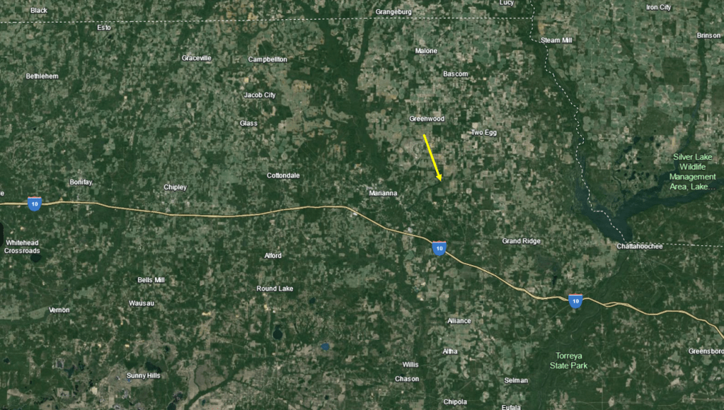
Jackson Blue Spring is in a heavily agricultural area, just to the east of the town of Marianna, Florida Caverns State Park, and the Chipola River into which it flows. It is dammed downstream where it passes just south of Marianna. According to Jackson County, this dam produced a reservoir that is now a “nationally known fishing site” (https://jacksoncountyfl.gov/services/parks-recreation/blue-springs-recreation-area/). The run would be big without the dam, but it is especially wide along its length because of the dam. As an interesting aside, the park originally hosted a club for Graham Air Force Base officers.
Google Earth images of the landscape around Jackson Blue Recreation Area (top) and of the dammed run (Merritts Mill Pond, bottom).
Jackson Blue Recreation Area (home to the headspring) is a medium-old Florida sort of place, with a dirt parking lot and a small ticket booth attended by a woman who was, perhaps, a high school student. The park is open only during the warm season and the swimming area is surrounded by a cement wall on the upstream end and a moveable wall on the downstream end.
The Jackson Blue swimming area.
On my visit, I put in below the swimming area, which already was starting to fill up with swimmers and divers when I arrived. As soon as I pushed off, I was in an eelgrass (Valisneria americana) wonderland all across the wide run.
Thick beds of eelgrass blanket most of the bottom of the Jackson Blue run.
Much of the eelgrass and other plants were somewhat coated with algae, all of which was photosynthesizing rapidly in the clear water. The evidence for this process was the production of copious bubbles. When plants or algae photosynthesize faster than the water can absorb the oxygen, oxygen bubbles form, covering the producers or rising to the surface if they get too big or disturbed.
Bubbles of oxygen streaming off the eelgrass leaves (and algae).
Beyond the swimming area, lovely old cypress trees (Taxodium distichum) produced shade close to the banks.
Cypress trees in the shallows of Jackson Blue Spring. Duckweed (Lemna sp.) covered the surface of the water in many areas.
Downstream of the headspring, several other springs dot the run. The most famous of these is Shangra-La Spring on northern bank of the run.
Shangri-La main spring above water (top) and underwater (bottom).
The Shangri-La second vent just off shore, photographed above the water (top) and underwater (bottom).
Twin Caves Spring is a little further downstream next to a swimming platform near the southern bank of the run.
Two views of Twin Caves Spring.
Just below the swimming area, the algae was pretty thick, but back under the trees along the banks, the sandy substrate was more visible. In the shallows under the cypress trees, there were more juvenile largemouth bass (Micropterus salmoides) than I have ever seen in one place. And, of course, there were lots of sunfish, especially spotted sunfish (Lepomis punctatus), all over the run.
Thick algae with spotted sunfish just downstream from the canoe launch.
Several juvenile largemouth bass passing through as two bluefin killifish (Lucania goodei) flared bright blue dorsal fins in a territorial display.
Still more juvenile largemouth bass downstream.
In addition to the large sunfish and largemouth bass populations, the turtle populations also seemed to be healthy.
A turtle passing by two spotted sunfish.
A tiny loggerhead musk turtle (Sternotherus minor) climbing over the rocks in this view from Shangri-La Spring out toward the center of the run (below).
Like most other springs in Florida, the available data for Jackson Blue Spring is a bit spotty. The discharge time series reported by USGS (https://waterdata.usgs.gov/nwis) and DEP (https://floridadep.gov/sites/default/files/JacksonBlue-MerritsMill-nutr-tmdl.pdf) only ranged from 2005 to 2010. Over that period of time, Jackson Blue discharge ranged from 38 to 219 cfs, a massive 576% difference in magnitude from the lowest to highest discharge. The temperatures at the headspring were comparatively cool (USGS data from 1972-2023: 20.5-21oC; 21.1-22.3oC for me). The dissolved oxygen concentrations were high for a spring (USGS: 7-10.3 mg/L at the headspring; 7.05-9.17 mg/L for me). The high values for the headspring suggest that the water issuing from the spring is not underground long. High dissolved oxygen downstream also would have been related to the large producer (plants and algae) populations. The conductivity was low, as expected given the spring’s distance from the Gulf: 197-287 microS/cm for USGS and 280-310 microS/cm for me.
For many of the biggest springs in Florida, the state developed MFL (Minimum flow and level) plans to maintain spring discharges and TMDL (Total Maximum Daily Load) plans to restore nutrient concentrations. I could not find an MFL plan for Jackson Blue, but the TMDL plan reported nitrate concentrations that ranged from 3.1-3.4 mg/L in recent years, an order of magnitude higher than the concentration in 1960 and than the background concentration of 0.35 mg/L used for many springs across the state. DEP examined the isotopic ratios of the nitrogen (14N vs 15N) in Jackson Blue and came to the conclusion that most of the nitrate emerging from the springs was from fertilizers. As organisms process nitrate, they use the lighter 14N before the heavier 15N, so their waste tends to have a low ratio of 14N:15N. The reported phosphorus concentrations, happily, all were low, about 0.02 mg/L.
View of the Morrison Springs main pool, looking upstream from the vent.
I first tried to visit Morrison Springs in February, but the spring, like so many others in the panhandle, was still flooded from Hurricane Idalia that hit back in August 2023 and subsequent storms. Its large main pool was impossible to see as it was completely covered in brown water. Video is a lot more effective when you can see.
Morrison Springs in February (top) and May (bottom) 2024.
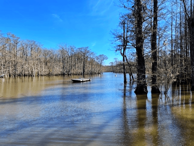
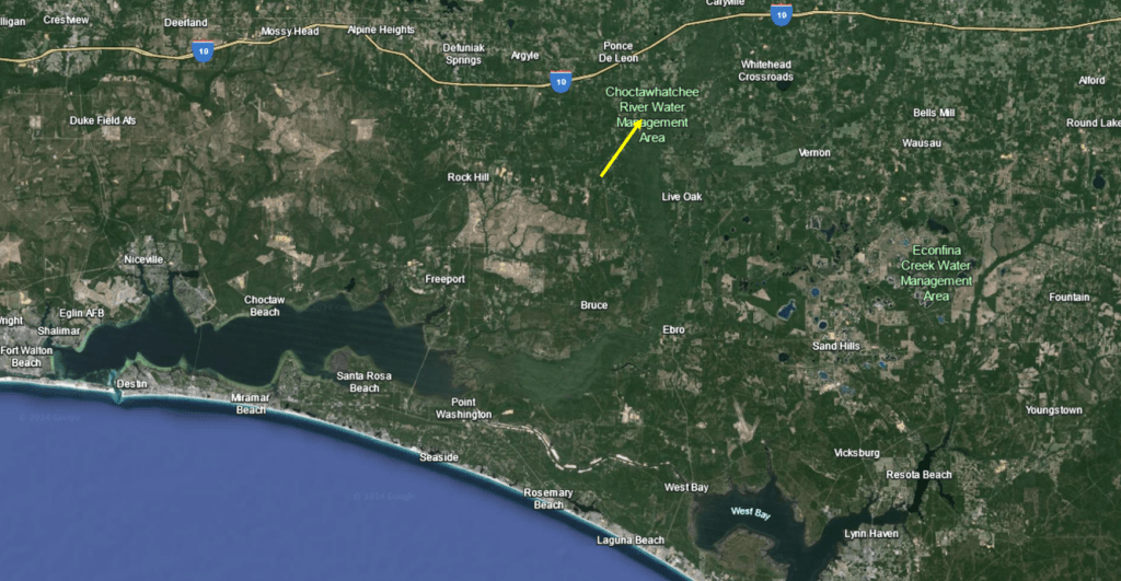
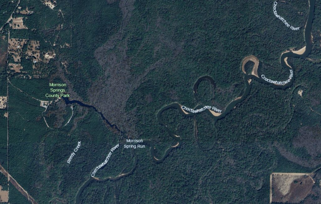
Morrison Springs is a large spring, with a 250-ft diameter main pool. This pool contains three cavities, one of which descends to 300 feet, that produce something on the order of 50 million gallons of water per day, so the spring is categorized as 2nd magnitude, despite its size. Located just south of the town of Ponce de Leon and downstream of Ponce de Leon Spring, Morrison flows down a broad and somewhat shallow run into the Choctawatchee River. The Choctawatchee River meanders down to the Choctawatchee Bay, which opens to the Gulf of Mexico at Destin.
Google Earth images of the location of Morrison Springs on the Choctawatchee River (yellow arrow, top) and of the spring itself (bottom). The headspring appears almost as wide as the Choctawatchee River into which it flows.
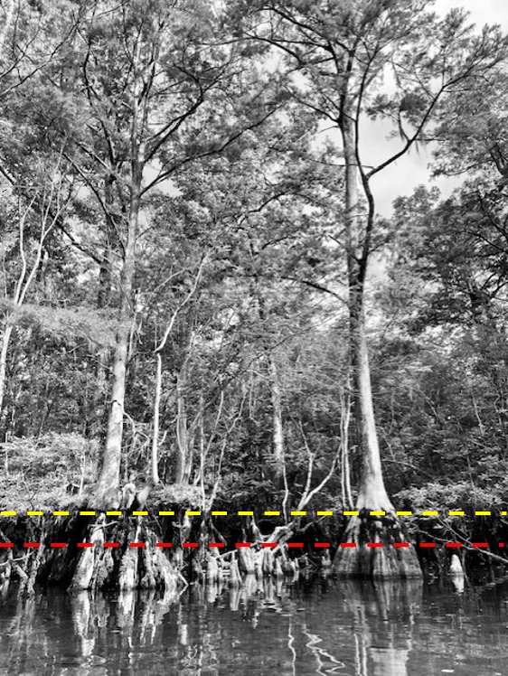
Upon my return to the spring months later, two characteristics struck me: 1) the thick and lovely cypress forest all along the banks and 2) the high water lines on the trees. There were two obvious lines, one about 1/2 meter and one about a meter above the surface of the water on the day that I visited. The prominence of these lines suggest that the spring run attains this stage (water height) often.
Closer view of some of the cypress trees with dotted lines representing their high water lines.
Up near these cypress trees, the water somewhat clear with a layer of suspended sediment near the surface. Happily, I could see both lots of fish and loads of snails. A shoal of shiners made way for largemouth bass (Micropterus salmoides) and spotted sunfish (Lepomis punctatus), which made way for an adult chain pickerel (Esox niger) on the right side of the main pool.
Shiners (top), largemouth bass and spotted sunfish (middle), and a chain pickerel (bottom).
The spring had flooded back into the trees, so I also filmed further back among the cypress trees and was rewarded with two juvenile chain pickerel.
Two juvenile chain pickerel.
On the left side of the main pool, I discovered bizarre-o bluegill sunfish (Lepomis macrochirus) that had virtually no markings. I only recognized them by their diagnostic black dot on the dorsal fin. Typically, fish this large would have prominent dark bars running from top to bottom.
Bluegill sunfish (and one spotted) missing their typical bar patterns.
Alas, the water clarity declined once I left the headspring area. Despite the murkiness, I was able to film several different species of fish, including a bowfin (Amia calva), golden silversides fighting (Labidesthys vanhyningi), and the crown jewel: bluenose shiners (Pteronotropis welaka). I have been asked many times if I have seen them in my visits to springs and finally I can say yes. This species is categorized as a state-designated threatened species due to its isolated populations that are vulnerable to extirpation (local eradication).
A bowfin looming over a juvenile largemouth bass (top), a golden silverside (middle), and bluenose shiners (bottom). Note the shiners’ bright blue snout and sparkles, which no other Florida shiner possesses. When breeding, the males get much darker and more blue and the dorsal and anal fins get very large and round.
Golden silversides fighting.
I wish that I had better video that could show off the vents of Morrison Spring (I have read that there are three), but the water clarity was too low to see much of anything from the GoPro on my kayak. However, the recording of bluenose shiners made the trip more than worth it. I will have to try again on some day like today (6/12/24) when the Walton County website (https://www.co.walton.fl.us/523/Morrison-Springs) lists water clarity as 1 (the clearest).
My best view of the vent area on the day of my visit in early May 2024. The view, although terrible, was still much better than in February.
I was unable to find much water quality data on Morrison Spring. About the best that I was able to find was four sets of USGS samples collected from 1969 to 1985 and a 2006 NWFWMD report entitled: Ground water chemical characterization of Morrison Spring, Florida (https://www.nwfwater.com/content/download/6674/48451/WRSR0602.pdf). This report seemed to describe data from wells near Morrison all the way up to the Alabama border. However, their data matched mine (what I collected) quite well, with relatively cold temperatures (NWFWMD = 20.7oC, my data = 20.8-21.5oC at the headspring, 22.7oC downstream), moderate dissolved oxygen (NWFWMD = 3.17 mg/L, my data = 3.02-3.74 mg/L at the headspring, 2.99-4.16 mg/L downstream), and low conductivity (NWFWMD = 226 microS/cm, my data ~230 microS/cm at the headspring, 220-230 microS/cm downstream). The nitrate data that they reported also were quite low (0.180 mg/L). Happily, these data were comparable to the data collected by USGS decades ago, suggesting that Morrison Springs may have been less impacted by human activity than many other springs. However, I did see reports that it was closed due to high bacterial counts in 2014 and I saw recent warnings about the large number of visitors in the warm seasons.
A few of the visitors at the Morrison Springs main pool in May 2024.
The Alafia River upstream of Lithia Springs. I have many photos of the river that look like paintings.
The Alafia River in this reach felt like old natural Florida.
This project was a lesson in expectations. I did not expect the Weeki Wachee run to be as pretty as it was and I did not expect the Alafia River to be sublimely lovely either.
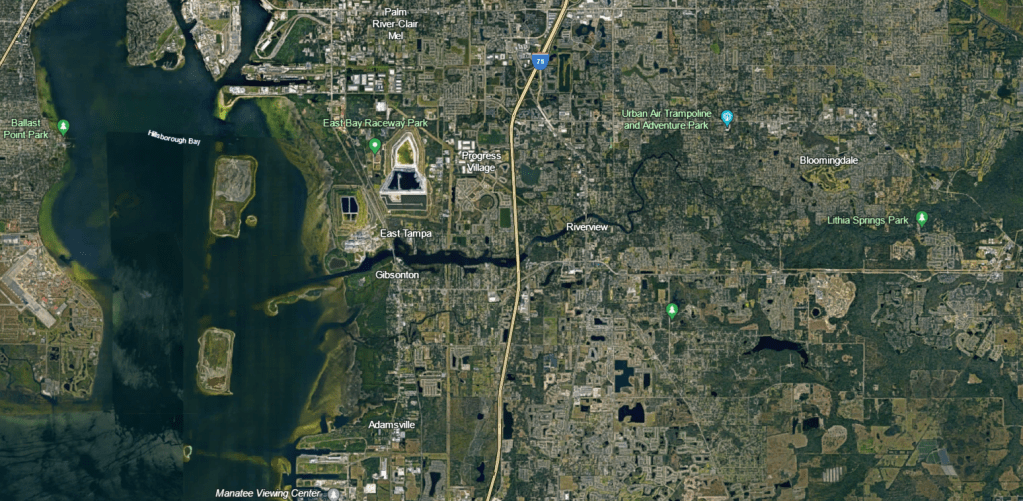
My only experience with Tampa area springs was from the heavily modified springs of the Hillsborough River and my only knowledge about the Alafia came from a paper on the effect of mine drainage and agriculture on invertebrate assemblages. Google Earth images of the landscape around the Alafia River, highly modified with residential development to the west and agriculture to the east, also helped to set my expectations. However, happily, the riparian forest has been preserved in the upper reaches. As a result, the experience of paddling near Lithia and Buckhorn springs feels very natural (as can be seen in the photo above). It just goes to show that you should not listen to your expectations (even those you do not realize that you have).
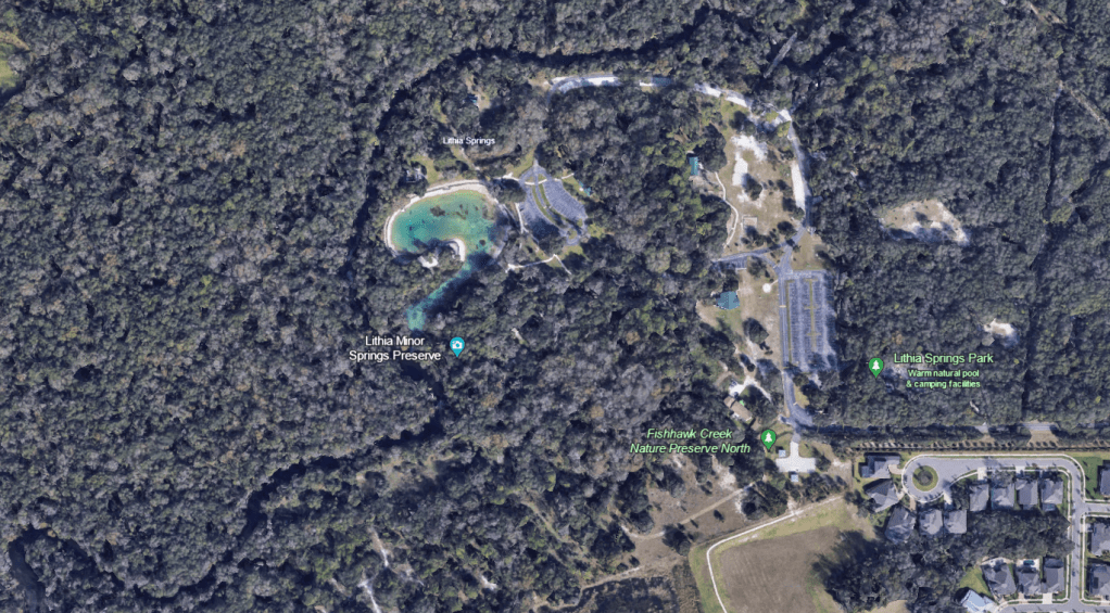
Google Earth image of the Alafia River, which flows into HIllsborough Bay. Note the green riparian (river) forest along the banks in the upper reaches on the right side of the image.
A lower elevation view of Lithia Major (the big blue pool) and Lithia Minor (the camera icon) as well as the Alafia River.
Lithia Major
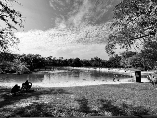
Contrary to the natural state of the Alafia in this area, the headspring of Lithia Major was converted into a large swimming pool. However, the park was nice and I appreciated the people spending the day outdoors. Once the spring water leaves the pool, it flows down a short, shallow run into the Alafia River. Lithia Minor is just upstream of Lithia Major.
The Lithia Major headspring was fenced in and closed until the afternoon when the visitors descended upon the pool. Many families were making an afternoon of it.
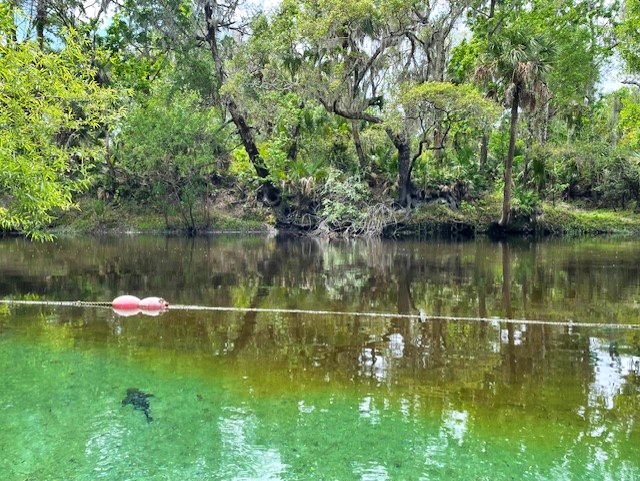
The canoe launch at Lithia Springs park is a little downstream of the springs, so the short paddle on the river provided a nice alternative to the pool. It was very easy to spot the Lithia Major run, which I came upon first, by the clear plume of spring water flowing into the brown water of the river.
The water of the spring was clear as a bell as it flowed into the tannic, tea-colored river. An exotic armored catfish (Pterygoplicthys sp.) set the stage for what I would see as I paddled up the run.
The rope designated that the run was off-limits to the public and someone from the park raced down to ask me what I was doing when they spied me in my boat. Clearly, they have a lot of pressure from the public, but they were very gracious when I told them what I was doing.
The run was very shallow, sandy, and chock full of exotic fish. After the armored catfish, I next noticed the abundant blue tilapia (Oreochromis aureus) nests.
A very obvious blue tilapia nest.
Three tilapia nests, one with the male guarding it (top), and a closeup of the fish on the nest (bottom).
It was an interesting visit, if slightly shocking, because I have never seen abundances of exotic fish like I saw in the Tampa area springs. Had I spent time observing fish around the canals of south Florida, perhaps I would have been more prepared for the overwhelming biomass of exotic fish in both the Hillsborough and Alafia springs.
Every fish in these two images from Lithia Major, one from either side of the run, was either a juvenile blackchin tilapia (Sarotherodon melanotheron) or spotted tilapia (Pelmatolapia mariae). While I chose stills from the videos that I thought highlighted the fish well, the videos were filled with these fish. The other videos that I collected from this spring were similar.
The blue tilapia, which were less abundant than the blackchins or the spotted tilapia, dwarfed the other cichlid species. Until I surveyed at Lithia, I had not appreciated how aggressive the blue tilapia could be or how deep their nests were. Blue tilapia build and maintain their nests by picking up sand in the nest site and spitting it outside of the nest.
A blue tilapia building a nest.
I also picked up on video a bunch of the much smaller chanchita (Cichlasoma dimerus, yet another exotic cichlid), The video depicts an interesting feeding behavior of a chanchita in the foreground as it wiggles its tail to kick up food. An aggressive blue tilapia in the background sinks into its nest like a giant hovercraft (a longer version of this video showed the tilapia chasing away fish that approached its nest).
A chanchita doing a little feeding dance while a blue tilapia returns after defending its nest in the background.
Loads of armored catfish littered the run as well.
Armored catfish feeding in the run with a few blackchin tilapia in the background.
I did see a few native fish in the run, mostly seminole killifish (Fundulus seminolis), but also at least one largemouth bass (Micropterus salmoides) and a few individuals of various sunfish species (Lepomis spp.).
Two seminole killifish with blackchin tilapia and armored catfish in the background (top) and a lone largemouth bass with blackchin tilapia in the background (bottom). It is interesting how pale the bass was in this sandy spring.
Lithia Minor
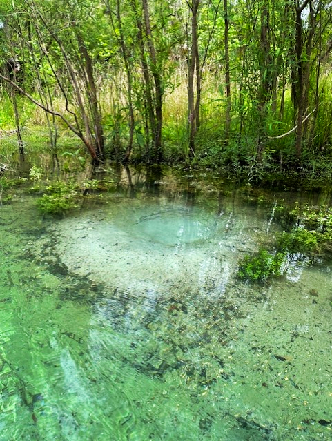
As might be expected, Lithia Minor was a much smaller spring than Lithia Major, with a round and rocky headspring and short, shallow run. The substrate was darker and supported a lot more aquatic plants.
The Lithia Minor run looking out toward the river.
The Lithia Minor headspring and vent (the bluish color).
For as small as Lithia Minor was, it had a lot going on. The fish included all of the species that occurred in Lithia Major, with the exception of seminole killifish, but it had relatively more native fish than its larger cousin. Perhaps the replacement of the big sandy plains with a rocky substrate accounted for the lower percentage of blackchin and blue tilapia, both of which dig pit-like nests 9https://www.fishbase.se/summary/1412). Adult spotted tilapia, which I did not see in Lithia Major (I only saw loads of juveniles), also were present in Lithia Minor.
The Lithia Minor headspring, looking downstream (top) and back at the vent (bottom). In the top photo, spotted tilapia that were transitioning from juvenile to adult are in the center of the frame, identifiable by the bars that were shortening into spots. Above the spotted tilapia was a native bluegill sunfish (Lepomis macrochirus) and some blue tilapia. In the bottom photo, all of the fish were spotted tilapia and all were juveniles with the exception of the fish with the spotted yellow side.
I picked up a couple of new fish (to me) at the Lithia Minor headspring: a Rio Grande cichlid (Herichthys cyanoguttatus) and an African jewelfish (Hemichromis letourneuxi).
A Rio Grande cichlid (top) and two African jewelfish (bottom) at the Lithia Minor headspring.
A video of an armored catfish scraping algae off of the rocky side of the Lithia Minor vent. Also visible were two largemouth bass, some spotted tilapia, a couple of bluegill sunfish (barred with black dot on dorsal fin), and a Rio Grande cichlid in the foreground.
In one of the most fun and scary clips of the project, two adult spotted tilapia herd a cloud of juveniles down the run (hopefully, they are visible in the small version of this clip!). According to FWC, spotted tilapia have sticky eggs (~2000!) that they attach to hard surfaces (https://myfwc.com/wildlifehabitats/profiles/freshwater/spotted-tilapia/), so it makes sense that they would be spawning in this spring rather than in the sandy Lithia Major.
Spotted tilapia parents guarding their young in Lithia Minor.
Buckhorn Spring
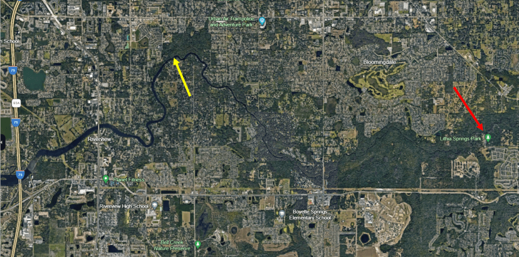
Buckhorn Spring is several miles downstream of Lithia Springs, on a northward curve of the Alafia River before it heads to Hillsborough Bay. To find the spring, I floated downstream from the Alafia River public boat ramp
Google Earth image showing the location of Buckhorn Spring (yellow arrow) relative to Lithia Springs (red arrow).
A lower elevation photo showing the location of the headspring at the top right of the photo and the plume of Buckhorn Spring entering the Alafia River (yellow arrow).
The spring was of my favorite type, narrow and sandy with full canopy. However, it also had about a million snags, so trying to get all the way up to the headspring was ambitious, particularly given that I read that the headspring is owned by Mosaic Phosphate Company. I had planned to paddle up to the fence and take a picture, but alas after portaging over many, many trees, I realized that I would likely run out of time before I made it up there. I turned around about halfway up the run. Buckhorn Creek is reputed to have several springs that contribute to its flow and I am fairly sure that I found one of them, but it appeared to not be flowing.
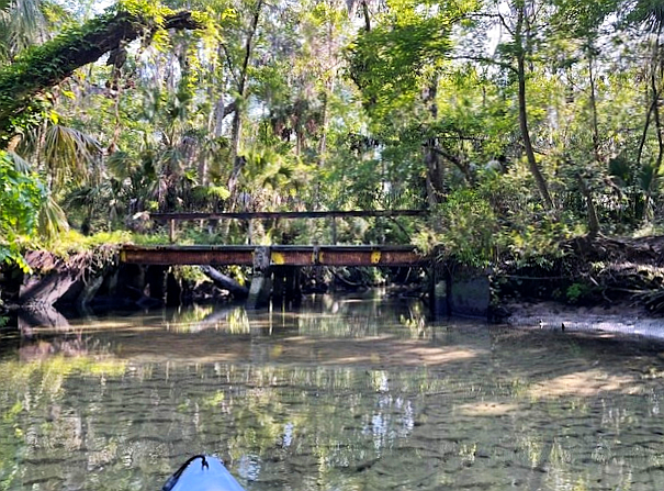
This bridge crossed Buckhorn Creek a short way up the run from the Alafia River.
One of the many obstacles, although this one was relatively easy to get past.
Along a lot of the run, I observed no fish from the boat. The water flowed very fast and scoured the run down to the sand in many areas. At the spot where I turned around, about halfway up the run, I captured no fish on the cameras either, but as I worked my way downstream, I picked up the occasional sunfish and lots of shiners working very hard to stay in place in the vicinity of flow-blocking structure.
Shiners working hard to stay in place about 1/3 of the way up the Buckhorn Spring run.
A spotted sunfish hanging out around the flow-breaking structure of logs.
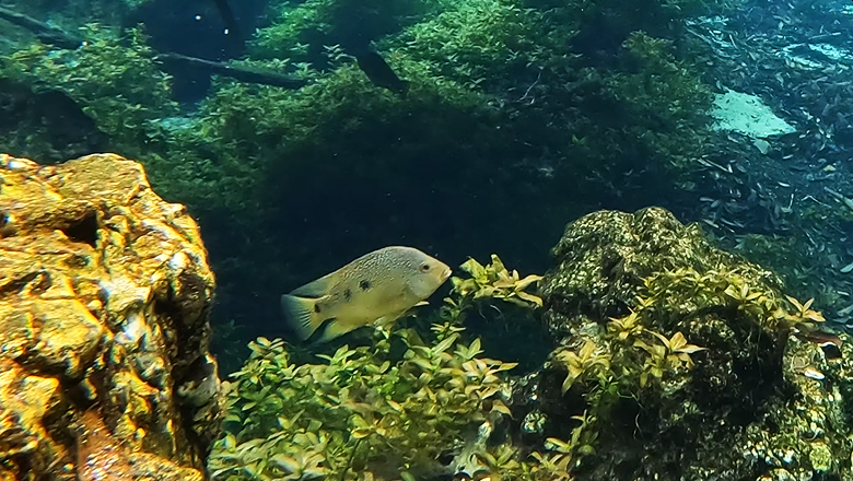
Downstream of the bridge, the spring was deeper and the flow was a little slower. The fish did not have to work as hard to stay in place and so I recorded lots of shiners as well as a largemouth bass and a spotted tilapia.
A largemouth bass in the upper corner of the image with a huge shoal of shiners.
A spotted tilapia inspecting the camera.
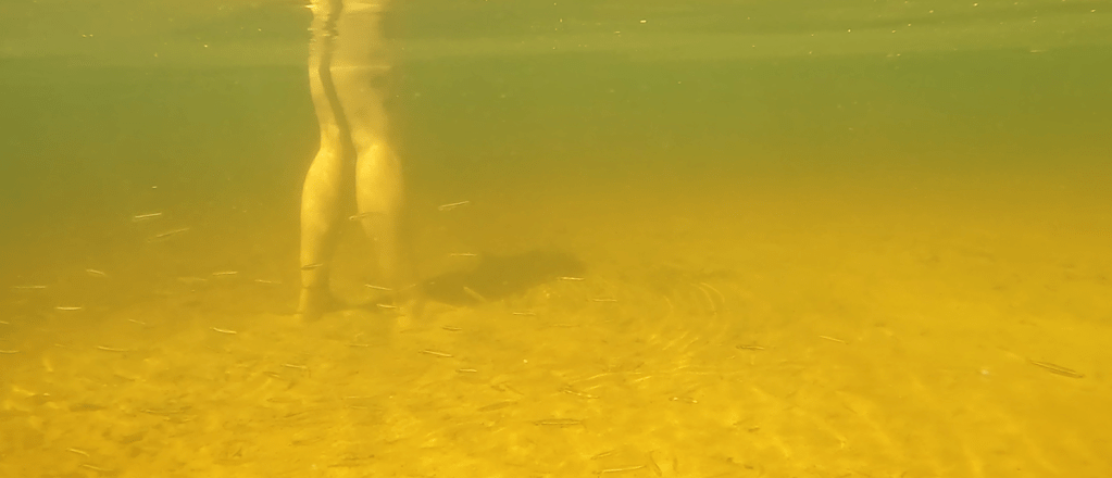
Where the spring water met the river, the light became golden and spotted sunfish and tilapia milled around, entering the spring and returning to the river.
A spotted sunfish at the confluence of the spring and the river.
The point where the spring enters the river is apparently a popular spot for recreation. I watched three different parties spend some time there in the short time that it took me to film the end of the spring. One woman told that I should come out and film the “fish tornado” around her legs. It turns out that the tornado was composed of silversides; usually when I see silversides, they are golden silversides (Labidesthes vanhyningi) and I see them alone or in pairs. Inland silversides (Menidia beryllina), on the other hand, form schools, so perhaps I would have another species to add to the list if I could be sure of the identification in the murk.
Recreators at the confluence of the spring and the river (top) and the “fish tornado” of silversides (bottom) in the river just off the point where the boat is parked in the top photo.
Spring characteristics and water quality
The three springs described in this post differed greatly in morphology, from very wide to very narrow. Two of the three were sandy; one was rocky. Two had moderately high flow; one had very high flow. Despite these differences, all three had relatively little algae and all had loads of exotic species. All three were on the slightly warmer side for Florida springs (24.1 to 25.9oC).
I was not able to measure oxygen at the headspring of either Lithia Major or Buckhorn Spring. In its short run, Lithia Major ranged from 2.74 to 5.69 mg/L and, in its longer run, Buckhorn ranged from 3.77 to 5.28 mg/L. Lithia Minor ranged from 1.75 mg/L at its headspring to 3.88 mg/L near its confluence with the river. The conductivity of these springs was about double the values for springs that I visited farther inland (Lithia Major ~560 microS/cm, Lithia Minor ~570 microS/cm, and Buckhorn ~540 microS/cm), but still low relative to the springs with tidal influences. The values for all of these variables seem typical to good for Florida springs.
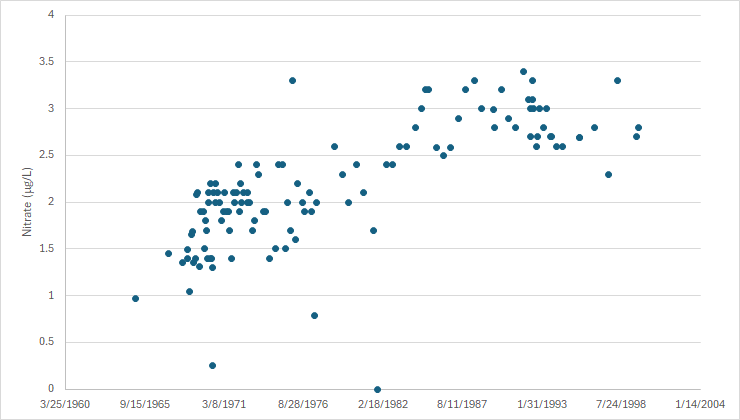
However, the water quality data that I found suggested that all three have experienced massive increases in nitrate, despite their lack of abundant algae. The USGS collected nitrate data for Lithia Major from 1965 to 1999 (why did they stop?) and these data show a huge increase in nitrate up to the late 1980s, but the nitrate concentrations in 1965 already were quite high (if the background nitrate concentration was on the order of 0.35 mg/L). What were background concentrations of nitrate in these springs if concentrations were already so high in 1965 and what has happened since 1999?
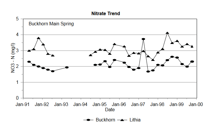
Data in a SWFWMD report for Buckhorn from the early 1990s to 1999 suggest that its nitrate concentrations were only a bit lower than those of Lithia. The only data that I could find on USGS NWIS for Buckhorn were from 1972 and suggest that nitrate was 0.9 mg/L at that time.
A SWFWMD report from 1993 indicated that the source of the nitrate in Lithia and Buckhorn Springs was “inorganic fertilizers applied to citrus, with minor animal-waste [dairy] contributions” (https://www.swfwmd.state.fl.us/sites/default/files/medias/documents/LithiaBuckhornSprings.pdf). It also reported that the “minimum travel time of groundwater in the fracture [limestone fractures in the aquifer] is approximately 1 mile every 5 years”. According to a Hillsborough county website, the proportion of land in agriculture has dropped from 27 to 13% from 1990 to 2020 (http://hillsborough.wateratlas.usf.edu/watershed/geography.asp?wshedid=1&wbodyatlas=watershed), but I could find no data older than 1990. If land in citrus was taken off line, how long would it take the nitrate to stabilize or decline if other land uses contributed less nitrate? The report indicated that bringing 11,000 septic online by the early 1990s might affect the spring nitrate concentrations. It would be interesting to know what those concentrations are now.
At a discharge of 400 million gallons of water per day, Wakulla Springs is one of Florida’s monster spring systems. Its wide headspring drops off quickly to the vent 185 ft below the surface, fed by an extensive cave network that has connections from just south of Tallahassee to the Gulf. Sally Ward Spring enters Wakulla just below the headspring.
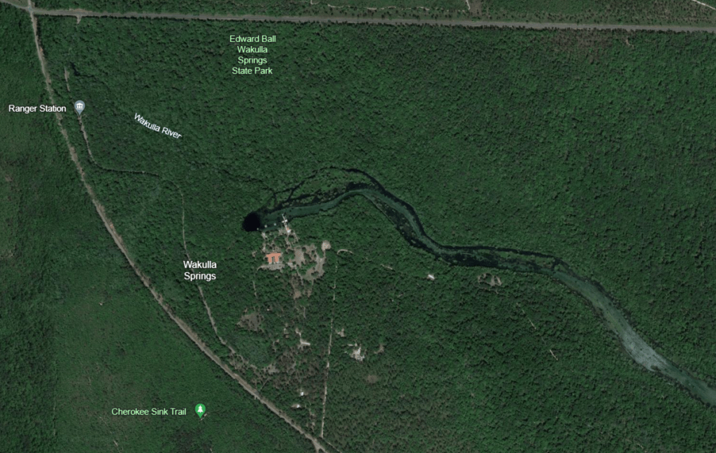
The Wakulla headspring looks like a deep dark hole on the map. The run beyond it is wide and fairly shallow. The water labeled “Wakulla River” on the map is actually Sally Ward Spring.
In some ways, it is one of the best protected springs in the state as well as one of the largest. When he deeded the land to the state, Edward Ball stipulated that the general population would only be allowed beyond the swimming area on escorted tours. He wanted to ensure that the spring would not be loved to death, as they say. As a result, the swimming area with its dive platform, shown in the opening photograph, is the only way that an individual can get on the water without getting a ticket for a pontoon boat ride. Much of the landscape to the east and west of the spring is heavily protected.
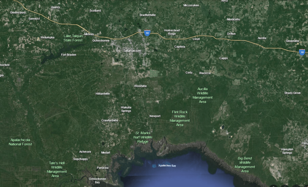
Map of the big bend area of Florida, with Wakulla Springs shown south of Tallahassee.
However, given the extensive connections in the region, the water leaving the vent has likely been impacted at multiple points within its springshed. Landscape impacts are a reality for all Florida springs, but the Wakulla connections are especially vulnerable (an infographic by FusionSparks media is particularly helpful in seeing the flow direction: http://www.fusionspark.com/portfolio/wakulla-springs-interactive-graphic/)
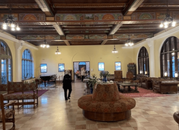
In addition to protecting the spring from heavy human use, Edward Ball also provided the park with a mansion that functions as a lodge and restaurant now. While it has amenities like wifi, history lives on in the lodge.
The entrance to the Lodge.
The lobby of the Lodge with hand painted ceiling beams.
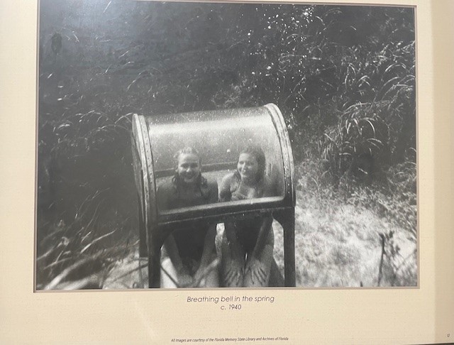
A whole row of historic photos grace the hallway walls.
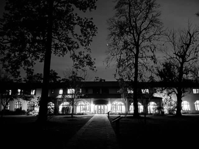
The Lodge at night, photographed with my back to the spring.
A visit to Wakulla Springs is fun on many levels, but I was there to work. I started on Sally Ward Spring.
Sally Ward Spring
The first Sally Ward vent.
Most people miss Sally Ward Spring. Its runs roughly parallel to the driveway into the park and the access point to the spring is shortly after the entrance to the park off the highway. However, it is difficult to see from the road and there is no obvious parking for it. I must confess that I have not seen the absolute source of all of its water as there is water running from a culvert that runs under the road. However, it seems that most of the water is coming from the two vents below the culvert, and they shimmer with the aqua blue that make so many Florida springs lovely.
The second vent was in a bit of shadow as it was late in the day.
Many of the fish that I observed were mosquitofish (Gambusia holbrooki), shiners, and sunfish of various species (Lepomis sp.). However, there were more species on the footage than I remembered initially: a fair number of bluefin killifish (Lucania goodei) milling around, some striped mullet (Mugil cephalus) streaming past the camera, a surprising number of largemouth bass (Micropterus salmoides), a golden silverside (Labidesthes vanhyningi), and a couple of turtles.
A largemouth bass with a bluefin killifish getting out of its way.
A shoal of mullet.
These small fish originally appeared to be shiners. However, when I zoomed in on the photo, their tails looked square rather than forked, so I think that they are juvenile bluefin killifish narrowly avoiding 10 (!) largemouth bass. I counted a dozen bass on another video downstream.
A golden silverside and a turtle.
I had originally intended to film at 5 locations on Sally Ward Spring (my typical plan). However, there was a large alligator between station 5 and me. I do not usually worry too much about alligators while I am in my boat, but the run was very narrow and I was warned about an alligator at this exact spot in 2017. While looking right at me, it sank down into the water and I decided instead to film where the hiking trail intersects the run downstream. I was rewarded with my favorite video of the entire trip.
The bridge over the Sally Ward run.
Two largemouth bass in Sally Ward run at the bridge.
My favorite: a brown water snake (Nerodia taxispilota), identified by Terry Farrell, foraging on Sally Ward run at the bridge.
Wakulla Spring
Sunrise at Wakulla headspring. Part of the vent was still in shadow.
The next morning I sampled Wakulla Spring at 8 am. Wakulla in the early morning is glorious. The massive spring feels almost prehistoric, with its gnarled old cypress trees running in a line down the north side of the run and petrified cypress stumps under the water line.
Some of the ancient cypress trees (top) and a petrified stump under the water in a photo looking back towards the headspring (bottom). The pontoons are the tour and park service boats.
Although the spring was not as clear as I had hoped, the clarity was still good enough to work. The ranger told me that the spring usually clears up after spring break, but the extent of the brown water is new, likely the result of groundwater abstraction upstream in the aquifer (https://news.fsu.edu/news/science-technology/2018/10/24/why-is-wakulla-springs-water-turning-brown-fsu-researchers-may-have-the-answer/). The video below, taken at the headspring, gives an idea of the volume of water expelled and how dark it was this past February. It appears that the darker water was denser than the clearer water, although this effect could have been an artifact of the camera.
Florida gar (Lepisosteus platyrhincus) in the Wakulla headspring.
Some striped mullet munching their way down the spring. It looks like there is a band of darker water above the sediment.
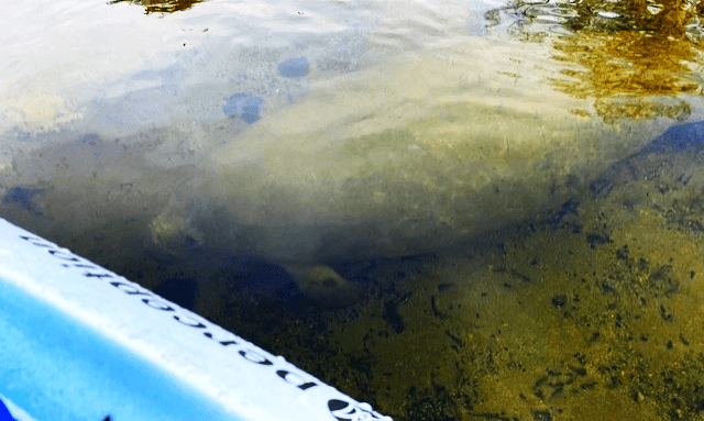
As I worked my way downstream, I was surprised to see a manatee. When I surveyed at Wakulla seven years ago, I saw none.
A manatee friend next to my boat.
Besides the impressively large spring, the gorgeous old cypress trees, the mastodon bones, and the chorus of birds in the morning, one of the notable things about Wakulla Spring is its cohort of beautiful largemouth bass and Florida gar. In addition to the bass and gar, a variety of poeciliids (mosquitofish and sailfin mollies, Poecilia latipinna), killifish, shiners, sunfish, and mullet made the fish assemblage fairly diverse. Turtles were abundant, too.
Largemouth bass.
Some lovely redbreast sunfish (Lepomis auritus).
A big seminole killifish (Fundulus seminolis) and a couple of spotted sunfish (Lepomis punctatus).
More striped mullet.
A turtle at the confluence of Sally Ward and Wakulla Springs.
As I worked my way down the run and up the side channel, I was passed by the park service staff escorting a couple of scientists, one an older gentleman. I am not sure who he was, but he asked me if I was filming the little fish. He said that bluefin killifish disappeared from the spring for a while. Happily, I filmed a lots of them.
Bluefin killifish and a redear sunfish (Lepomis microlophus).
My only disappointment was that I failed to get on video the baby alligators that I scared (by accident) from a nest or the older (but still small) alligator from the bank. All I got was the trail.
The trail of a startled alligator.
Because I was trying to look for saltwater influences on spring fish assemblages, I decided to try filming downstream at the State Road 30 bridge. Although I saw a crab and a couple of sunfish, most of the animals that I observed were olive nerites (Vitta usnea), which represent a brackish species that occurs in the Gulf of Mexico and the Caribbean.
This video of olive nerites crawling is sped up 3000x. A small bass zooms through the video if you can catch sight of it.
With the exception of the tannin stained water coming out of the vent, the water quality of Wakulla Spring appears to be generally fairly good. The likely culprit for the increase in tannin-stained water coming out of the vent, according to FSU scientists, is higher groundwater withdrawals to support growing populations in the region. Tannins are produced naturally when plant material decomposes in swampy conditions, much like steeping tea. The tannin-stained water then enters the aquifer in the regional forests naturally. However, prior to increases in groundwater withdrawals, there was enough clear water in the system that this tannic water was diluted or flowed elsewhere.
With respect to nutrients, the spring has undergone several studies and the history of this work is outlined in the spring’s MFL plan (minimum flow and level). One such study, in 2004-2005, suggested that the city of Tallahassee’s water treatment facility was contributing a great deal of nitrate to the spring due to leakage through the underground connections in the limestone. The water treatment facility was upgraded in 2012. Later, BMAP (basin management action plan) and MFL programs were developed for the spring in 2018 and 2021, respectively. The BMAP, which was primarily focused on nutrient abatement for the spring, again identified Tallahassee’s water reclamation facility as the largest contributor to nitrate concentrations in the spring. As a result, the facility was upgraded again, this time to “advanced wastewater treatment”. The MFL document, which was primarily focused on water quantity but also included water quality and ecological data, reported that by 2021 septic tanks were the largest contributor of nutrients (34%), followed by atmospheric deposition (27%), and farming (21%). As a result, Leon County aggressively constructed four major septic-to-sewer projects, which put homeowners on sewer rather than septic, between 2019-2021. Since the late 1990s, the nitrate concentrations appear to have dropped by almost half. It appears that the biggest improvement was from that 2012 upgrade, but that the other two programs, initiated by the BMAP and the MFL, have continued the nitrate concentration decline towards the 0.35 mg/L baseline goal.
Figure from: Recommended Minimum Flows for Wakulla and Sally Ward Springs, Wakulla County, Florida, Northwest Florida Water Management District.
The conductivity (freshwater version of salinity) of Wakulla and Sally Ward springs has tended to be moderately low for Florida springs (~300+ microS/cm). My measurements agreed with this trend (308-346 microS/cm) in the two springs and the conductivity was only slightly higher in the Wakulla River at the State Road 30 bridge (334-380 microS/cm). Similarly, the dissolved oxygen has tended to be fairly low in Wakulla Spring (1-3 mg/L). The dissolved oxygen that I measured was fairly low at the Wakulla vent (2.0 mg/L) and in the vicinity of the Sally Ward vents (3.0 mg/L). However, the oxygen downstream of the Wakulla headspring was a bit higher (3.3-6.6 mg/L), as it was in Sally Ward (3.9-8.4 mg/L), likely due to the large eelgrass (Valisneria americana) and algae beds.
The Hillsborough River springs were about as different from the Econfina Creek springs as Florida springs could be. Whereas the Econfina Creek springs were somewhat wild and remote, the Hillsborough River springs were city springs with echoes of swimmers and picnickers past and whispers of visitors future. All three springs have exceedingly short runs that flow into the lower half of the Hillsborough River in the heart of Tampa.
The location of the three springs (Sulphur, Purity, and Ulele, right to left) in the Tampa metro area.
Sulphur Spring
I visited Sulphur Spring first, after securing a permit from some very nice people at Film Tampa Bay (I thought that process was funny because the group issues permits for companies making feature films and whatnot). The park hosts two large pools. One is a round pool of spring water that fills the run through a dam. The other looks like a regular swimming pool. From the round pool, after the water goes through the dam, it travels down a short run and into the Hillsborough River. The banks of the run are partially constrained by cement and metal walls and other park structures.
The spring issues from somewhere under the round pool and the water shoots through a huge dam, marked by a red arrow, into the run below, which enters the river at the yellow arrow.
The dam on Sulphur Spring.
The corroded retaining wall along the upper part of the run across from the large dam.
A bridge and gazebo about halfway down the run.
Because it was the off season, the park was locked up tight, so I put my boat in at the river just below the spring. As I launched, I noticed some crab carapaces among the rocks, which was encouraging as I was hoping to find salt-tolerant fish in the run. Fortunately, I was able to paddle up the run from the river, passing some manatees resting in the warm outflow in the early morning.
Manatees just visible in the spring’s outflow.
The water flowing over the dam produced a plunge pool of deeper water, but the remainder of the run was quite shallow. It appeared that exotic tilapia were nesting in deeper water of the pool. Male tilapia build nests by excavating sand with their mouths. They defend these nests during breeding season, waiting for females to come deposit their eggs. However, the nests that I saw in Sulphur Spring appeared to be empty.
A likely tilapia nest in the plunge pool.
Throughout this 2024 version of the project, I have been looking for differences in fish assemblages between springs that are proximal to salt water and springs that are not. All of the fish that I observed in this spring were either salt tolerant or exotic. Of the native freshwater fish that I observed, they were all either mosquitofish (Gambusia holbrooki), which can live nearly anywhere that is not full sea water, or rainwater killifish (Lucania parva), which tend to occur near coasts in water with higher conductivity (the freshwater version of measuring salinity). Rainwater killifish are fun because they can change hue with their background, appearing almost white over sand or mottled brown over leaves. Over the algal background in Sulphur Spring, they looked mottled, but not very dark.
Rainwater killifish chasing each other in territorial displays.
Sulphur Spring also hosted a fair number of salt tolerant fish, including striped mullet (Mugil cephalus), tidewater mojarra (Euchinostomus harengulus), and Atlantic needlefish (Strongylura marina).
Some mullet that I startled as they were coming up into the run.
Tidewater mojarra darting around with the rainwater killifish.
An Atlantic needlefish. The water clarity was a bit low, so it blends into the background.
This spring was my first experience with the dense exotic fish populations in the Tampa area. Having worked on exotic aquatic organisms for decades, I have looked at maps of exotic fish distributions on the USGS Nonindigenous Aquatic Species website. Even so, I was not prepared for the scale of the issue. If I were to evaluate the biomass (number of fish multiplied by the average weight of a fish) of native and exotic fish in Sulphur Spring, the exotic fish would far outweigh the native fish, I am quite sure. And in Sulphur Spring, they were all blackchin tilapia (Sarotherodon melanotheron).
A video of blackchin tilapia sped up 500 times.
The color patterns on the blackchin tilapia were highly variable. Some were almost all silver, some had golden sections on their sides, and some had spots in various places around their heads.
In addition to exotic fish, Sulphur Spring hosted loads of exotic snails: quilted melania (Tarebia granifera). These snails occur throughout Florida. No doubt other snails occur in the run as well, but their numbers would have been swamped by the hugely abundant quilted melania, I suspect.
Snails dotting the Sulphur Spring run (top) and a close up of the species: quilted melania (bottom).
On my way out of the spring, I stopped to take a look at the recreational area of the park.
The swimming pool features a large pink frog (?) and a yellow water slide.
Purity Spring
After finishing Sulphur Spring, I ventured over to Purity Spring, which was very small. The headspring was surrounded by a small cement wall, presumably to produce a pool for contemplation. It had a short, sandy run that flowed into the Hillsborough River through a culvert.
Purity headspring with its retaining wall.
The clear and sandy Purity Spring run.
Purity Spring outflow into the Hillsborough River.
Given that the connection to the river was through a culvert, I almost did not film here. But I was already there, so I decided to go ahead. The wall around the headspring precluded easy fish movement, although fish from the run were present, and there were no plants in this little pool. However, downstream the run was filled with plants and leaves. Most of the fish in the run were mosquitofish (Gambusia holbrooki) and sailfin mollies (Poecilia latipinna).
Male sailfin molly showing off his blue and gold breeding colors on his tail. Some individuals can get quite extravagant with huge fins and bright colors.
As I watched the mosquitofish living their lives on the video, I was surprised to see three chanchita (Cichlasoma dimerus) timidly approach the camera. They jerk forward and stop as if they are ready to dart off at a moment’s notice.
Mosquitofish and chanchita in the Purity Springs run.
I was surprised again when I saw another exotic species new to me in the wild: the convict cichlid (Amatitlania nigrofasciata). I was starting to see a theme.
A stripy little convict cichlid darts through the foreground. Chanchita and mosquitofish mill around in the background.
This spring also hosted an exotic snail, a different melania: the red-rimmed melania (Melanoides tuberculata).
Red-rimmed melania dotting the sandy substrate of Purity Springs.
The spring itself had much lower salt concentration than the river, producing distortion as the spring water entered the river.
Visual distortion due to the difference in salinity of the water leaving the spring and the water of the river.
Ulele Spring
Ulele Spring, in Water Works Park, is in some ways a brand new spring. I have been told that the original spring was under the law building behind it and the water has been piped out from underneath the building through a culvert and into the restored run of the spring.
The law building in the background sits atop the source of Ulele Spring.
Like the spring, Water Works Park is brand new as well. It was a brownfield site that was completely reclaimed to produce a green space, a splash park, a dog park, restaurants, apartments… and Ulele Spring.
View of apartments (I think) and retail space from the spring.
View of the Ulele Run with Ulele Restaurant alongside. As I worked, people ate and relaxed on the patio.
Public art in the green space next to the Ulele Spring run.
A view looking down the spring at the bridge that spans the run. Just beyond the bridge is the Hillsborough River.
As I worked, a young boy and his dad stopped out of the stream of people walking late in the day. They asked me if I was fishing. After I told them what I was doing, they thanked me for my work. So nice.
When I began to review the footage that I collected at Ulele, I was stunned by two things: 1) the incredibly high density of fish and 2) the incredibly high density of large, exotic fish. I have never seen anything like it.
A very flashy male sailfin molly courting females with a huge dorsal fin and gold color in the foreground (top) and very pregnant female mollies (bottom) in Ulele Spring. Not only are there a lot of mollies and mosquitofish in the foreground, but there are lots of big cichlids milling around in the background. It is a lot of fish biomass.
Beyond the poeciliids (mosquitofish and mollies), there were only a few native, truly freshwater fish. I recorded a few killifish (bluefin, Lucania parva, and least, Heterandria formosa). In the upstream area, almost all of the other fish were exotic. I recorded more chanchita, convict cichlids, blackchin cichlids, but I also observed blue tilapia (Oreochromis aureus) and Mayan cichlids (Mayaheros urophthalmus). The exotic fish biomass was astounding.
A large blue tilapia with a very blue snout (top) and Mayan cichlids with blackchin cichlids in the background (bottom).
Downstream, below a small weir, I observed more marine fish: common snook (Centropomus undecimalis), striped mojarra (Eugerres plumieri), tidewater mojarra (Eucinostomus harengulus), and Atlantic needlefish (Strongylura marina).
Tidewater mojarra darting around the foreground with a snook cruising through the background.
Striped mojarra with blackchin tilapia in the background.
Even with all that fish biomass, a turtle ventured into the spring.
Mayan cichlid in the foreground with blackchin cichlids in the background and mosquitofish and mollies above and below. Shortly after the end of this clip, the Mayan was overrun by more Mayans and blackchins.
I have been looking for saltwater influences on springs and I definitely found them in two of the three of these springs. Purity was too small and disconnected to have salt tolerant fish roaming into and out of it, but the other two springs hosted a combination of freshwater, salt tolerant, and exotic fish. These mixtures of freshwater and salt tolerant fish were no surprise as the conductivity (something like the freshwater version of salinity) in Sulphur Spring (5.3 microS/cm) and in Ulele Spring below the weir (5-5.1 microS/cm) was 25-50 times the conductivity in most of the other springs that I have visited (Ulele conductivity above the weir = 0.7 microS/cm, Purity conductivity = 0.5 microS/cm). According to the eminent Florida journalist and writer, Craig Pittman, Sulphur Spring has experienced increases in salinity as underground connections have changed with landuse on the surface. In Ulele, the high conductivity water below the weir probably was river water.
Finding current water quality data on springs in Florida can be a challenge as it has been collected somewhat spottily, if at all. Nitrogen data for Sulphur Springs suggest that the nitrate concentrations have not been particularly high, but the phosphate concentrations have been an order of magnitude higher than background. High nutrient concentrations could contribute to the abundant algae that I observed in the run, although there is likely more to that story. My data suggest that all three of these springs were particularly warm for Florida springs (25-26C). As for oxygen, for all but the walled-off headspring of Purity Springs, the oxygen concentrations were high for Florida springs (Sulphur: 5.4-9.1 mg/L, Purity: 1.6-4.7 mg/L, Ulele: 6.7-7.9 mg/L). However, I cannot know the oxygen concentrations at the sources of Sulphur and Ulele as I was sampling water that had gone through a dam at Sulphur and through a conduit at Ulele.
Some Florida springs seep from soil, some gush from giant underground gashes in the limestone, and some spurt from caves. Washington Blue Spring is of the latter type with the cool, clear water rushing out of two caves (each with multiple openings).
View of the entrance to the right-hand spring cave (the dark area off to the right of the platform, top) and of the left-hand spring cave (middle) with its multiple openings (bottom).
The water flow produced by the two caves produces a Y-shaped spring. There actually is a third arm (producing a trident?), although I may have missed a vent on that arm. The Washington Blue Spring system is just upstream of Gainer, Pitt, Sylvan, and Williford springs on Econofina Creek. Econfina Creek flows into Deerpoint Lake and eventually St. Andrews Bay at Panama City. The region is agricultural to the east, water management area to the west, and a mixture of both upstream.
Maps showing the morphology of the spring (top) and the location relative to other springs surveyed.
Of the springs that I surveyed on Econfina Creek, this spring had a higher diversity of fish, my main goal in these visits, but also of human experiences. The human density at the park was low, but a few souls were enjoying their Friday morning outside. I heard discussions of the fish present, but also of bar dynamics, salads as healthy eating, and goats as pets. A friendly bear of a man on a paddle board shared his music, Meat Puppets “Backwater”, with the fish and me. Alas, I did not get a picture of the stinkin’ cute pet baby goat that was investigating the sand bar formed by the confluence of Washington Blue Spring with Econfina Creek.
Fish with a soundtrack. The ticking sounds in the background were of animal origin (crayfish?), but the Meat Puppets was being conducted through the water from a boombox and through a paddleboard. I got a big wave from the man on the paddleboard. The fish seem unaffected by the music or the clicking.
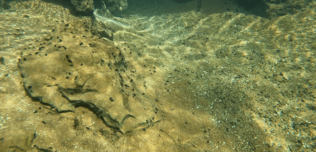
This spring was blanketed with a lot more live algae than the lower Econfina springs. Perhaps as a result, the springsnails (Elimia sp.) had really proliferated, especially on the limestone and sandy substrate near the caves.
A mixture of live and senescent algae at two sites along the Washington Blue Spring run. The brightest green algae was likely Vaucheria, a yellow-green species that resembles green hair.
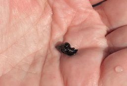
Spring snails on the limestone and sand (top) and a closeup of a snail on my hand (bottom).
I discovered that there were other snails crawling through the sediments when I sped up the film that I collected near the left cave system. Because they were buried in the sediments, I did not see a live one to pick up and identify.
Unidentified snails crawling at 2000x their normal speed.
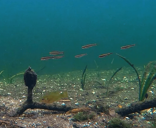
Fish diversity and density was a bit higher in this spring than in the other springs the I visited on Econfina Creek in February. In addition to the shiners and sunfish that I saw at those other springs, I recorded more species of sunfish, more bass, more fundulids (killifish and topminnows), and some golden silversides (Labidesthes vanhyningi) at Washington Blue Spring. Spotted sunfish, which approached nearly every camera in central peninsula, were less abundant and more shy here. Instead, I got some footage of shiners attacking the camera.
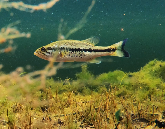
Pretty juvenile redbreast (Lepomis auritus) and redear sunfish (Lepomis microlophus) that are a little too close to the camera and moving to be sharp (top). A golden largemouth bass (Micropterus salmoides) matching the algal background (bottom).
A Russetfin topminnow (Fundulus escambiae) in the shallows near one of the caves (top) and a golden silverside and largemouth bass downstream (middle and bottom).
Shiners attacking the camera with human discussion traveling through the water in the background.
Given the high proportion of water management area land near Econfina Creek, nutrient concentrations were generally low for the period of 2009-2020 (https://protectingfloridatogether.gov/water-quality-status-dashboard). In that time period, most data points were near ~0.2 mg/L with periodic measurements up to 0.6 mg/L and a few high spikes up to 1.4+ mg/L (that would be considered quite high). Phosphorus has exhibited similar trends with most points quite low (~0.01 mg/L), virtually all points below 0.03 mg/L and just a few points in the 0.035-0.045 mg/L range. Interestingly, the oxygen concentrations were higher in the shallow left arm (3.8-9.9 mg/L) than on the deeper right arm (1.9-2.8 mg/L) of the spring, likely due to the abundant algae. Downstream, the oxygen concentrations were 6.3-7.1 mg/L. The conductivity was low 1280-1450 microS/cm for all samples.
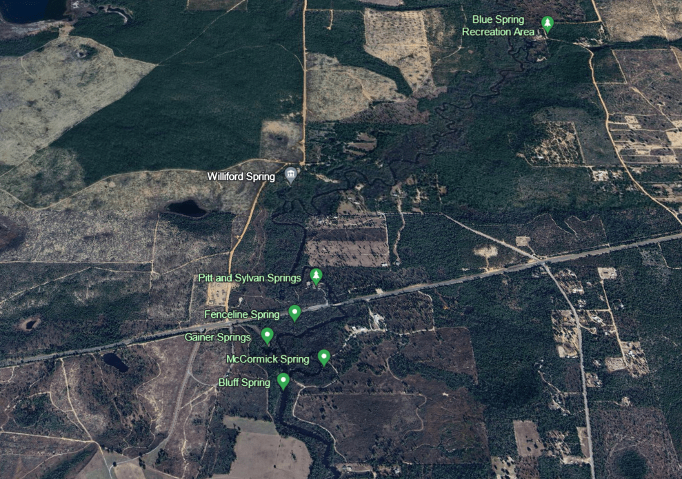
Pitt (above), Sylvan, and Williford springs are just upstream of the Gainer springs group on Econfina Creek. The region around Pitt and Sylvan Recreation Area hosts a cluster of springs that contribute to Econfina Creek, which flows into Deerpoint Lake and eventually St. Andrews Bay at Panama City. The region is agricultural to the east, water management area to the west, and a mixture of both upstream.
Map of the landscape around Pitt, Sylvan, and Williford springs (top) with a closer version showing some of the many springs in the vicinity (bottom).
Pitt Spring has a parking area adjacent to it, but walking trails connect with the other two spring systems. I raced to visit these springs before I ran out of light for the day. Because I had to use a boat to get there, I visited the Sylvan Spring system first. In my haste, I only found the spring system by the clear water flowing out into the flooding Econfina River. I paddled up the short run to a flat, sandy underwater plain that was largely covered with dead algae. Near the bank at the end of this plain, I saw a tell-tail sign of spring vents: circular rippling on the surface.
The three Sylvan vents at the surface.
Underwater, the vents were obvious by the live, bright green algae waving in the flow.
Sylvan Spring vents underwater. Notice the fluttering green algae.
The dead algae-covered sand plain near the Sylvan vents.
The fish density was quite low in this spring system and virtually all of the fish that I observed were sunfish of one species or another. I only observed larger numbers of fish, interestingly, at a spot where the water was murky with suspended material. Here, the bluegills were undoubtedly eating invertebrates from the decaying algae.
A spotted (Lepomis punctatus) and a longear sunfish (Lepomis megalotis) in clear water and bluegill (Lepomis macrochirus) in the murkier water.
Near the confluence, there were lots of snails covering fallen log, although I sadly did not pick any up to identify them. Next time.
Snails dotted all over a fallen log with a lone sunfish in the background.
The river was running fast due to the flooding and I flew back to the canoe launch.
Floating down the Econfina River to the canoe launch from Sylvan Spring.
Once I pulled the boat out of the water, I visited Pitt Spring on foot as the confluence with the river was blocked. Pitt Spring was a contrast to the Sylvan system: lovely, clear and blue, with a large, round vent and almost no run. However, the fish diversity was low there as well. I thought that there were only shiners and sunfish, mostly bluegills (Lepomis macrochirus), but when I scanned through the extra footage, I discovered a fish new to me: a lovely little russetfin topminnow (Fundulus escambiae).
Shiners (top), bluegill (middle), and a russetfin topminnow (bottom) at the Pitt headspring.
After filming at Pitt Spring, I hurried up to Williford Spring by car. A trail leads to the spring from the Pitt/Sylvan parking lot, but I was running out of daylight. Had I had more time, I could have paddled up to it, but it was a bit of a trek, so I filmed on foot only.
The Williford Spring vent at sunset.
The fish density in Williford Spring also was low. I only observed mosquitofish (Gambusia holbrooki) and a few bluefish killifish (Lucania parva). I was rewarded, however, with a tiny juvenile musk turtle in one of the videos. I have seen an adult musk turtle (Sternotherus sp.) mistaken for a juvenile snapping turtle because they are so small; the juvenile musk turtle is barely bigger than a quarter.
Underwater views on either side of the Williford vent, with mosquitofish at the surface and a tiny juvenile musk turtle in the lower left hand corner of the bottom photo.
All three of these springs benefited from restoration projects between 2012 and 2015. Projects included bank stabilization and stormwater runoff reduction. I could not find specific water quality information for the springs, but nutrient concentrations for Econfina Creek have been generally low for the period of 2009-2020 (https://protectingfloridatogether.gov/water-quality-status-dashboard). Most data points have been in the ~0.2 mg/L range with periodic measurements up to 0.6 mg/L and a few high spikes up to 1.4+ mg/L (that would be considered quite high) during the period of the restoration. Phosphorus has exhibited similar trends with most points quite low (~0.01 mg/L), virtually all points below 0.03 mg/L and just a few points in the 0.035-0.045 mg/L range. My oxygen measurements were low for the headspring of each system (0.45-1.95 mg/L) and the measurements for the Sylvan run only reached as high as 4.72 mg/L for one sample. The conductivity was low 1330-1400 microS/cm for all samples.
Like the Choctawatchee River, Econfina Creek is a hotspot for springs in the panhandle. Many of those springs, alas, are on private land, but fortunately, there are some springs accessible from public land.
The SR 20 canoe launch. I travel light.
Econfina Creek flows into Deerpoint Lake just north of Panama City. Although the area to the west looks a little like agricultural land, it is actually part of the Econfina Creek Water Management Area. It felt much more natural on the ground than it appears in the Google Earth image. It was a lovely drive over.
A few of the many springs on Econfina Creek.
During the planning stages of this project, I was told that the area was completely transformed by the loss of large riparian trees during Hurricane Idalia. Some large trees made through the storm, but clearly the area had been ravaged.
A Google Earth image from 40 m with some downed trees still visible (top), a photo from the river showing trees stripped of most or all of their branches (middle), and some trees that made it through the storm (bottom).
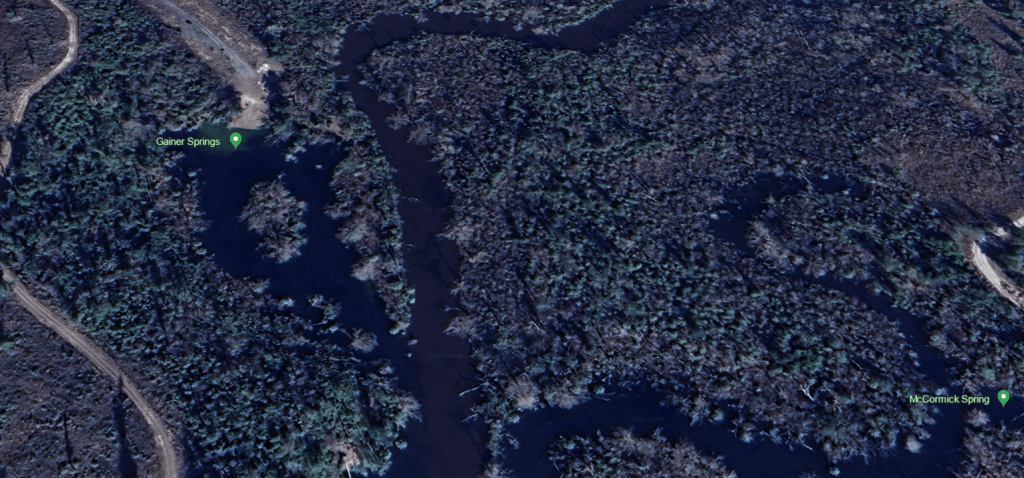
The creek was flowing very brown, turbid, and fast, so I flew down to the springs. Once there, though, the spring water was clear. Despite being the southernmost of the springs that I visited that day, I found Gainer #2 first. Gainer #2 Spring comes from a small cave in the pitted limestone wall along the edge of the river. The pressure from the spring water shot me backwards as I tried to photograph it.
The limestone banks of the river, just upstream of Gainer #2 Spring.
Gainer #2 Spring cave.
Not surprisingly, given the water flow, there were few fish to film. Next to the strong flow out of the cave, there was a little backwater area with a few shiners, but not much else. Fish aren’t stupid.
The cave and its outflow area (top) and the outflow area underwater (bottom). The pressure from the strong water flow from Bluff Spring blasted the sand clear of vegetation and detritus.
After Gainer #2 Spring, I paddled upstream a hundred meters or so into a little run to reach the Gainer #3 springs. Although the description of this system is Gainer #3, there were actually two springs up this run (and apparently, I missed a third), which formed a large pool with an island in the middle. The spring on the right side of the pool (facing upstream) was a large vent on the bottom and the spring on the left side of the pool came out of a cave in a limestone wall, like a smaller version of Gainer #2. The large vent on the bottom had been the real goal for the day because it is a first magnitude spring, discharging more than 150 cubic feet per second. I missed the spring coming out of the wall on my first visit, but I could not miss the main vent, which was blasting sand out in a plume. It was gorgeous.
Gainer #3 main vent blasting sand.
The caves that represent the other Gainer #3 vents (one on far left, another closer to middle, a third on right).
This system was much bigger than the Gainer #2 system and it supported a lot more fish, including some redear sunfish (Lepomis microlophus). I see this species often at Volusia Blue Spring, but I have recorded them only rarely on this survey of Florida western springs. I also recorded a warmouth sunfish (Lepomis gulosus), which I rarely see and is characterized by its large mouth and iridescent rays radiating back from the mouth on the opercula (gill covers). The bottom of the run was blanketed with a mixture of senescent and live algae, like so many other Florida springs.
Redear sunfish with the Gainer #3 vent in the background.
Bluegill sunfish (Lepomis macrochirus), largemouth bass (Micropterus salmoides), and redear sunfish in the Gainer #3 run.
A slightly banged up warmouth sunfish underneath a bluegill near the cave vents that contribute to the Gainer #3 run.
In addition to shiners, sunfish, and bass, I also captured some bluefin killifish (Lucania goodei), Florida gar (Lepisosteus platyrhinchus), spotted sucker (Minytrema melanops), and a few exotic grass carp (Ctenopharyngodon idella). This spring was the only location where I filmed any exotic fish in the panhandle or Big Bend area of Florida.
Florida gar that I scared floating down the run (top) and a spotted sucker (bottom).
Grass carp moving off into the river (bottom).
Racing against the coming end of the day, I also ventured up the Gainer #1 run. This spring run was the longest of the three and much narrower than Gainer #3. However, like the main Gainer #3 vent, it also was shooting out sand, although at a lower volume.
Gainer vent #1C pumping out sand.
The fish that I recorded in Gainer #1C were similar to the two other Gainer springs in the group, although I did not see the grass carp in this shallower spring run. I captured on video mosquitofish, shiners, sunfish, bass, and, in one video, bluefin killifish (Lucania goodei) males showing off their colorful fins in a display of aggression. I also picked up a turtle that passed behind a spotted sunfish (Lepomis punctatus) and a largemouth bass (Micropterus salmoides) in one of the videos taken in the run. The turtle was probably a yellow-bellied slider (Trachemys scripta) according to Terry Farrell, Florida herp expert extraordinaire.
Male bluefin killifish showing aggression.
Spotted sunfish, largemouth bass, and turtle.
Bluff Spring
On my first trip to Econfina Creek, I completely missed Bluff Spring, which was just downstream from Gainer #2. It was substantially smaller than most of the Gainer springs and, although it also had water issuing from small caves, it also had water shooting from underneath a limestone wall. This flow produced a small pool alongside Econfina Creek, which was obvious once I was on top of it by the clear water. All but two of the fish that I recorded here were sunfish; the other two were largemouth bass.
One of the caves releasing spring water (top) and water shooting out from under the limestone wall (bottom).
It is interesting that the springs of Econfina Creek were clear when a) the springs of the lower Choctawatchee were not and b) the creek itself felt like it was running fast enough to be flooding. I have a lot to learn about the hydrology of the panhandle.
The clear springs of the Econfina (yellow) as opposed to the brown springs of the lower Choctawatchee (red).
There is a USGS publication that I regularly consult, called the Springs of Florida. It was originally published in the 1977 and it was updated in 2004. Along with lots of useful information about discharge and water quality from the 1960s, 1970s, and early 2000s, there are photos. I do not know when these photos were taken, but in these photos, the substrate of Gainer Springs is bare sand. In my photos and videos, the substrate is covered mostly in senescent and some live algae (the brown is senescent, dying or dead). In fact, in the Gainer vent #3 video, there is a little patch of the senescent algae that goes rolling down into the vent, exposing the sand below, after I apparently disturbed it with my paddle.
Alas, I can find no more current water quality data than what was reported in the Springs of Florida, but those data suggested that as of 2001, the nitrate concentrations were quite low (0.16-0.21 microg/L). I very much wonder what they are now. The temperature data that they reported (21.1-22.0 C) was similar to what I measured on my visit (21.7-22.0 C). Their reported dissolved oxygen (2.12-3.0 mg/L) was somewhat higher than my measurements (1.07 mg/L at the headspring of Gainer vent #1), which may be related to the senescent algae. Their conductivity, which is a measure of salts in the water, was low (82-142 microS/cm), as mine was (133-155 microS/cm). Clearly, these springs are not being tidally influenced by the Gulf, at least not in terms of salt.