March 2024
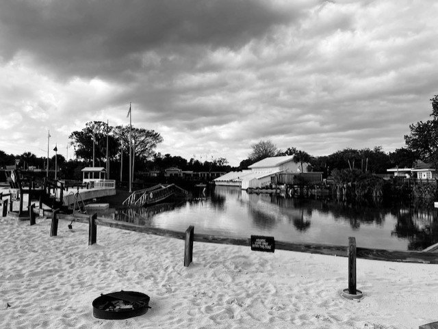

View of the mermaid show building from “Buccaneer Bay”, looking upstream at the headspring (top) and down the run at the waterslide (bottom).
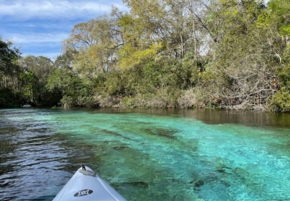
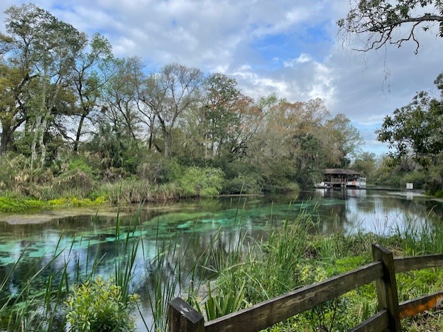
Weeki Wachee Spring was not what I expected. I had only been to the park once in the early-mid 2000s for a conference on spring conservation. I brought my sons who were smallish at the time and they had a blast playing on the water slide and whatnot. Therefore, I expected the water slides and, of course, the mermaid theater for which the park is so famous. However, I did not expect the gloriously blue and clear water of the run below the water park. It was wonderful.
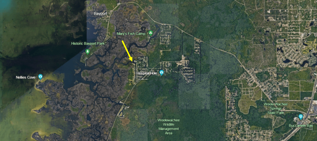
The park sits at the southern end of a swath of undeveloped coastal land and salt marsh, due east of Brooksville. Like Homosassa Springs, the west of the springhead is green coastal forest and salt marsh, but downstream development punctures the green between the spring and the Gulf. However, there the comparison ends. Homosassa is wide, deep, and relatively straight with development right outside the park and all down the north side. Weeki Wachee is narrow, shallow, windy, and turquoise, with a substantial house-less stretch of the run just downstream of the park.
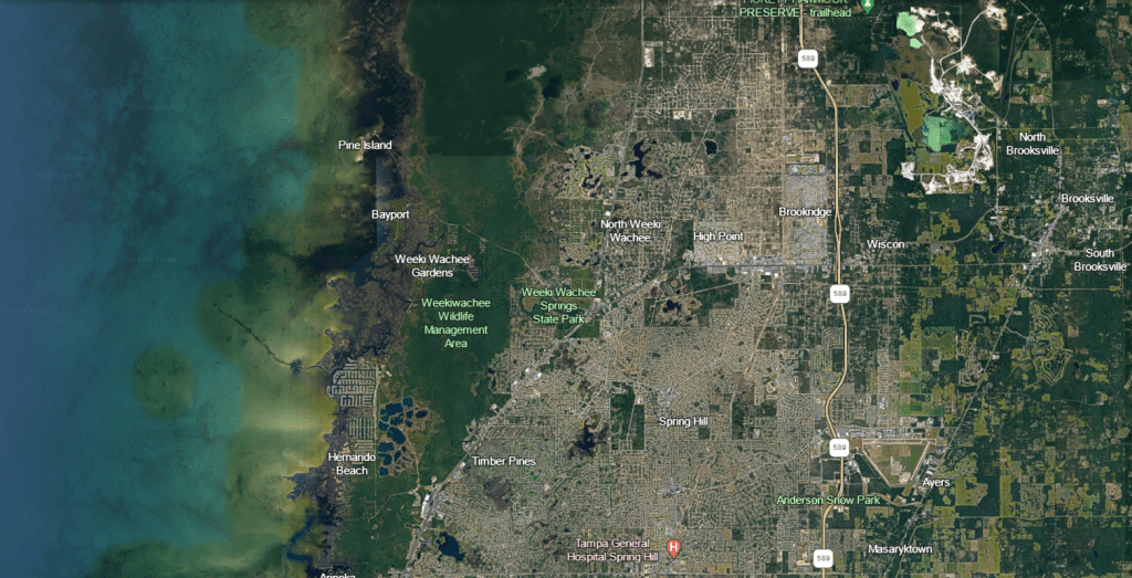
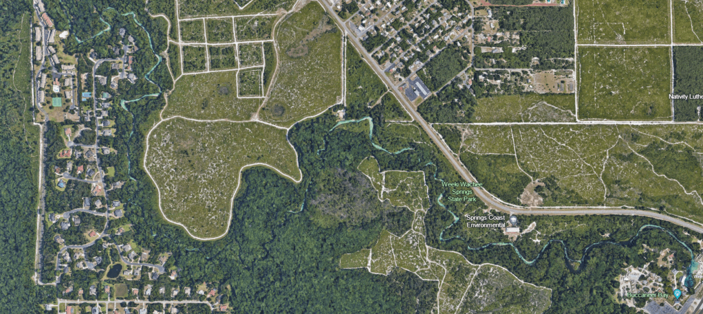
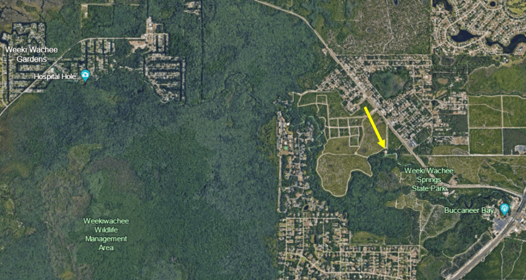
Google Earth images showing Weeki Wachee State Park, Wildlife Management Area, and nature coast development (top) and the blue of the run, even visible by satellite (bottom).
Happily, the park let me in before the visitors arrived, so I was able to photograph unobstructed.
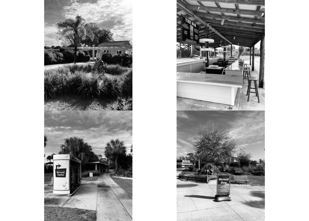
Features of the park, often highlighting the mermaids.
Despite the built environment of the mermaid theater, Buccaneer Bay, and the support buildings surrounding the headspring, the run was clear and wonderfully blue.

View downstream of Buccaneer Bay, looking at the ecotour dock (top) and of the run further downstream as I floated downstream (bottom).
When I first started filming, the park was very quiet. After a quick splash, I saw a diver disappear into the large headspring. This round-ish headspring measures approximately 100 ft across and the mermaids swim down to a depth of about 20 ft and cave divers report that the main pool is 45 ft deep (https://www.floridastateparks.org/learn/history-weeki-wachee, http://www.caveatlas.com/systems/system.asp?ID=89). However, divers have explored down past 400 ft, making it the deepest cave system in the US (https://www.swfwmd.state.fl.us/projects/springs/weeki-wachee). As I set up my first camera, I had no idea that someone had a rock soundtrack going underwater for their work that day until I watched the video that I collected.
A three legged turtle swimming to Ozzy Osbourne’s Crazy Train.
I was pleasantly surprised at the diversity of fish, even at the headspring. I recorded a variety of shiners and sunfish (Lepomis spp.), bluefin killifish (Lucania goodei), largemouth bass (Micropterus salmoides), gar (Lepisosteus sp.-in the distance so harder to ID), striped mullet (Mugil cephalus), Atlantic needlefish (Strongylura marina), and sheepshead (Archosargus probatocephalus) in addition to several turtles. None of these fish are rare, but still the diversity was higher than several other springs that I visited.

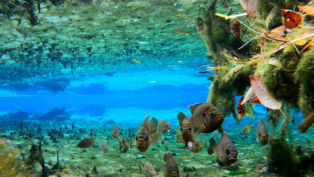
The above-water view as I set my camera downstream of Buccaneer Bay (seen in the distance, top) and the underwater view as bluegill (Lepomis macrochirus) and spotted sunfish (Lepomis punctatus) checked out the camera.

A largemouth bass posing at this same site with striped mullet and sheepshead in the background.


Further downstream: so many bass (top) and two Atlantic needlefish facing off (bottom).
There also were some fun predator-prey dynamics. A bass dropped down the bottom of the run, right behind some algae, a little like a police officer positioning their car behind some trees to spot speeders. After the bass disappeared, its potential prey (shiners) reappeared.
The bass landing on the bottom (speed 500x).
Shiners coming out of hiding in a very busy spot (video speed is 1000x).
I floated downstream through the clear blue water and eelgrass (Valisneria americana) with riparian forest on either side. I turned around when I saw the first building, which appeared to be some kind of camp.
Google Earth image showing where I turned around.
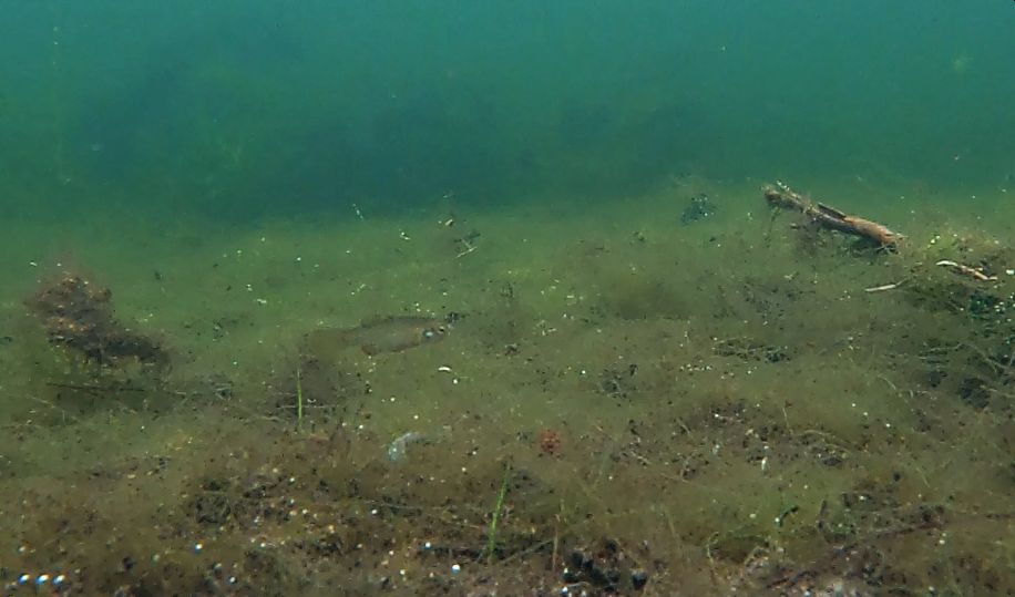
Downstream, there was more algae and somewhat more suspended particles, but it was still lovely. I picked up more mullet and needlefish downstream. I also filmed some rainwater killifish (Lucania parva), which I have observed in springs with higher conductivities.
Mullet scraping off the algae growing on the eelgrass with needlefish in the background.

Mullet and a sheepshead.
Later, I paddled upstream from the neighborhood where I had rented an Airbnb on a canal. Here boat traffic was higher and much of the vegetation disappeared, although there still were scattered beds of eelgrass.
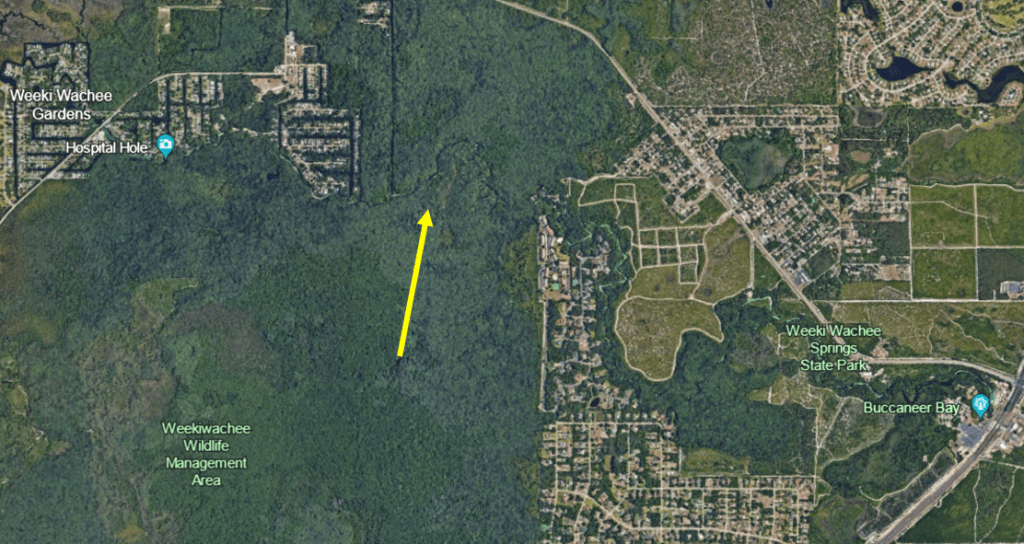
Google Earth image of the area between the neighborhoods.
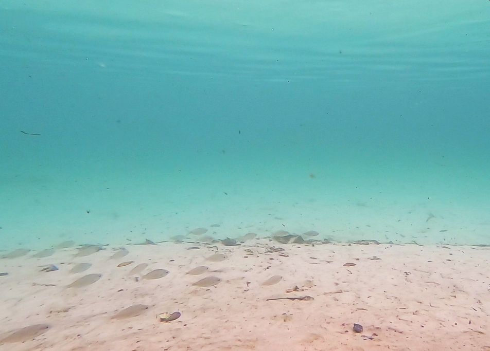
In many of the areas, the bottom was pure sand and I picked up an additional salt-tolerant fish, the tidewater mojarra (Eucinostomus harengulus).
Tidewater mojarra.
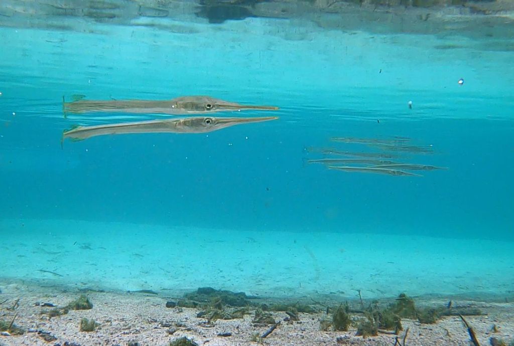

Needlefish and mullet downstream of the park.
Just upstream of Weeki Wachee Gardens, a dredge operation was deepening the channel. Even so, as I paddled late in the day, after the workday was done, I saw a manatee.
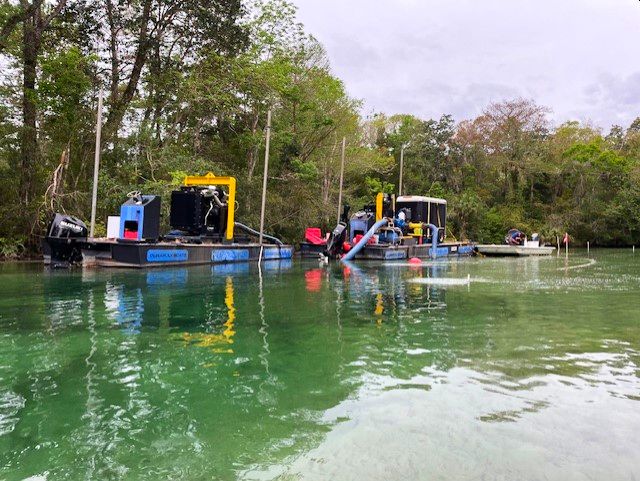
Dredge operation upstream of Weeki Wachee Gardens.
I also ventured downstream Weeki Wachee Gardens, heading toward the Gulf. As I floated downstream, I saw crevalle jacks, gar, and snook as well as the bass, mullet, needlefish, and sheepshead that I observed upstream.
As I left the neighborhood, the landscape changed to saltmarsh and the water got very salty and murky. However, I could just barely make out a gulf killifish (Fundulus grandis), more mojarra, and what appeared to be a snapper.

Google Earth Image of the area where I videoed downstream of Weeki Wachee Gardens (top) and a view of the sunset over the salt marsh (bottom).
Gulf killfish in the saltier water downstream of the neighborhoods.
Like the other Nature Coast springs, the springshed of Weeki Wachee is highly developed to the east, but relatively untouched to the west.
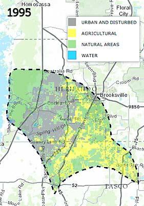
Weeki Wachee springshed landuse map (from https://www.swfwmd.state.fl.us/projects/springs/weeki-wachee/dashboard)
The SW FL Water Management District water quality dashboard indicates that the water clarity today (6/10/24) is 67 feet at the headspring, allowing clear views of the mermaids (and fish). It produces somewhere between 80 and 140 million gallons per day, making it a first magnitude spring. A graph on the dashboard suggests that disharge is higher now than it was in the mid-2000s. The spring is very slightly warmer than many Florida springs (SWFWMD = 75.1oF, I measured 23.6-24.1oC) and the dissolved oxygen concentrations are moderately low (SWFWMD = 1.81 mg/L at the headspring today, I measured 2.09 near the headspring). The oxygen increased as I traveled downstream, reaching 8.18 mg/L in the portion of the run between the two neighborhoods, likely due to a combination of turbulence, oxygen production by eelgrass upstream, and the more abundant algae in this region of the spring. The conductivity of the upstream portion of the spring is relatively low (SWFWMD = 370 microS/cm, I measured ~360 microS/cm). Below Weeki Wachee Gardens, the conductivity shot up considerably to 3960-5250 microS/cm), likely accounting for the larger number of salt tolerant species in this region of the run.
Like many Florida springs, the nitrate concentration of Weeki Wachee has increased over time. However, for the last decade, it has maintained a fairly constant, but very high, level (the background level used for DEP planning for springs in FL is 0.35 mg/L). The seminal studies on nitrate in FL springs showed increases through the 1970s, but Weeki Wachee was at the commonly-used baseline in the early 1990s. Fortunately, Weeki Wachee has been monitored for well over 100 years, so I was able to find nitrate data back to the 1970s (the earlier data would be for streamflow only). In fact, Weeki Wachee does show this same increase in nitrate that has been observed in other springs–it just started a lower concentration (~0.1 mg/L). Hopefully, the leveling off that the data suggest has happened will be a long term trend (even better would be a decrease, of course).

Increase in nitrate concentration in Weeki Wachee spring over time from the 1990s to the present (from: https://www.swfwmd.state.fl.us/projects/springs/weeki-wachee/dashboard).
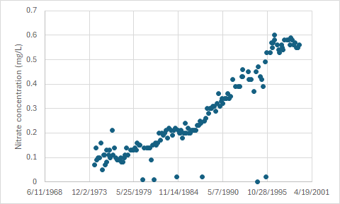
Increase in nitrate concentration in Weeki Wachee from the 1970s to the 1990s (data from USGS NWIS: https://maps.waterdata.usgs.gov/mapper/index.html). The upper end of this graph matches the start of the graph above perfectly, showing that the nitrate concentrations steadily increased from the mid 1970s to the early 2010s.
