I started my fish-filming journey seven years ago in Rainbow Springs, so it seems appropriate that I end these posts there as well (at least for now!). With its clear, blue water and many, many vents spouting water and sand, it is a spring-enthusiast’s dream.
Rainbow Springs is in an agricultural/residential area southwest of Ocala. The closest town to Rainbow Springs is Dunnellon, which did not feel appear to have grown a great deal since I stayed there seven years ago, although I did not spend a lot of time there on either trip. The neighborhoods just north and west of the spring, on the other hand, seemed to have grown substantially in the intervening years.
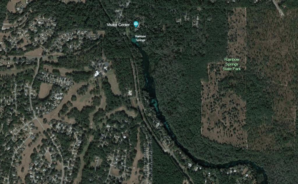
Google Earth images of the landscape around Rainbow Springs and of the spring itself. The blue of the run is obvious even from these high elevation images. The darker areas are thick beds of plants.
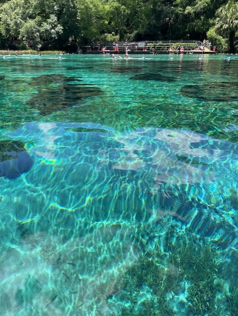
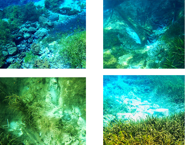
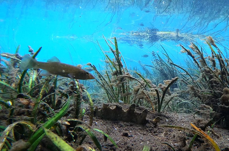
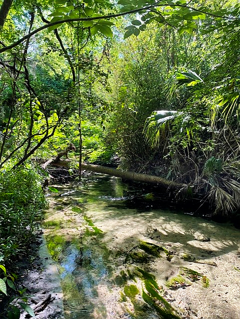
The headspring of Rainbow is actually a collection of smaller springs that collectively form a large blue pool, scattered with rocks and ringed by submerged and emergent plants.
View of the headspring pool, looking back toward the swimming area. It is a blue to which swimming pool owners aspire.
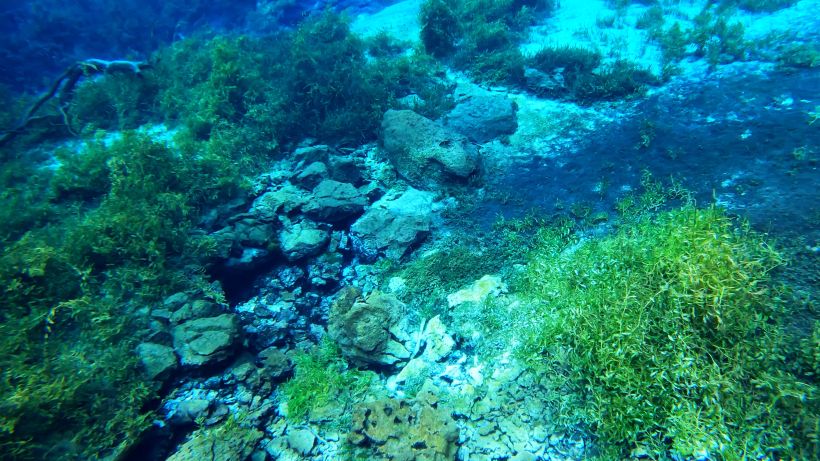
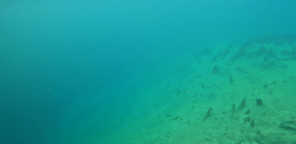
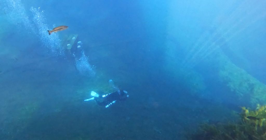
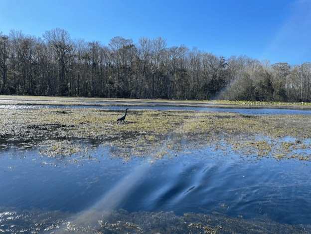
Underwater views of several vents or sand boils, starting with one of the headspring vents in the upper left-hand corner and ending with cloudy plumes coming from sand boils downstream in the lower left-hand corner.
Filming fish is both easy and hard at Rainbow. The clear water makes the fish easy to see and identify, but its depth makes it hard to set cameras. The vistas are stunning.
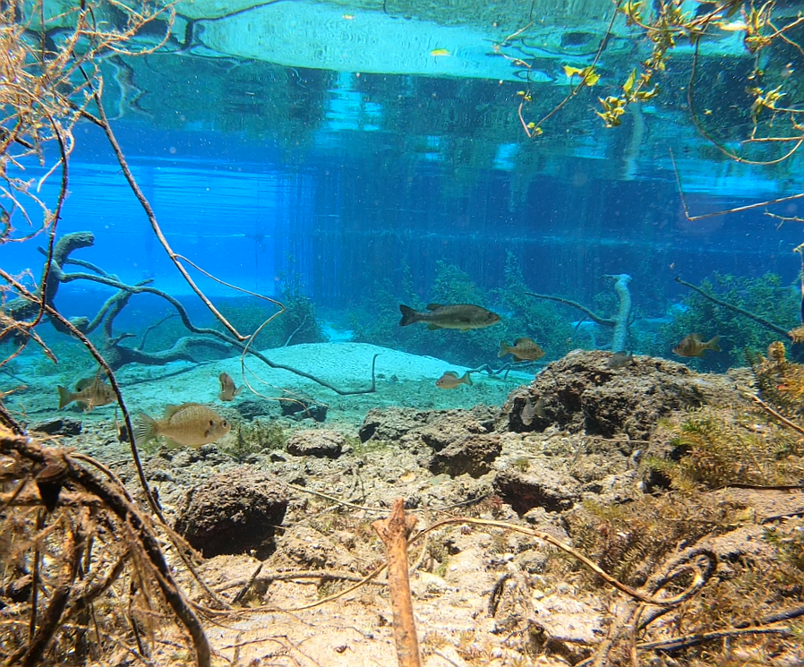
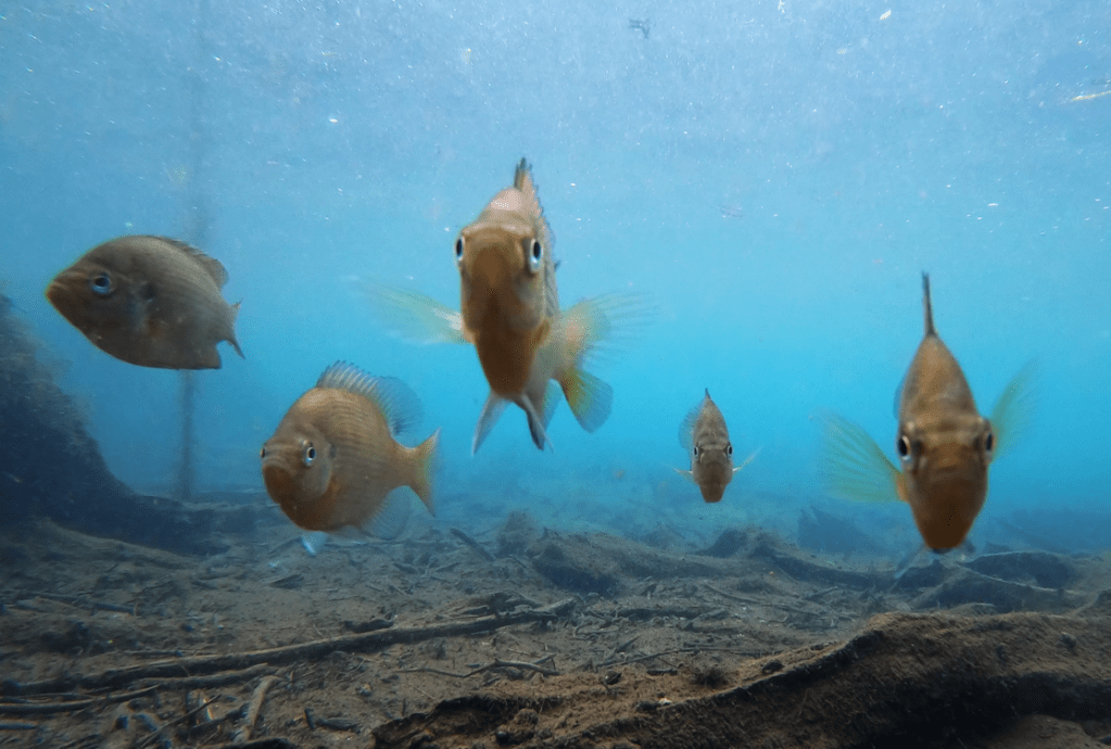
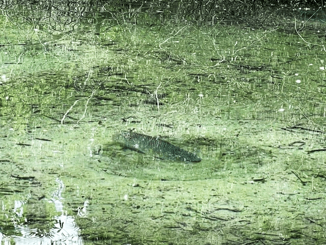
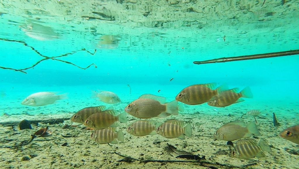
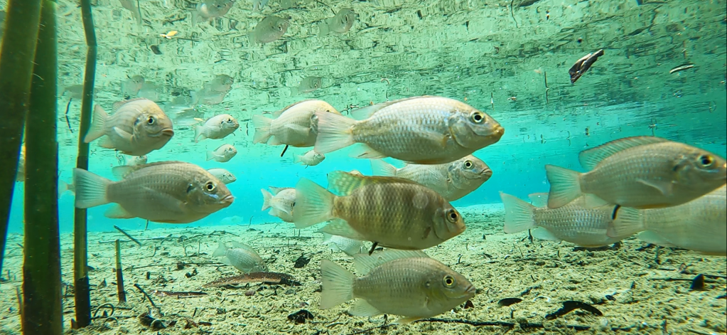
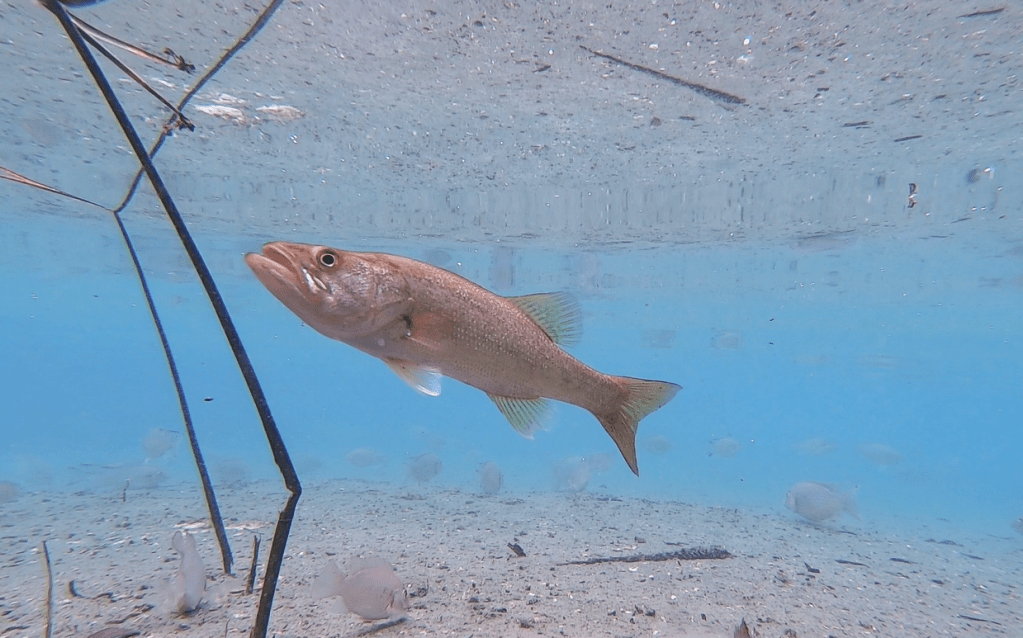
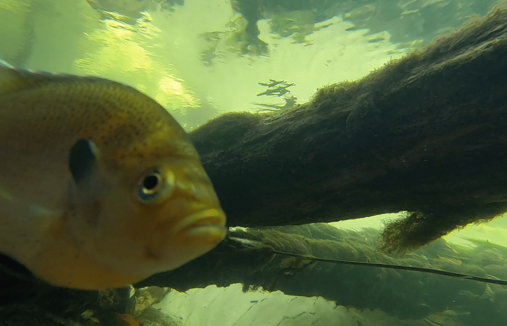
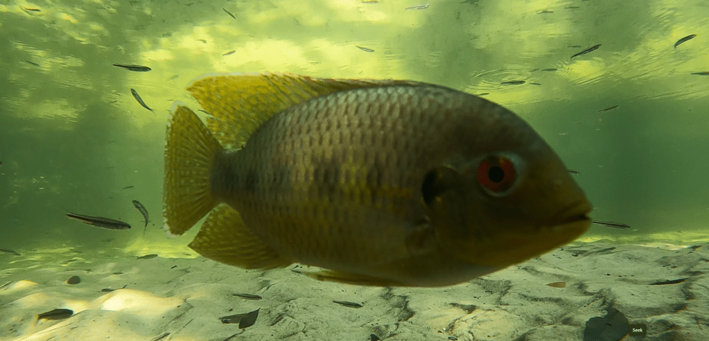
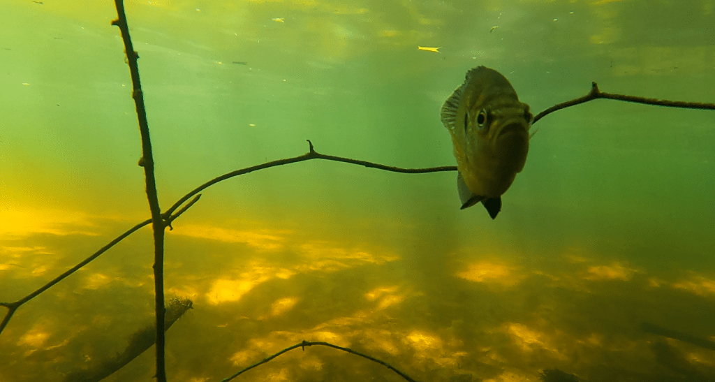
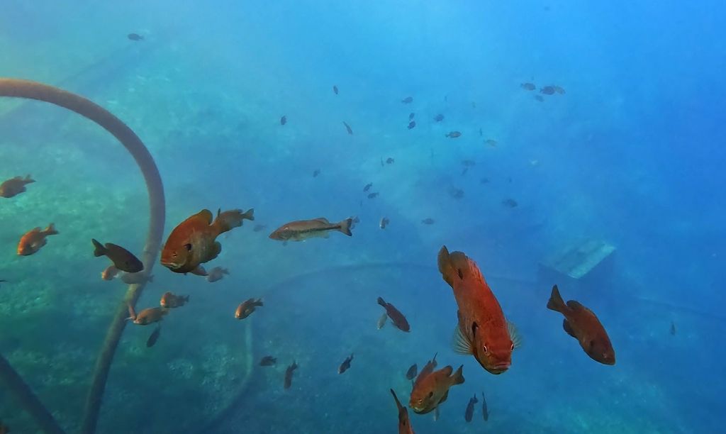
A largemouth bass (Micropterus salmoides), a redear sunfish (Lepomis microlophus), a redbreast sunfish (Lepomis auritus), and some bluegill sunfish (Lepomis machirochirus) up at the headspring.
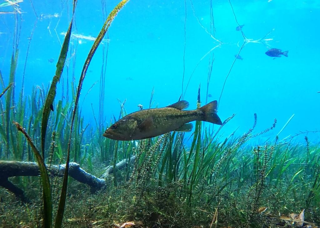
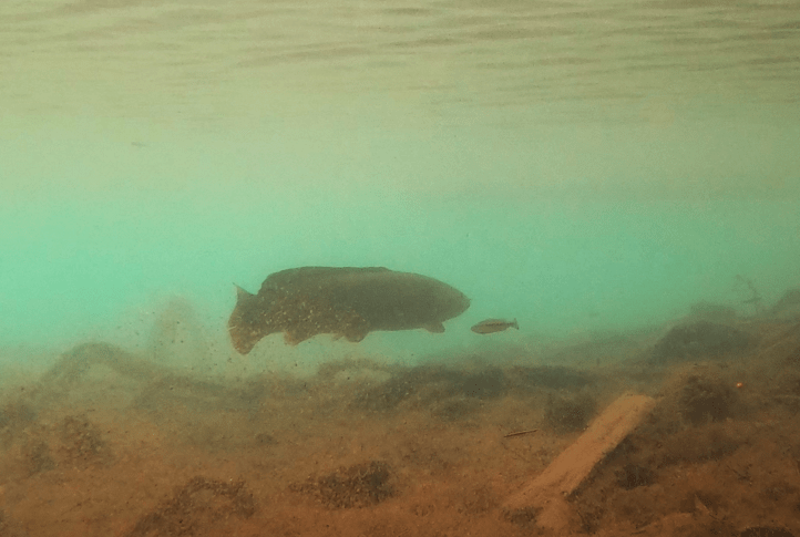
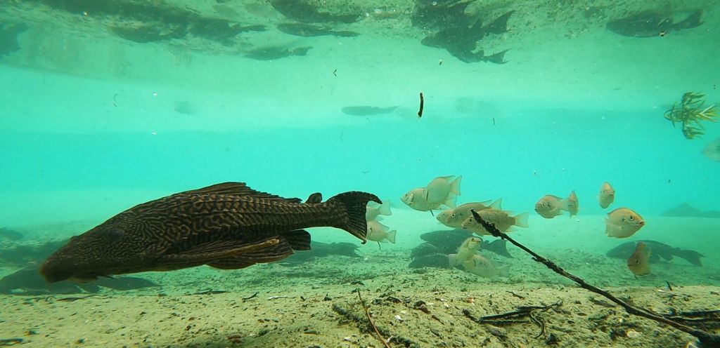
The number of predators in this spring was remarkable. I got at least one largemouth bass is virtually every video that I collected. I even managed to get a bass feeding on video. Just downstream from the canoe launch, a downed tree on the edge of a little bay provided structure for a whole host of longnose gar (Lepisosteus osseus). Interestingly, there were gar in that exact same spot seven years ago.
Some impressive predators: a largemouth bass cruising through the site (top) and a video of another feeding (bottom).
A gathering of longnose gar around a downed tree.
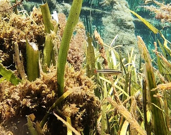
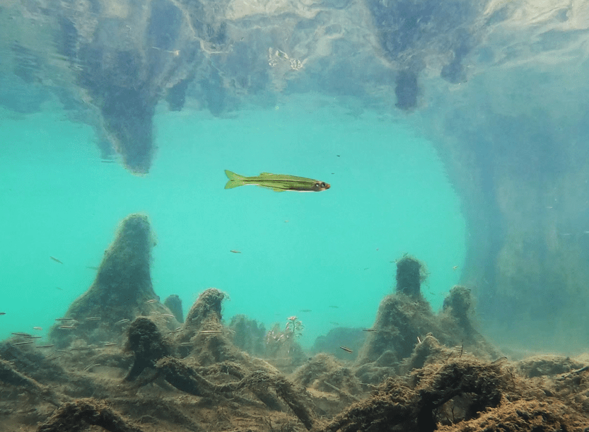
The smaller fish, like mosquitofish, shiners, and killifish, were harder to find in attractive poses on video. Given the large number of predators and clear water, they stuck to the areas with more plants, which obstructed my camera view.
Two of the smaller fish species that I recorded: seminole killifish (Fundulus seminolis) and bluefin killifish (Lucania goodei). The red on the tail of the bluefin is just barely visible. They used to be called redfin killifish, but the males often get bright blue dorsal fins when they are breeding. Apparently, the blue is considered more dramatic than the red.
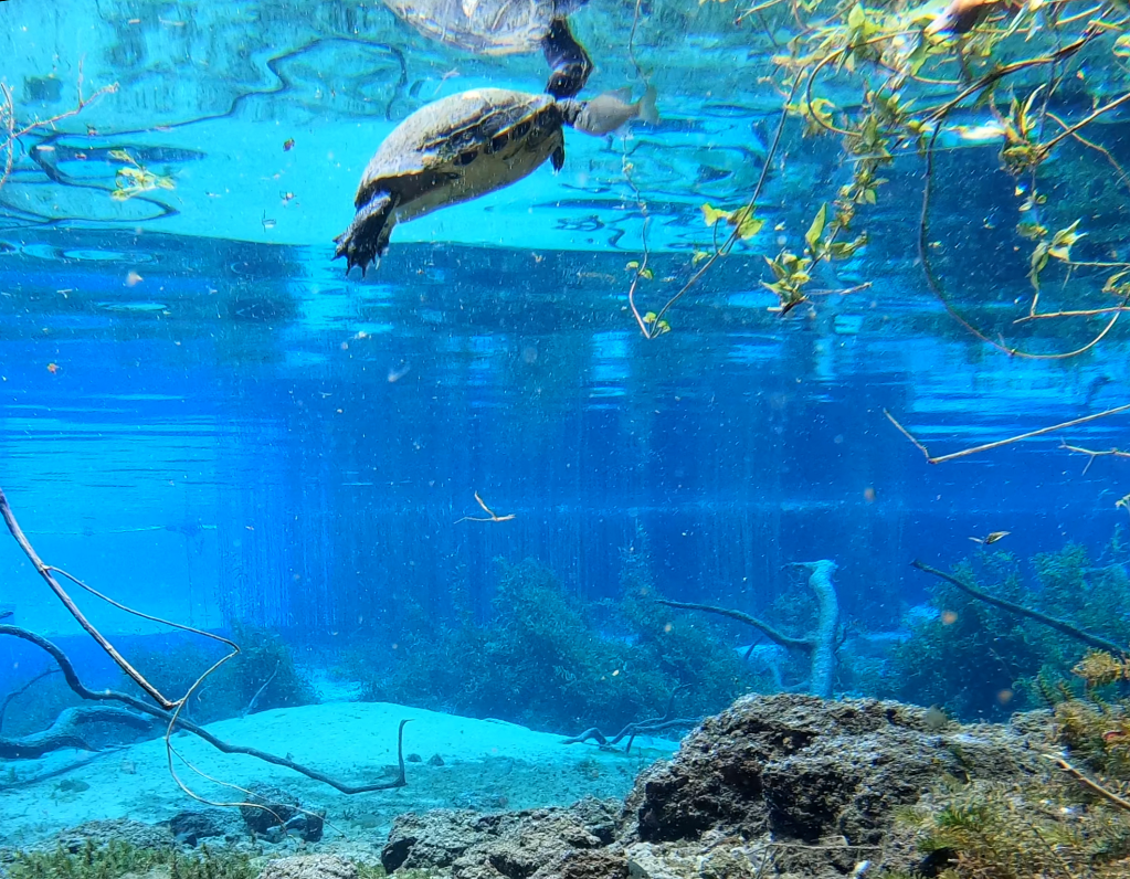
In addition to the number of predatory fish, the number and diversity of turtles was striking. The turtles favored the dense grasses that cover the east side of the run, which is a conservation area off limits to visitors. When I floated past that area, turtles were everywhere, resting on the grasses and swimming between them. However, I got turtles on video all along the run.
Three of the many turtles that I observed in Rainbow Springs, including on the bottom, a Florida softshell (Apalone ferox).
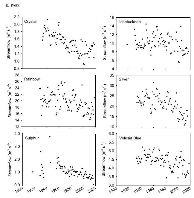
Rainbow Spring is enormous. The first vent alone discharges ~130-320 cfs and all of the subsequent vents add additional flow. When spring #6 adds its flow to the run just upstream of KP Hole, the discharge increases to 297-400 cfs. The 1995 USGS report that ranks the first magnitude springs of Florida puts Rainbow (at 711 cfs with the addition of still more vents downstream) in fourth after Spring Creek Springs, Crystal, and Silver Springs in descending order (https://pubs.usgs.gov/fs/1995/0151/report.pdf). The first two springs are a bit more marine, either on the coast or in the Gulf, so that leaves Rainbow competing with Silver for the biggest and clearest inland spring.
According to the SWFWMD Rainbow Springs dashboard (https://www.swfwmd.state.fl.us/projects/springs/rainbow/dashboard), the discharge of Rainbow Spring is a little higher than it has been in the last few years. The overall the trend has been downward for decades, not as steep a decline as some big Florida springs, but still.
Data on water quality for Rainbow Springs are hard to find. There is an Minimum Flow and Level plan, but it is not online. There is a Basin Management Action Plan (BMAP, https://publicfiles.dep.state.fl.us/DEAR/DEARweb/BMAP/Springs/RainbowSprings_Final_11302015.pdf), but it only gives the target concentration for nitrate. As a result, my conclusions are based on the SWFWMD Rainbow Springs dashboard and the little bit of data that I collected in 2017 and in 2024.
Rainbow Springs is on the warm side (23-24oC) and the dissolved oxygen is very high for a spring (5.85-7.94 mg/L). It was this spring that made me rethink what is “typical” for Florida springs as these values are more than an order of magnitude higher than the dissolved oxygen measurements that I typically take at the headspring of Volusia Blue. It would seem that the water is barely underground at Rainbow. The conductivity is predictably low (~180-380 microS/cm) for a spring a) far from the Gulf and b) without the underlying aquifer salt lens of some of the St. Johns River springs.
Nitrate concentrations, on the other hand, are quite high (more than 2.5 mg/L as compared to the BMAP target of 0.35 mg/L). Like many other Florida springs, the nitrate concentration has risen linearly in Rainbow Spring since the early 1990s at least (for many springs, the increase started in the 1970s). The BMAP attributed the high nitrate loading primarily to cattle and horse pasturelands. However, the rapid increase appears to have slowed and this trend seems to have occurred in other springs as well. Hopefully, we’re turning a corner there.
View of the Morrison Springs main pool, looking upstream from the vent.
I first tried to visit Morrison Springs in February, but the spring, like so many others in the panhandle, was still flooded from Hurricane Idalia that hit back in August 2023 and subsequent storms. Its large main pool was impossible to see as it was completely covered in brown water. Video is a lot more effective when you can see.
Morrison Springs in February (top) and May (bottom) 2024.
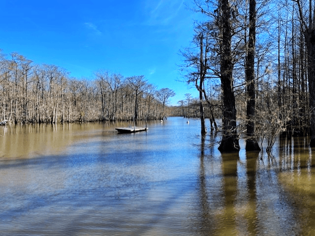
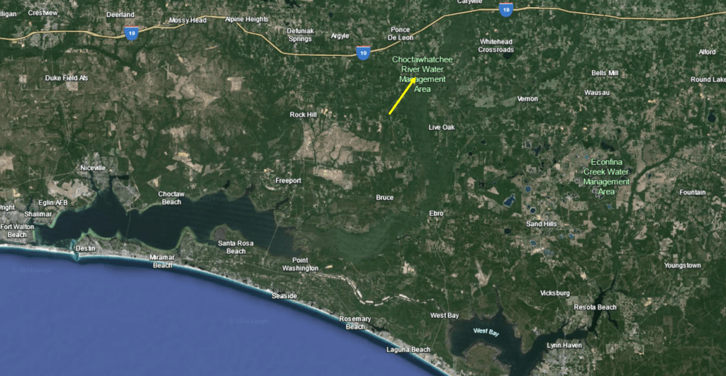
Morrison Springs is a large spring, with a 250-ft diameter main pool. This pool contains three cavities, one of which descends to 300 feet, that produce something on the order of 50 million gallons of water per day, so the spring is categorized as 2nd magnitude, despite its size. Located just south of the town of Ponce de Leon and downstream of Ponce de Leon Spring, Morrison flows down a broad and somewhat shallow run into the Choctawatchee River. The Choctawatchee River meanders down to the Choctawatchee Bay, which opens to the Gulf of Mexico at Destin.
Google Earth images of the location of Morrison Springs on the Choctawatchee River (yellow arrow, top) and of the spring itself (bottom). The headspring appears almost as wide as the Choctawatchee River into which it flows.
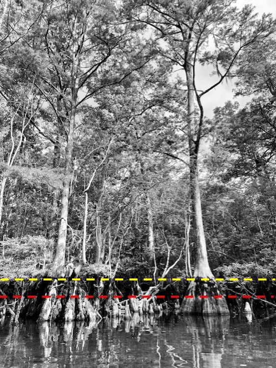
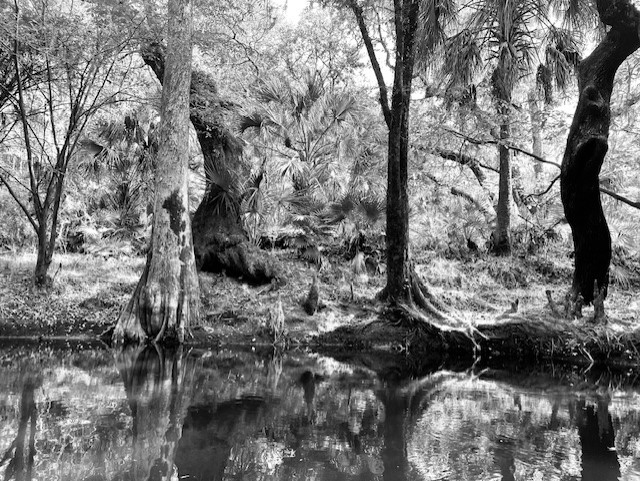
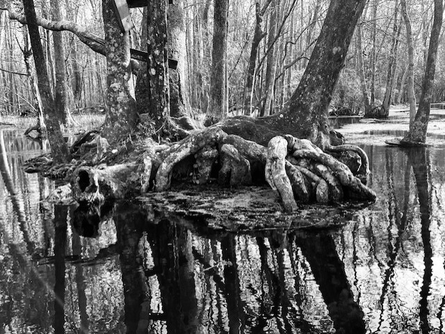
Upon my return to the spring months later, two characteristics struck me: 1) the thick and lovely cypress forest all along the banks and 2) the high water lines on the trees. There were two obvious lines, one about 1/2 meter and one about a meter above the surface of the water on the day that I visited. The prominence of these lines suggest that the spring run attains this stage (water height) often.
Closer view of some of the cypress trees with dotted lines representing their high water lines.
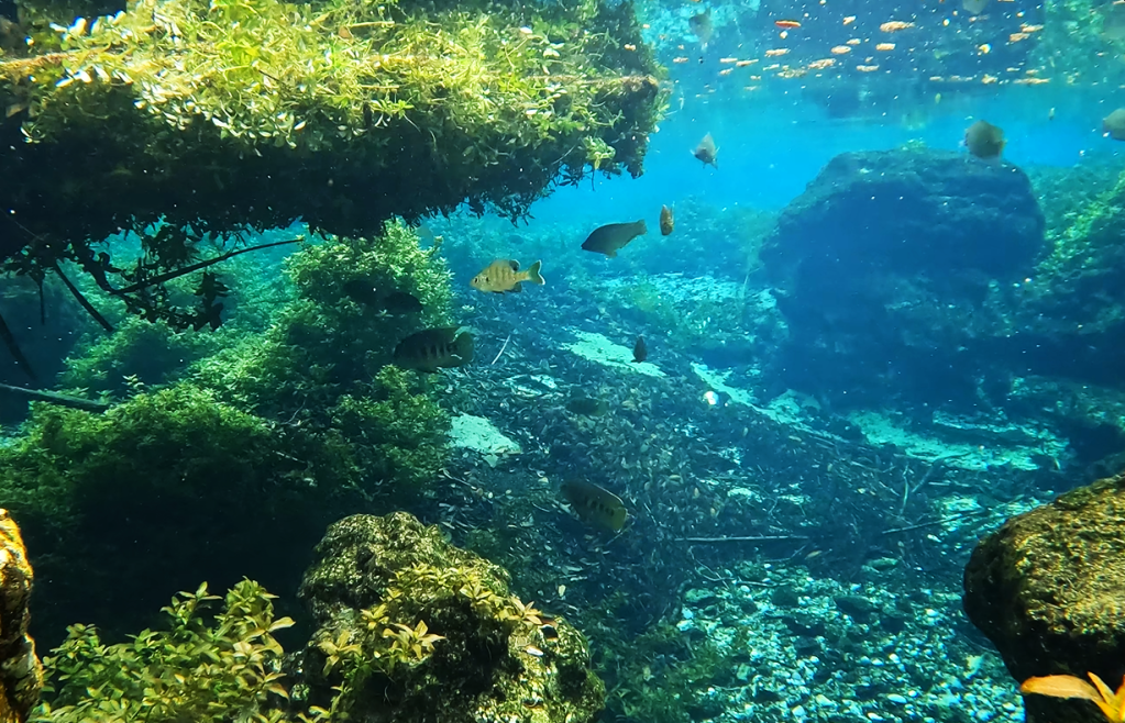
Up near these cypress trees, the water somewhat clear with a layer of suspended sediment near the surface. Happily, I could see both lots of fish and loads of snails. A shoal of shiners made way for largemouth bass (Micropterus salmoides) and spotted sunfish (Lepomis punctatus), which made way for an adult chain pickerel (Esox niger) on the right side of the main pool.
Shiners (top), largemouth bass and spotted sunfish (middle), and a chain pickerel (bottom).
The spring had flooded back into the trees, so I also filmed further back among the cypress trees and was rewarded with two juvenile chain pickerel.
Two juvenile chain pickerel.
On the left side of the main pool, I discovered bizarre-o bluegill sunfish (Lepomis macrochirus) that had virtually no markings. I only recognized them by their diagnostic black dot on the dorsal fin. Typically, fish this large would have prominent dark bars running from top to bottom.
Bluegill sunfish (and one spotted) missing their typical bar patterns.
Alas, the water clarity declined once I left the headspring area. Despite the murkiness, I was able to film several different species of fish, including a bowfin (Amia calva), golden silversides fighting (Labidesthys vanhyningi), and the crown jewel: bluenose shiners (Pteronotropis welaka). I have been asked many times if I have seen them in my visits to springs and finally I can say yes. This species is categorized as a state-designated threatened species due to its isolated populations that are vulnerable to extirpation (local eradication).
A bowfin looming over a juvenile largemouth bass (top), a golden silverside (middle), and bluenose shiners (bottom). Note the shiners’ bright blue snout and sparkles, which no other Florida shiner possesses. When breeding, the males get much darker and more blue and the dorsal and anal fins get very large and round.
Golden silversides fighting.
I wish that I had better video that could show off the vents of Morrison Spring (I have read that there are three), but the water clarity was too low to see much of anything from the GoPro on my kayak. However, the recording of bluenose shiners made the trip more than worth it. I will have to try again on some day like today (6/12/24) when the Walton County website (https://www.co.walton.fl.us/523/Morrison-Springs) lists water clarity as 1 (the clearest).
My best view of the vent area on the day of my visit in early May 2024. The view, although terrible, was still much better than in February.
I was unable to find much water quality data on Morrison Spring. About the best that I was able to find was four sets of USGS samples collected from 1969 to 1985 and a 2006 NWFWMD report entitled: Ground water chemical characterization of Morrison Spring, Florida (https://www.nwfwater.com/content/download/6674/48451/WRSR0602.pdf). This report seemed to describe data from wells near Morrison all the way up to the Alabama border. However, their data matched mine (what I collected) quite well, with relatively cold temperatures (NWFWMD = 20.7oC, my data = 20.8-21.5oC at the headspring, 22.7oC downstream), moderate dissolved oxygen (NWFWMD = 3.17 mg/L, my data = 3.02-3.74 mg/L at the headspring, 2.99-4.16 mg/L downstream), and low conductivity (NWFWMD = 226 microS/cm, my data ~230 microS/cm at the headspring, 220-230 microS/cm downstream). The nitrate data that they reported also were quite low (0.180 mg/L). Happily, these data were comparable to the data collected by USGS decades ago, suggesting that Morrison Springs may have been less impacted by human activity than many other springs. However, I did see reports that it was closed due to high bacterial counts in 2014 and I saw recent warnings about the large number of visitors in the warm seasons.
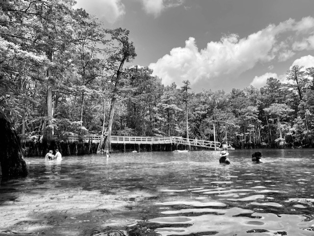
A few of the visitors at the Morrison Springs main pool in May 2024.
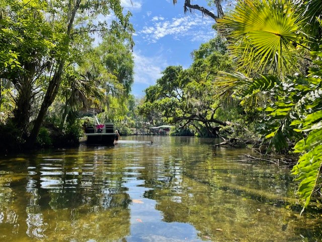
The Alafia River upstream of Lithia Springs. I have many photos of the river that look like paintings.
The Alafia River in this reach felt like old natural Florida.
This project was a lesson in expectations. I did not expect the Weeki Wachee run to be as pretty as it was and I did not expect the Alafia River to be sublimely lovely either.
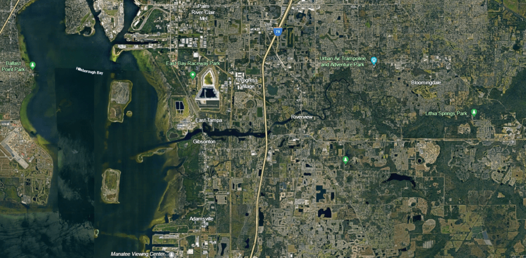
My only experience with Tampa area springs was from the heavily modified springs of the Hillsborough River and my only knowledge about the Alafia came from a paper on the effect of mine drainage and agriculture on invertebrate assemblages. Google Earth images of the landscape around the Alafia River, highly modified with residential development to the west and agriculture to the east, also helped to set my expectations. However, happily, the riparian forest has been preserved in the upper reaches. As a result, the experience of paddling near Lithia and Buckhorn springs feels very natural (as can be seen in the photo above). It just goes to show that you should not listen to your expectations (even those you do not realize that you have).
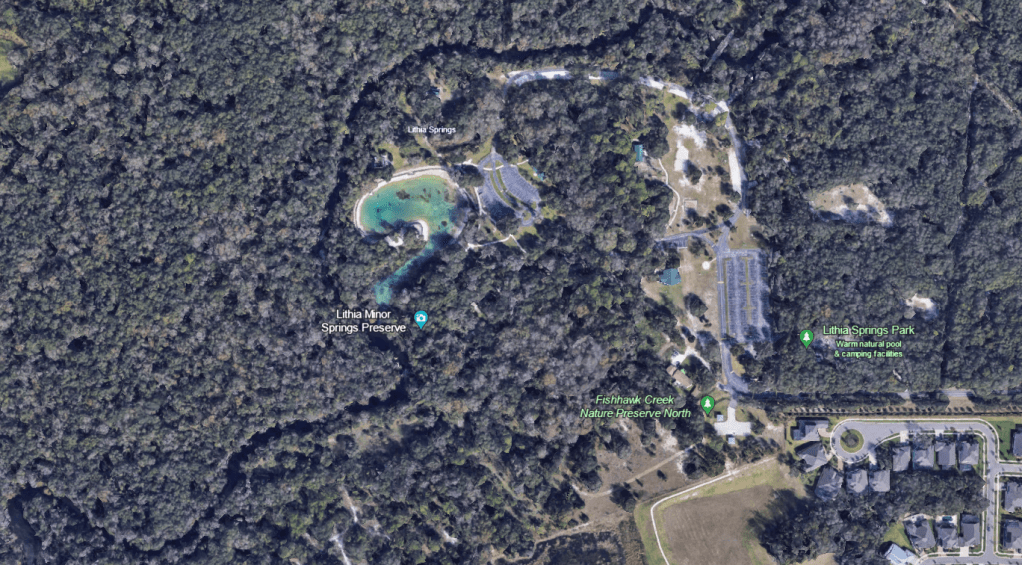
Google Earth image of the Alafia River, which flows into HIllsborough Bay. Note the green riparian (river) forest along the banks in the upper reaches on the right side of the image.
A lower elevation view of Lithia Major (the big blue pool) and Lithia Minor (the camera icon) as well as the Alafia River.
Lithia Major
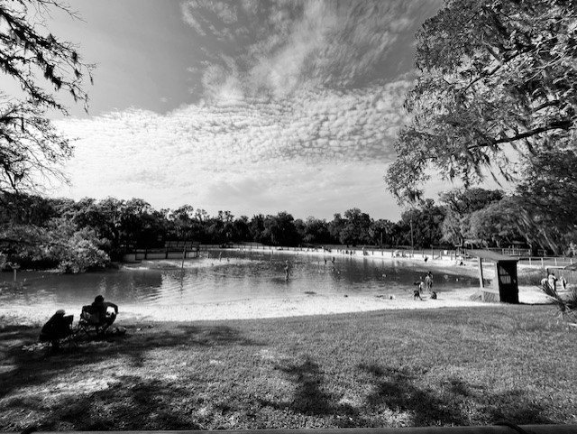
Contrary to the natural state of the Alafia in this area, the headspring of Lithia Major was converted into a large swimming pool. However, the park was nice and I appreciated the people spending the day outdoors. Once the spring water leaves the pool, it flows down a short, shallow run into the Alafia River. Lithia Minor is just upstream of Lithia Major.
The Lithia Major headspring was fenced in and closed until the afternoon when the visitors descended upon the pool. Many families were making an afternoon of it.
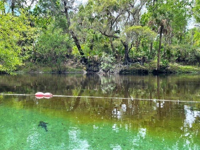
The canoe launch at Lithia Springs park is a little downstream of the springs, so the short paddle on the river provided a nice alternative to the pool. It was very easy to spot the Lithia Major run, which I came upon first, by the clear plume of spring water flowing into the brown water of the river.
The water of the spring was clear as a bell as it flowed into the tannic, tea-colored river. An exotic armored catfish (Pterygoplicthys sp.) set the stage for what I would see as I paddled up the run.
The rope designated that the run was off-limits to the public and someone from the park raced down to ask me what I was doing when they spied me in my boat. Clearly, they have a lot of pressure from the public, but they were very gracious when I told them what I was doing.
The run was very shallow, sandy, and chock full of exotic fish. After the armored catfish, I next noticed the abundant blue tilapia (Oreochromis aureus) nests.
A very obvious blue tilapia nest.
Three tilapia nests, one with the male guarding it (top), and a closeup of the fish on the nest (bottom).
It was an interesting visit, if slightly shocking, because I have never seen abundances of exotic fish like I saw in the Tampa area springs. Had I spent time observing fish around the canals of south Florida, perhaps I would have been more prepared for the overwhelming biomass of exotic fish in both the Hillsborough and Alafia springs.
Every fish in these two images from Lithia Major, one from either side of the run, was either a juvenile blackchin tilapia (Sarotherodon melanotheron) or spotted tilapia (Pelmatolapia mariae). While I chose stills from the videos that I thought highlighted the fish well, the videos were filled with these fish. The other videos that I collected from this spring were similar.
The blue tilapia, which were less abundant than the blackchins or the spotted tilapia, dwarfed the other cichlid species. Until I surveyed at Lithia, I had not appreciated how aggressive the blue tilapia could be or how deep their nests were. Blue tilapia build and maintain their nests by picking up sand in the nest site and spitting it outside of the nest.
A blue tilapia building a nest.
I also picked up on video a bunch of the much smaller chanchita (Cichlasoma dimerus, yet another exotic cichlid), The video depicts an interesting feeding behavior of a chanchita in the foreground as it wiggles its tail to kick up food. An aggressive blue tilapia in the background sinks into its nest like a giant hovercraft (a longer version of this video showed the tilapia chasing away fish that approached its nest).
A chanchita doing a little feeding dance while a blue tilapia returns after defending its nest in the background.
Loads of armored catfish littered the run as well.
Armored catfish feeding in the run with a few blackchin tilapia in the background.
I did see a few native fish in the run, mostly seminole killifish (Fundulus seminolis), but also at least one largemouth bass (Micropterus salmoides) and a few individuals of various sunfish species (Lepomis spp.).
Two seminole killifish with blackchin tilapia and armored catfish in the background (top) and a lone largemouth bass with blackchin tilapia in the background (bottom). It is interesting how pale the bass was in this sandy spring.
Lithia Minor
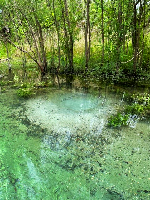
As might be expected, Lithia Minor was a much smaller spring than Lithia Major, with a round and rocky headspring and short, shallow run. The substrate was darker and supported a lot more aquatic plants.
The Lithia Minor run looking out toward the river.
The Lithia Minor headspring and vent (the bluish color).
For as small as Lithia Minor was, it had a lot going on. The fish included all of the species that occurred in Lithia Major, with the exception of seminole killifish, but it had relatively more native fish than its larger cousin. Perhaps the replacement of the big sandy plains with a rocky substrate accounted for the lower percentage of blackchin and blue tilapia, both of which dig pit-like nests 9https://www.fishbase.se/summary/1412). Adult spotted tilapia, which I did not see in Lithia Major (I only saw loads of juveniles), also were present in Lithia Minor.
The Lithia Minor headspring, looking downstream (top) and back at the vent (bottom). In the top photo, spotted tilapia that were transitioning from juvenile to adult are in the center of the frame, identifiable by the bars that were shortening into spots. Above the spotted tilapia was a native bluegill sunfish (Lepomis macrochirus) and some blue tilapia. In the bottom photo, all of the fish were spotted tilapia and all were juveniles with the exception of the fish with the spotted yellow side.
I picked up a couple of new fish (to me) at the Lithia Minor headspring: a Rio Grande cichlid (Herichthys cyanoguttatus) and an African jewelfish (Hemichromis letourneuxi).
A Rio Grande cichlid (top) and two African jewelfish (bottom) at the Lithia Minor headspring.
A video of an armored catfish scraping algae off of the rocky side of the Lithia Minor vent. Also visible were two largemouth bass, some spotted tilapia, a couple of bluegill sunfish (barred with black dot on dorsal fin), and a Rio Grande cichlid in the foreground.
In one of the most fun and scary clips of the project, two adult spotted tilapia herd a cloud of juveniles down the run (hopefully, they are visible in the small version of this clip!). According to FWC, spotted tilapia have sticky eggs (~2000!) that they attach to hard surfaces (https://myfwc.com/wildlifehabitats/profiles/freshwater/spotted-tilapia/), so it makes sense that they would be spawning in this spring rather than in the sandy Lithia Major.
Spotted tilapia parents guarding their young in Lithia Minor.
Buckhorn Spring
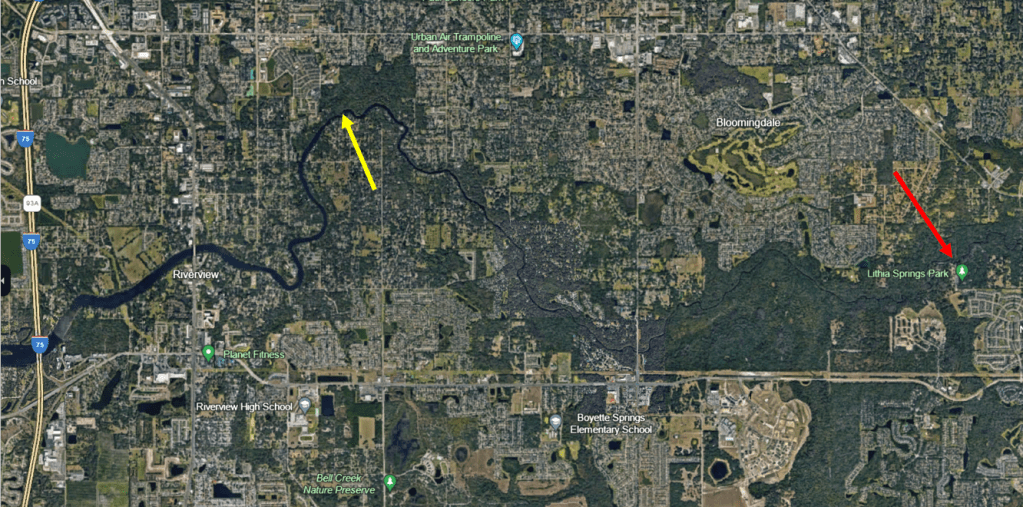
Buckhorn Spring is several miles downstream of Lithia Springs, on a northward curve of the Alafia River before it heads to Hillsborough Bay. To find the spring, I floated downstream from the Alafia River public boat ramp
Google Earth image showing the location of Buckhorn Spring (yellow arrow) relative to Lithia Springs (red arrow).
A lower elevation photo showing the location of the headspring at the top right of the photo and the plume of Buckhorn Spring entering the Alafia River (yellow arrow).
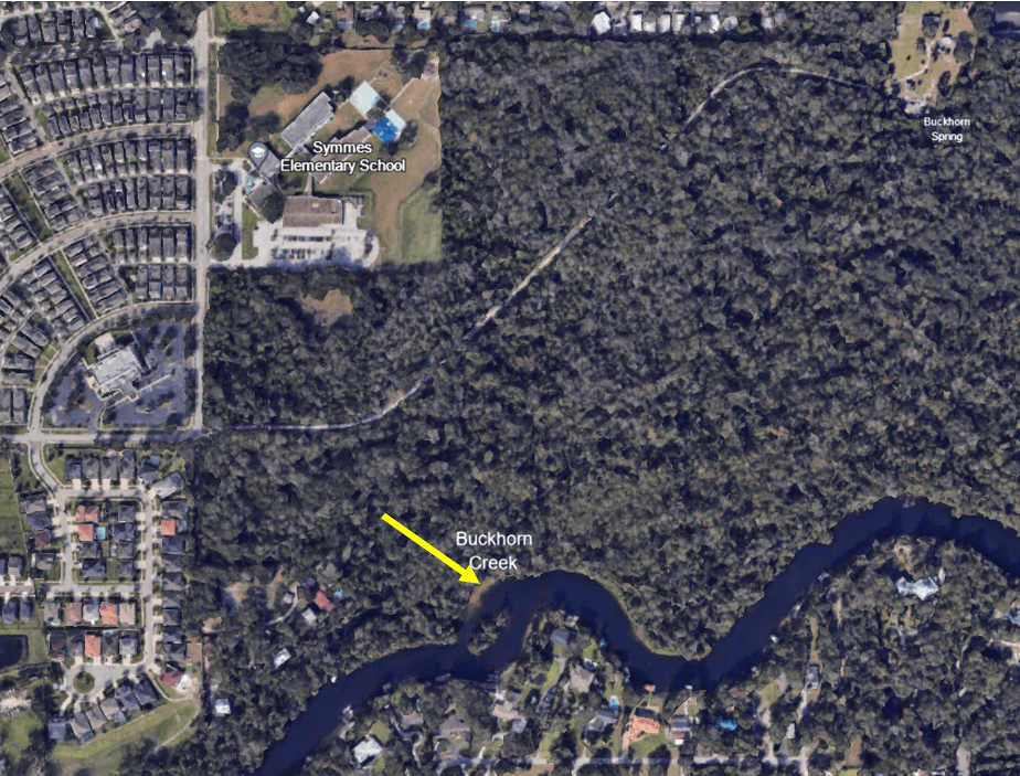
The spring was of my favorite type, narrow and sandy with full canopy. However, it also had about a million snags, so trying to get all the way up to the headspring was ambitious, particularly given that I read that the headspring is owned by Mosaic Phosphate Company. I had planned to paddle up to the fence and take a picture, but alas after portaging over many, many trees, I realized that I would likely run out of time before I made it up there. I turned around about halfway up the run. Buckhorn Creek is reputed to have several springs that contribute to its flow and I am fairly sure that I found one of them, but it appeared to not be flowing.
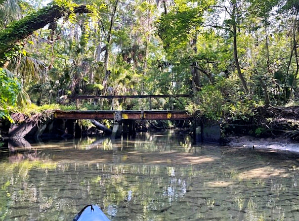
This bridge crossed Buckhorn Creek a short way up the run from the Alafia River.
One of the many obstacles, although this one was relatively easy to get past.
Along a lot of the run, I observed no fish from the boat. The water flowed very fast and scoured the run down to the sand in many areas. At the spot where I turned around, about halfway up the run, I captured no fish on the cameras either, but as I worked my way downstream, I picked up the occasional sunfish and lots of shiners working very hard to stay in place in the vicinity of flow-blocking structure.
Shiners working hard to stay in place about 1/3 of the way up the Buckhorn Spring run.
A spotted sunfish hanging out around the flow-breaking structure of logs.
Downstream of the bridge, the spring was deeper and the flow was a little slower. The fish did not have to work as hard to stay in place and so I recorded lots of shiners as well as a largemouth bass and a spotted tilapia.
A largemouth bass in the upper corner of the image with a huge shoal of shiners.
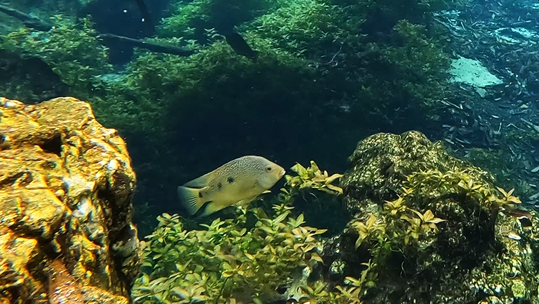
A spotted tilapia inspecting the camera.
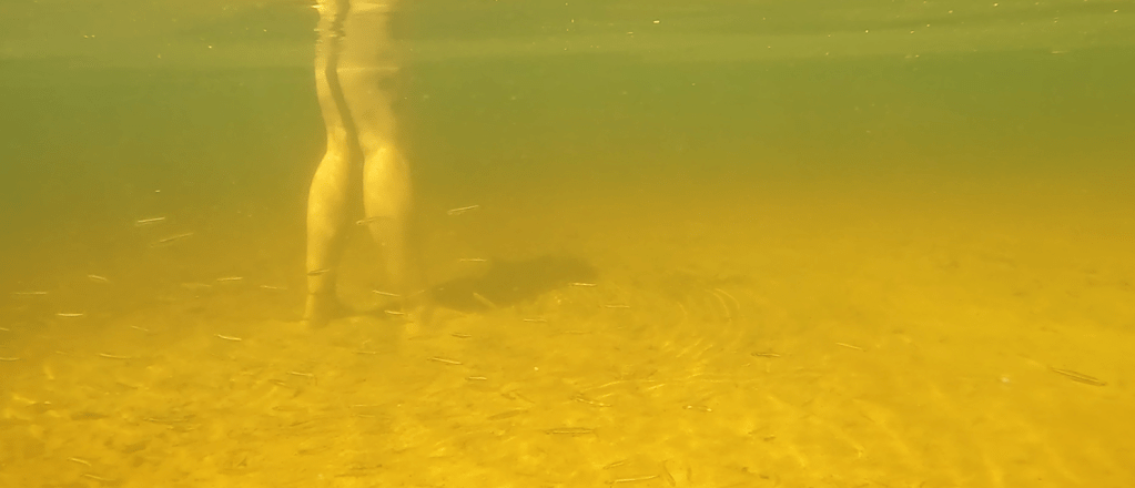
Where the spring water met the river, the light became golden and spotted sunfish and tilapia milled around, entering the spring and returning to the river.
A spotted sunfish at the confluence of the spring and the river.
The point where the spring enters the river is apparently a popular spot for recreation. I watched three different parties spend some time there in the short time that it took me to film the end of the spring. One woman told that I should come out and film the “fish tornado” around her legs. It turns out that the tornado was composed of silversides; usually when I see silversides, they are golden silversides (Labidesthes vanhyningi) and I see them alone or in pairs. Inland silversides (Menidia beryllina), on the other hand, form schools, so perhaps I would have another species to add to the list if I could be sure of the identification in the murk.
Recreators at the confluence of the spring and the river (top) and the “fish tornado” of silversides (bottom) in the river just off the point where the boat is parked in the top photo.
Spring characteristics and water quality
The three springs described in this post differed greatly in morphology, from very wide to very narrow. Two of the three were sandy; one was rocky. Two had moderately high flow; one had very high flow. Despite these differences, all three had relatively little algae and all had loads of exotic species. All three were on the slightly warmer side for Florida springs (24.1 to 25.9oC).
I was not able to measure oxygen at the headspring of either Lithia Major or Buckhorn Spring. In its short run, Lithia Major ranged from 2.74 to 5.69 mg/L and, in its longer run, Buckhorn ranged from 3.77 to 5.28 mg/L. Lithia Minor ranged from 1.75 mg/L at its headspring to 3.88 mg/L near its confluence with the river. The conductivity of these springs was about double the values for springs that I visited farther inland (Lithia Major ~560 microS/cm, Lithia Minor ~570 microS/cm, and Buckhorn ~540 microS/cm), but still low relative to the springs with tidal influences. The values for all of these variables seem typical to good for Florida springs.
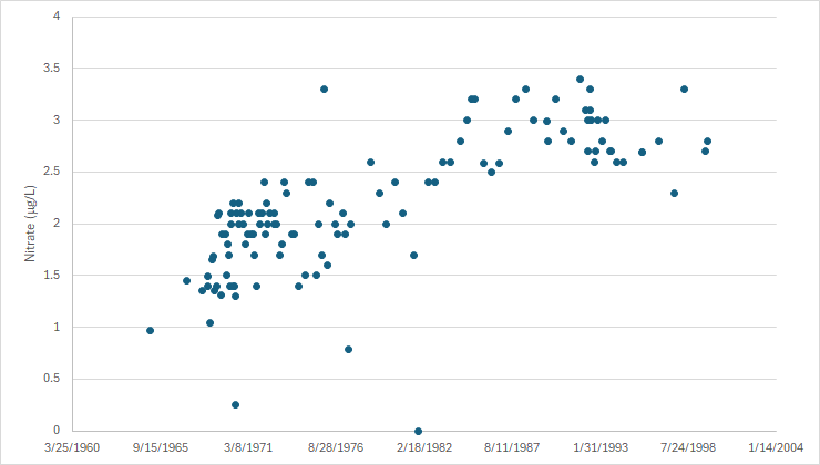
However, the water quality data that I found suggested that all three have experienced massive increases in nitrate, despite their lack of abundant algae. The USGS collected nitrate data for Lithia Major from 1965 to 1999 (why did they stop?) and these data show a huge increase in nitrate up to the late 1980s, but the nitrate concentrations in 1965 already were quite high (if the background nitrate concentration was on the order of 0.35 mg/L). What were background concentrations of nitrate in these springs if concentrations were already so high in 1965 and what has happened since 1999?
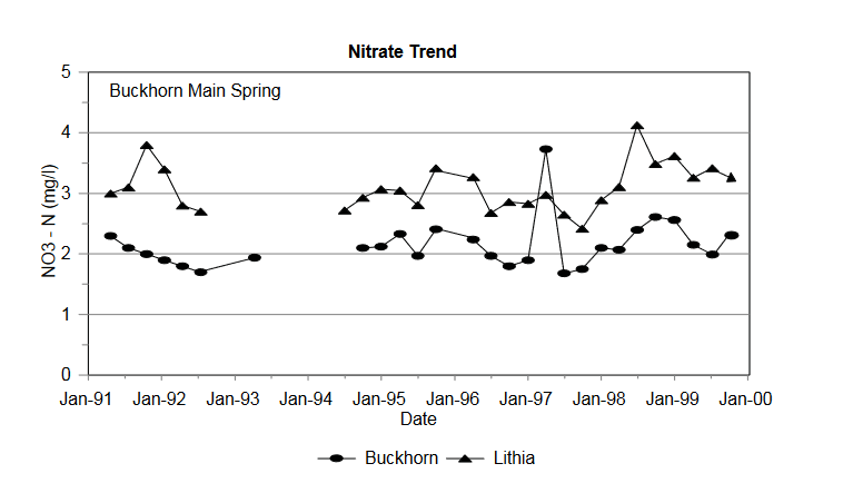
Data in a SWFWMD report for Buckhorn from the early 1990s to 1999 suggest that its nitrate concentrations were only a bit lower than those of Lithia. The only data that I could find on USGS NWIS for Buckhorn were from 1972 and suggest that nitrate was 0.9 mg/L at that time.
A SWFWMD report from 1993 indicated that the source of the nitrate in Lithia and Buckhorn Springs was “inorganic fertilizers applied to citrus, with minor animal-waste [dairy] contributions” (https://www.swfwmd.state.fl.us/sites/default/files/medias/documents/LithiaBuckhornSprings.pdf). It also reported that the “minimum travel time of groundwater in the fracture [limestone fractures in the aquifer] is approximately 1 mile every 5 years”. According to a Hillsborough county website, the proportion of land in agriculture has dropped from 27 to 13% from 1990 to 2020 (http://hillsborough.wateratlas.usf.edu/watershed/geography.asp?wshedid=1&wbodyatlas=watershed), but I could find no data older than 1990. If land in citrus was taken off line, how long would it take the nitrate to stabilize or decline if other land uses contributed less nitrate? The report indicated that bringing 11,000 septic online by the early 1990s might affect the spring nitrate concentrations. It would be interesting to know what those concentrations are now.
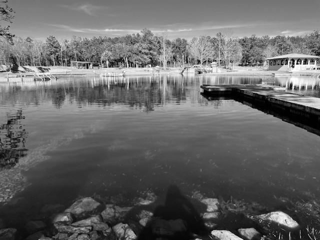
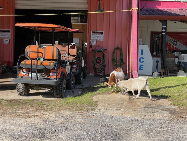
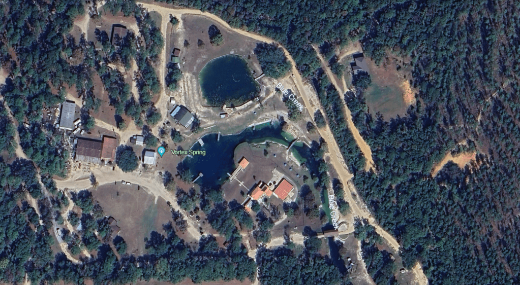
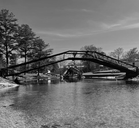
Vortex Spring, as the name would imply, was probably the most culturally unique spring that I visited. Reputed to be an energy vortex, this spring is an interesting mix of private dive school, military dive training facility, and water park. The facility included lodges and campsites, a store, and goats. They were very generous in sharing their park with me with essentially no notice (I got flooded out of some other sites that I had planned to visit that day).
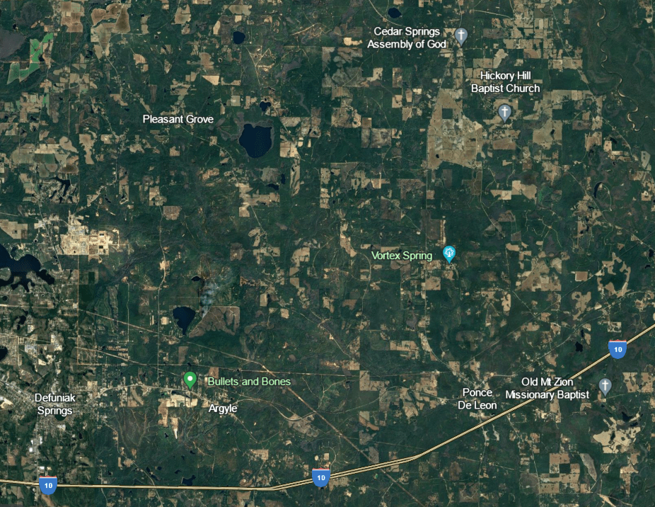
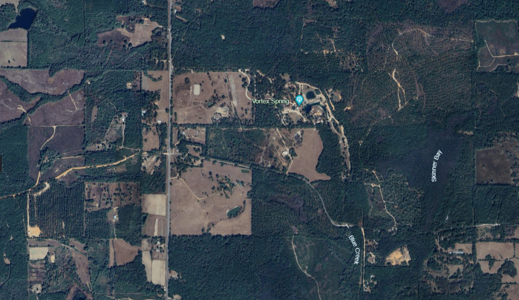
The spring is west of Tallahassee, well into the panhandle, in a landscape of uncut forest, silvaculture, agriculture and small towns.
Google Earth images of the landscape matrix around the spring. At 4000 m, the town of Defuniak Springs is visible to the west (top). Zooming in shows the rows of trees in the silvaculture operations (bottom).
The spring at about 100 m up.
The spring run itself is called “Blue Creek” and flows eventually into the Choctawatchee River. The river flows into Choctawatchee Bay, the west side of which is open to the Gulf at Destin.
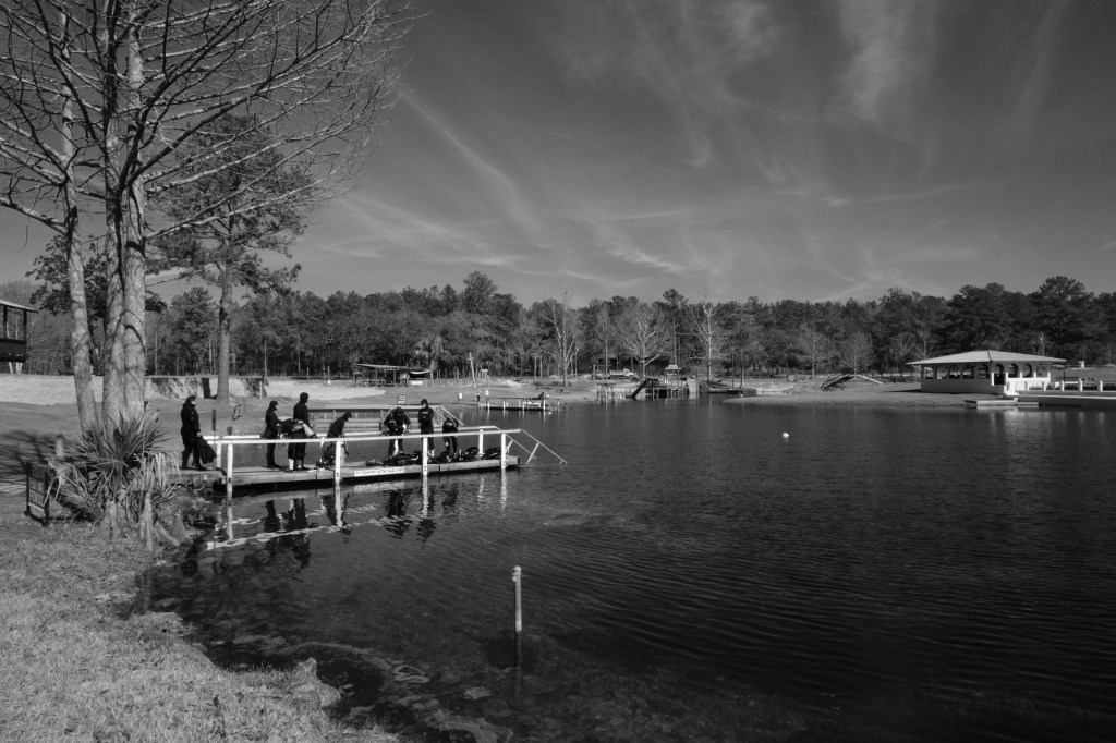
When I arrived, a small herd of pre- or early-teen kids jumped around in wetsuits on the dock awaiting their lesson, lovingly recorded by their parents on the bank.
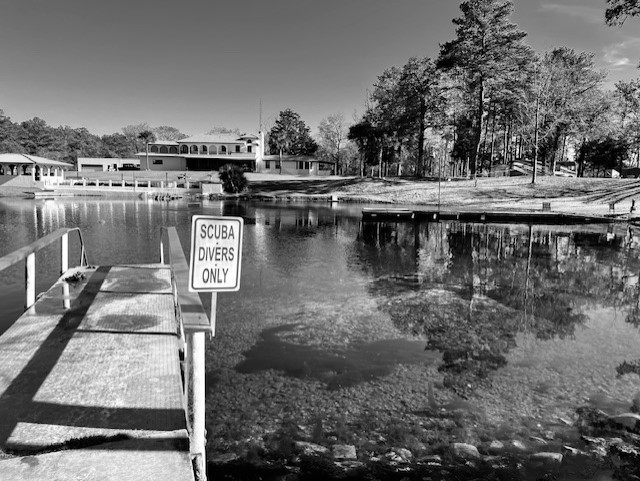
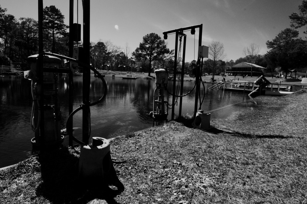
The park’s promotional material describes the spring as a “diving resort” complete with a sunken sailboat to explore. The area around and in the vent contained more gear, both above and below the water and obscure to the non-diver, than any other spring that I have seen.
Gear on bank of the headspring (top), a diver passing by box that I read was a “air bell” (middle), and sunfish and bass completely ignoring the pipes scattered around the headspring (bottom).
The large round pool drops off quickly to 58 feet, at which point a gate blocks the entrance to a cavern that reaches down to 117 feet, accessible only to experienced cave divers with the key. As advertised, the water was, in fact, “gin clear” and filled with fish, mostly shiners, bluegill (Lepomis macrochirus), spotted sunfish (Lepomis punctatus), and largemouth bass (Micropterus salmoides).
The clear water of the pool (top and middle) and a few of the very abundant shiners in the run just below the pool (bottom).
Some of the original sandy run remained, but much of it was covered with algae, as is true of a lot of Florida springs. It seems that shiners, sunfish, and bass are quite tolerant of algal-covered substrate.
A largemouth bass patrolling over an algae-covered sandy run. Lots of bubbles were being released, perhaps due to oxygen supersaturation from rapidly photosynthesizing algae. Supersaturation happens when the algae are photosynthesizing faster than the water can absorb the oxygen, producing bubbles.
Loads of snails littered the sand where it was exposed. Although I have not keyed them out, they appeared to be what the Florida snail expert, Fred Thompson, called “spring elimia” (Elimia sp.).
An Elimia sp. that I pick up off the sand.
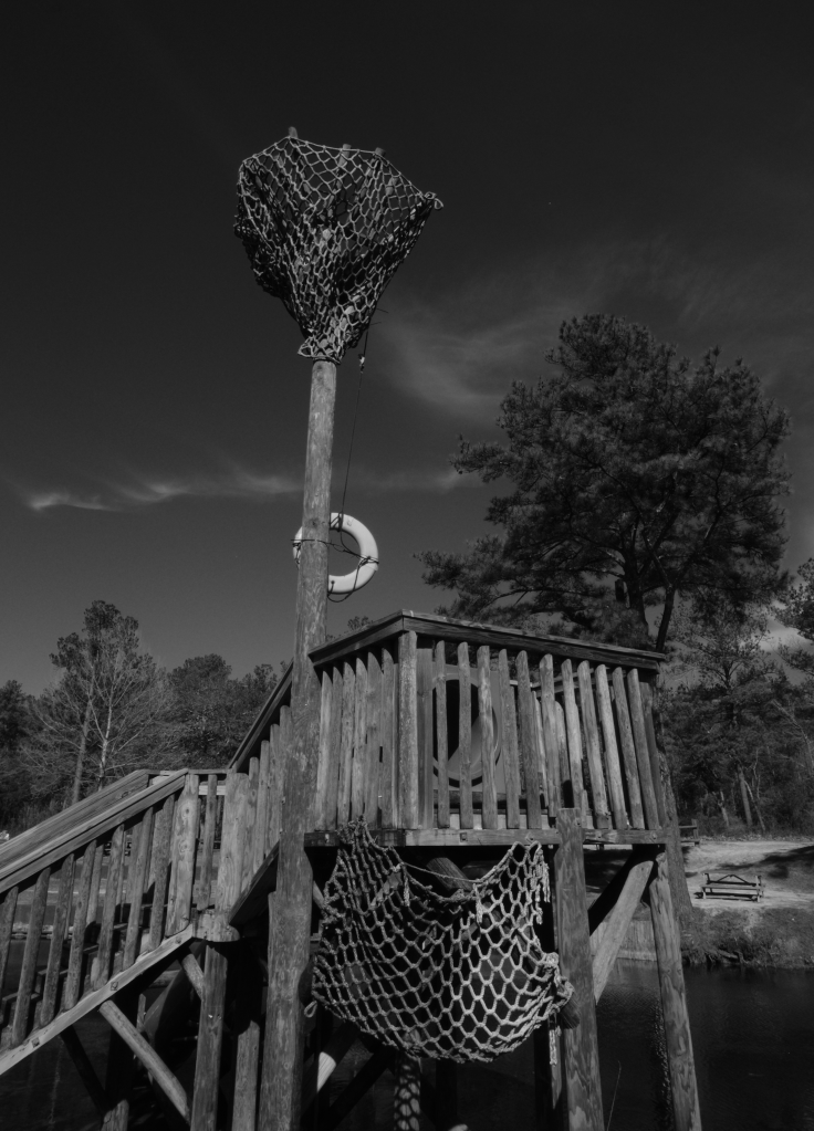
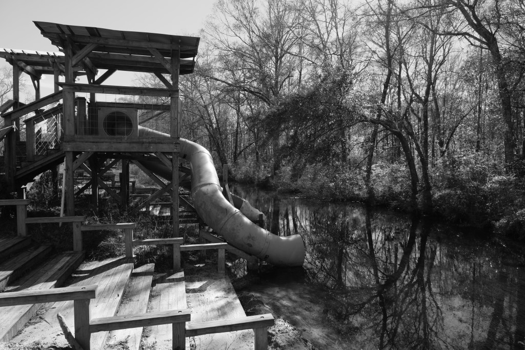
As I moved downstream, the park seemed to shift from dive training to water park. Bridges, a jumping platform, massive inflatable alligators, a mock ship’s crow’s nest, and water slides hinted at the crowds of swimmers that undoubtedly visit in the summer.
Some of the summer accessories for the water park.
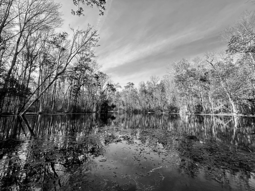
Past most of the water park equipment, the far bank was forested and the run looked a bit more original. Underwater, the run’s substrate shifted from sand and algae to hydrilla (Hydrilla verticillata) and algae. The water contained a little more particulate matter, probably due to the divers upstream. The fish were still a mixture of shiners, sunfish, and bass. It was kind of theme.
Oxygen bubbles being released from the hydrilla with a largemouth bass in the background.
My measurements of temperature (19.1C), dissolved oxygen (5.74 mg/L), and conductivity (221 microS/cm) at the headspring were in line with the only report that I found about Vortex Spring in my quick search. This spring is 2-5C colder than the springs in central Florida. The oxygen in the headspring was reasonably high and it got much, much higher as I moved downstream (over 10 mg/L), which accounted for the supersaturation bubbles. The conductivity was pretty low–no saltwater intrusion or tidal effects here. The only data that I could find on other water quality parameters were from one sample in 1972 taken by the USGS. Given the algal coverage that I saw, I suspect that the nutrients are higher than the 80 microg/L of nitrate reported for this sample.
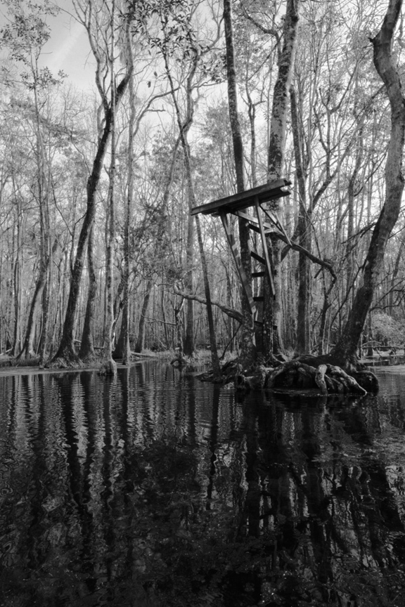
People say that Florida has no seasons, but this photograph says winter to me. The photo is centered on the homemade diving platform at Big Blue Spring on the Wacissa River. The trees, usually so lush, have few leaves, the shadows are long, and the swimmers have been gone for months. Winter on Florida springs is peaceful.
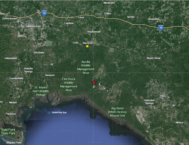
The Wacissa River starts east and slightly south of Tallahassee. It flows through the Aucilla Wildlife Management Area, passing between the Flint Rock Wildlife Management Area and the Big Bend Water Management Area. The drive out to the spring winds through forests or, if coming from Tallahassee, the occasional pasture. About 12 miles downstream from the start of the Wacissa, the river joins the Aucilla River to flow into the Gulf at Apalachee Bay. Together, these two rivers have been categorized as an Outstanding Florida Water.
A map of the Big Bend region that it is the home of the Wacissa River. The yellow star indicates the location of the river’s origin; the red star indicates where the Wacissa joins the Aucilla.
Like the Chassahowitzka, the Wacissa is a river made of springs. It, too, starts with a small spring that feeds into a wide run that meanders to the Gulf, although its meander is roughly 3 times longer. The small spring at the start of the Wacissa, Horsehead Spring, is narrow, somewhat brown, and thick with plants. At the headspring, I could not see the vent at the bottom. The spring seemed more like a hole in the plants than the rocky crevice that was undoubtedly underneath the dark water.
Map showing the location of the first two springs, Horsehead Spring (orange star) and the larger vent downstream at the start of the river proper (blue star).
The headspring for Horsehead Spring (top) and light streaming down from the distortion made by my paddle at Horsehead headspring (bottom).
Once I left the Horsehead headspring, the trees converged over this lovely little spring run. The run was so filled with plants that I had to find holes in the plant cover to get a good enough field of view to film. Some of these plants were eelgrass (Vallisneria americana) and some were nonnative hydrilla (Hydrilla verticillata), as seen in the video below.
Shiners and bluefin killifish (Lucania goodei) streaming past the camera at the headspring of Horsehead Spring.
In this small spring, I was rewarded with a fish species new to me, the metallic shiner (Pteronotropis metallicus). Shiners are very hard to identify on film because many of the characters that are needed for a good identification are too small and obscure to see at a distance, but this species has a very wide black stripe on its side and a dark dorsal fin etched in white and orange on the outer edge. As they darted around the plants, the fish popped their dorsal fins up and down, inadvertently signalling to me their species.
Metallic shiners in Horsehead Spring run.
As soon as I floated out of Horsehead Spring, I found myself over a spring vent that I had not realized was there. It was large and dark, but provided substantial flow to the river. I noticed the spring as I floated over it because it, too, looked like a round hole in the plants. In fact, the whole river upstream was thick with plants; the plants were so thick that the birds were walking on them as if on land.
Eelgrass waving in the flow of the river (top) and a little blue heron (Egretta caerulea) standing on the thick hydrilla in the river (bottom).
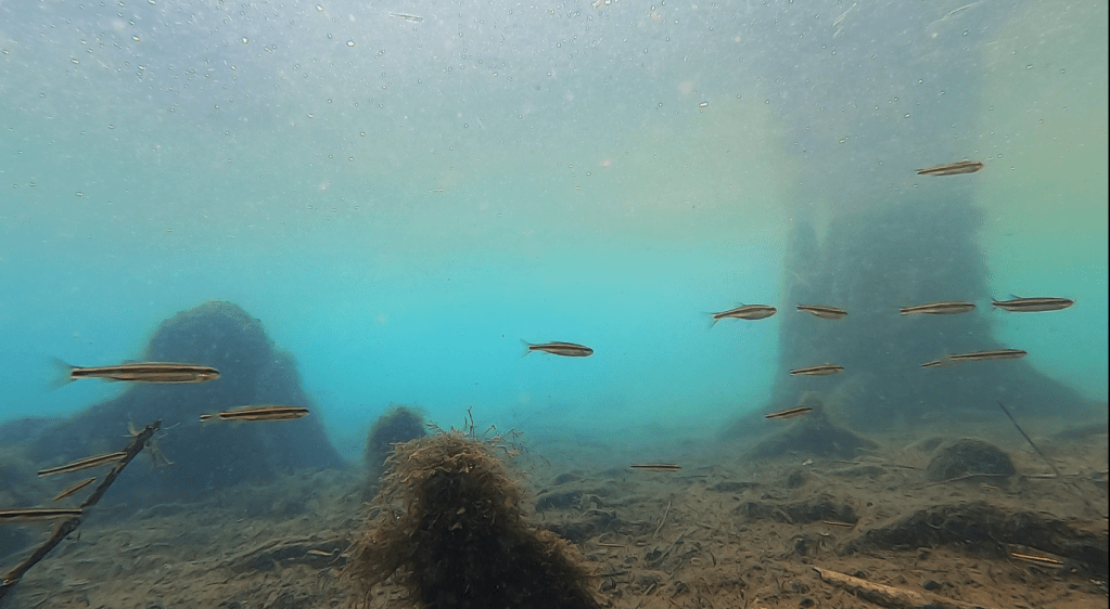
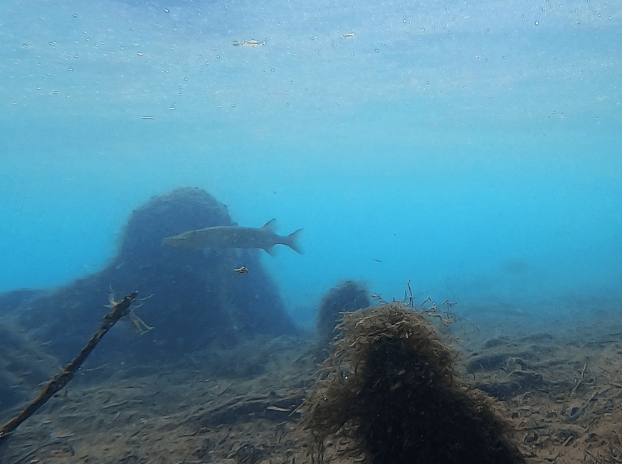
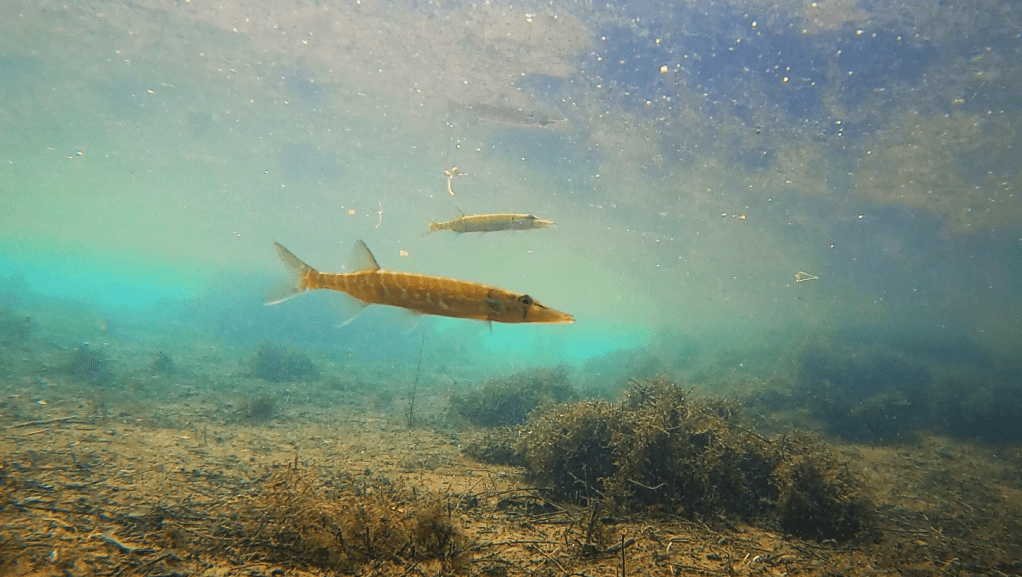
This thick plant life, both native and nonnative, provided cover for small fish. In contrast to the Chassahowitzka, which had virtually no plants in the main river, lots of predators, and very few small fish, the Wacissa was teaming with small fish. Every video showed some combination of 30-50 shiners, killifish, and livebearers like mosquitofish (Gambusia holbrooki). Large predators, like largemouth bass (Micropterus salmoides) or longnose gar (Lepisosteus osseus) were relatively rare in the videos of either the main river or the many springs that fed into it along its upper length.
A rare group of three largemouth bass patrolling (top) and a largemouth bass scaring shiners into the vegetation (bottom). The shiners wink back into view after the bass moves along.
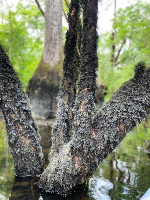
Flooding back into the forest also provided cover for fish. Hurricane Idalia passed over the area in August 2023 and the flood waters still had not completely receded in February 2024. Florida is so flat, its water table is so shallow, and there often is so much precipitation in the rainy season that floods can last a very long time. When the water penetrates back into the woods, the cypress knees and shrubs can provide extra cover from predators for small species.
The homemade diving platform above this knot of tree roots on Big Blue Spring suggests that it is likely on dry land in the summer when the floodwaters recede.
After I finished filming in the main river, I moved into some of the many springs that contribute water to the main flow: Big Blue, Little Blue, Buzzard Log, Garner, and Minnow.
Flooded forest (top) and duckweed (Lemna sp.) so thick that my kayak made a trail (bottom) in Minnow Spring.
I have been thinking lately about how small side springs and flooded forest might contribute to the overall diversity of larger systems. When I filmed back in the side springs of the Wacissa, many of the fish that I observed were the same species as in the main stem of the river. However, I also found some unique assemblages and species. Back in the side springs, I observed more least killifish (Heterandria formosa), our smallest fish species in Florida, than I have ever observed together. The specific epithet of this species references the family name of ants, Formicidae, undoubtedly because of their small size. I also observed a chain pickerel (Esox niger), a large predatory species that I have only caught on camera once in all of the video that I have collected to date.
Tiny least killifish above the slightly larger shiners at Minnow Spring (top) and a chain pickerel at Garner Spring (bottom). The camera at Minnow spring was back in the flooded forest and there was a lot of dissolved and particulate “stuff” in the water. The camera a Garner Spring captured a lot of live and dead algae and plants.
And much to my surprise, I also caught an entirely new type of organism for me: an eastern newt (Notophthalmus viridescens). This animal has a relatively unique life history, with a juvenile aquatic stage, followed by a juvenile terrestrial stage, and finally an adult aquatic stage (https://nationalzoo.si.edu/animals/eastern-newt). Given that I collected the video of this species at two different locations (right off the boat ramp and in Big Blue Spring), it is likely that there are a lot of newts in the system.
Eastern newts in Wacissa River springs.
The fact that the Wacissa River flows through Wildlife Management Areas likely contributes to its good water quality. The nitrate concentrations published by the US Geological Survey are among the lowest that I have observed for Florida springs (0.16-0.33 mg/L). The dissolved oxygen concentrations they published are relatively high (4.9-8.3 mg/L) and my measurements were in a similar range. The conductivity of the river and its springs, both published data and my data, are much lower (0.26-0.30 mS/cm) than what I measured in some of the Chassahowitzka springs (5-10 mS/cm), undoubtedly due to the greater distance between the Wacissa springs and the Gulf. Conductivity is a measure of ion concentrations in water, kind of the freshwater version of salinity. Salinity is a measure of sodium and chloride, whereas conductivity encompasses the broader range of ions typical of freshwater. To give some context, the conductivity of sea water is 3-6 S/cm, so several orders of magnitude higher than in the saltiest springs that I have measured. It is likely that the lower conductivity and the greater distance to the Gulf explains the exclusively freshwater assemblage that I observed on the Wacissa in contrast to the Chassahowitzka.