Juniper Spring, Marion County, May 2017

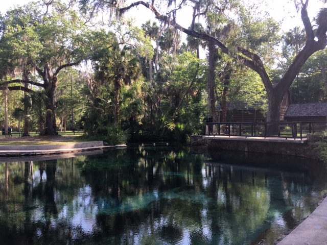
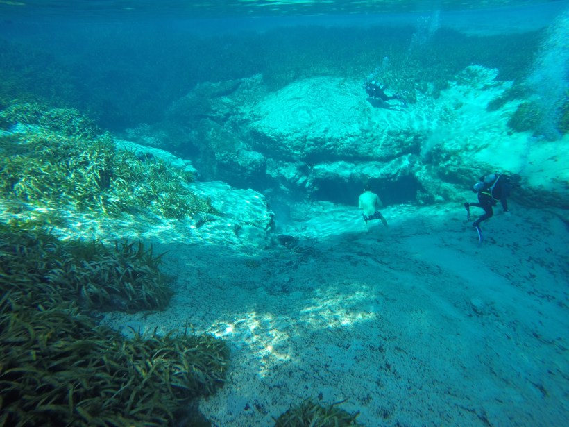
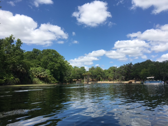
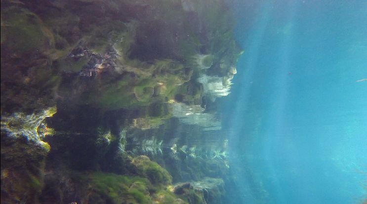
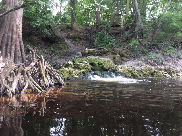
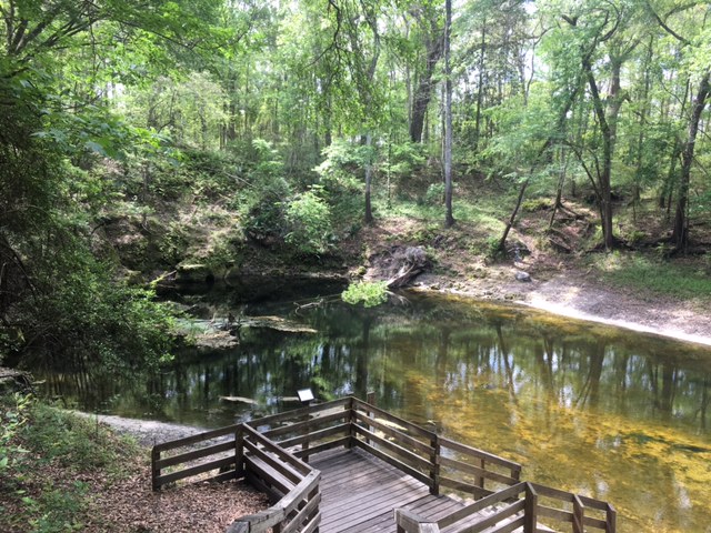
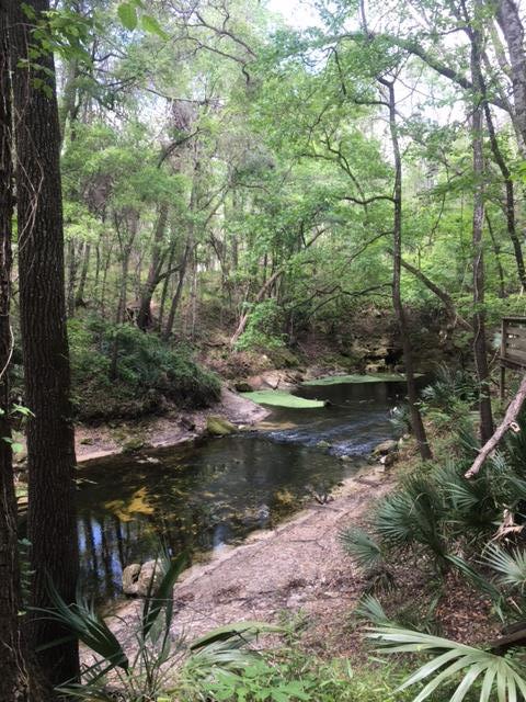
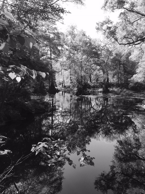
I gravitate toward small, sandy spring runs with overarching tree canopy, so Juniper Spring has always been a favorite.  Like many, or perhaps most, of the big springs in Florida, the Juniper headspring was modified long ago for swimming.

juniper boil2

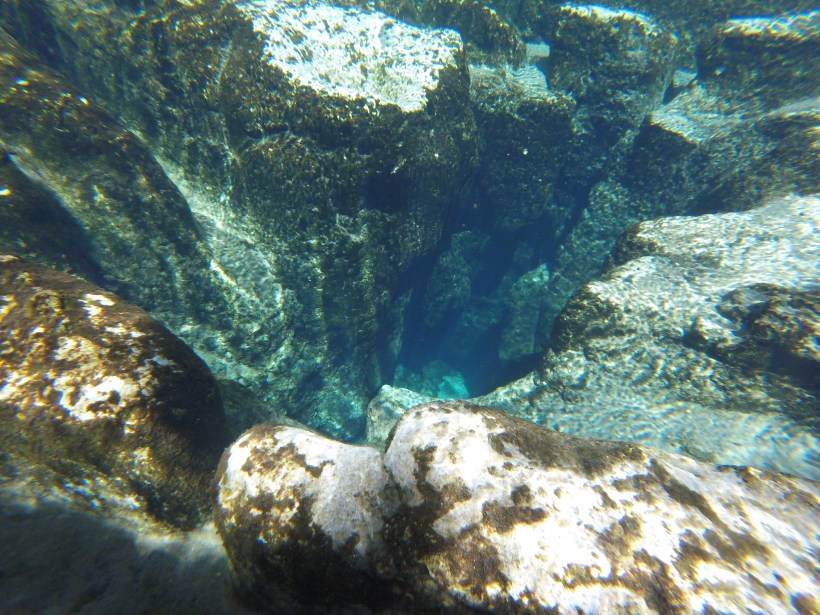
The Juniper headspring.  The vent is in the foreground of the photo.

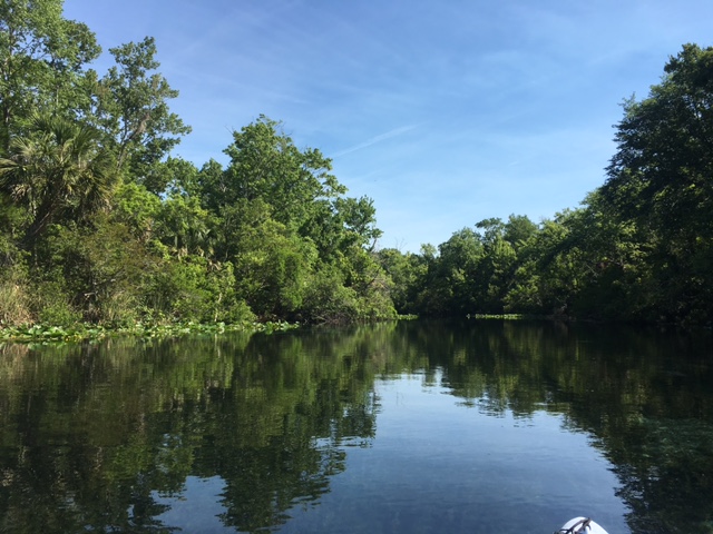
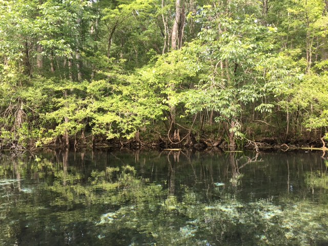
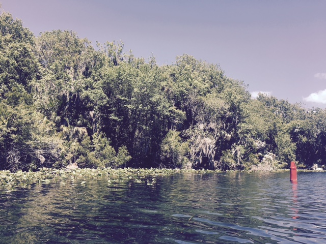
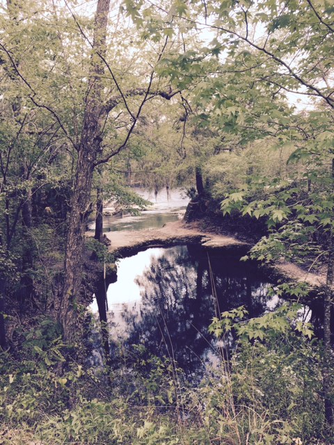
The modification makes for a nice, easy-access swimming area, but once the run leaves the headspring area, it is unmodified and seemingly pristine.  The bottom is sandy and the water is shallow and so clear so that it almost looks more like a dry sand path rather than a spring run.

juniper run 2

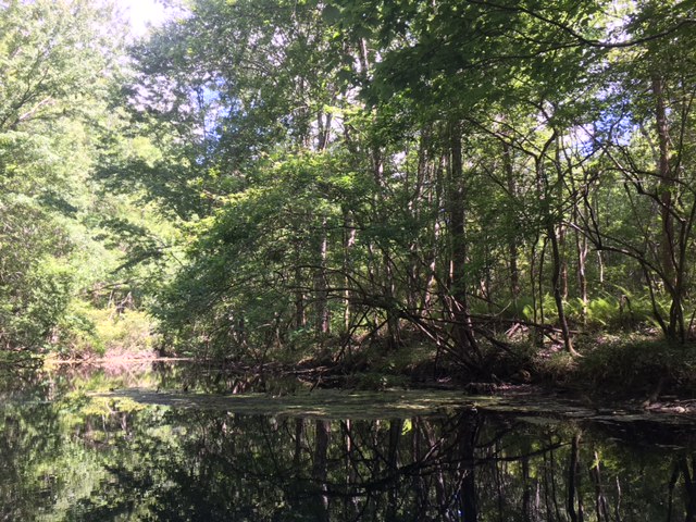
The Juniper Spring run just below the put-in for canoes.

Juniper spring run start under water

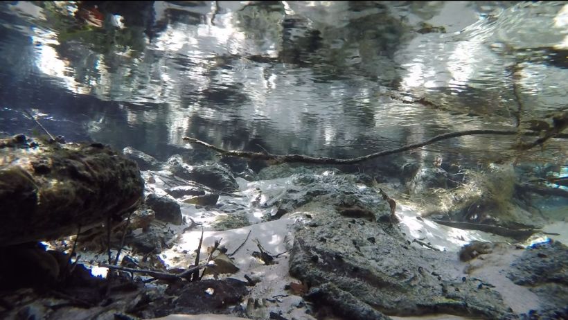
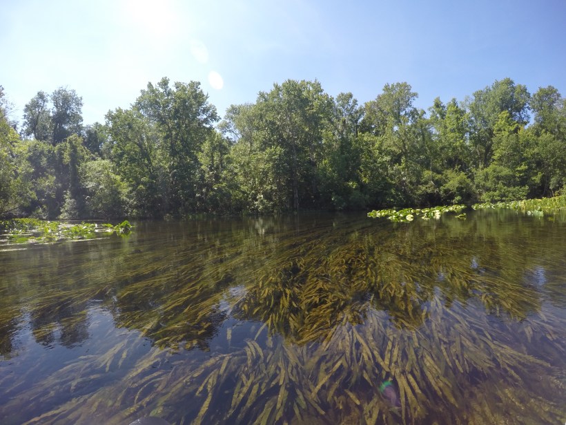
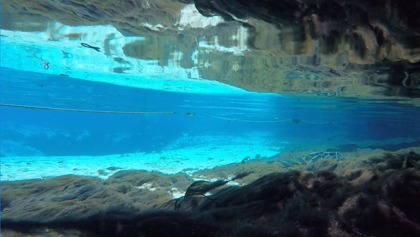
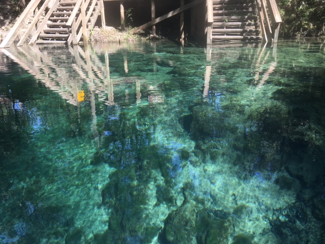
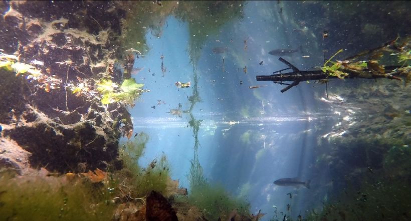
Looking upstream under water at the put-in spot for canoes.

juniper run 5juniper run 3juniper run 7juniper run 10

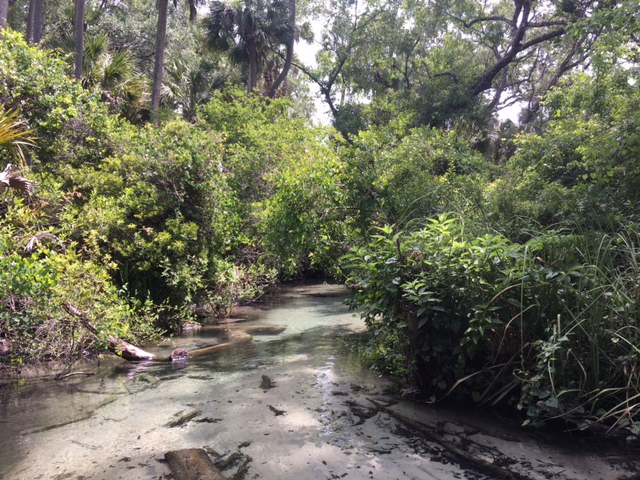
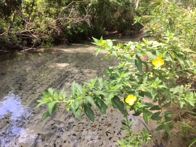
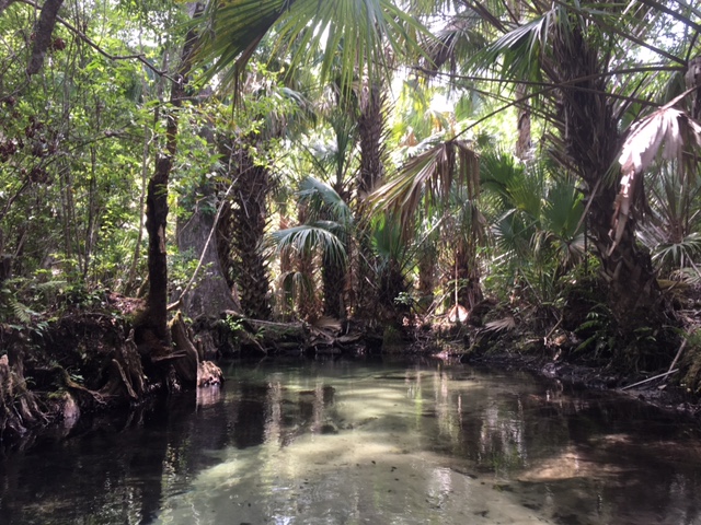
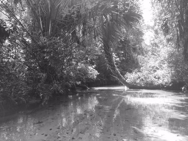
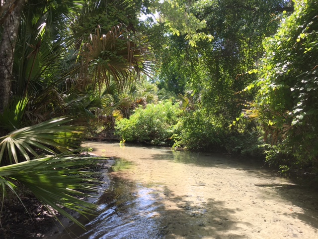
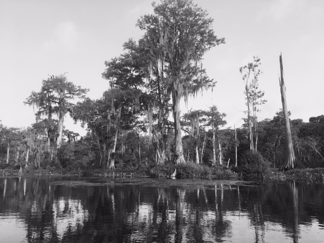
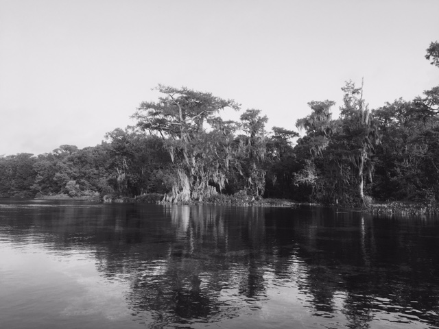
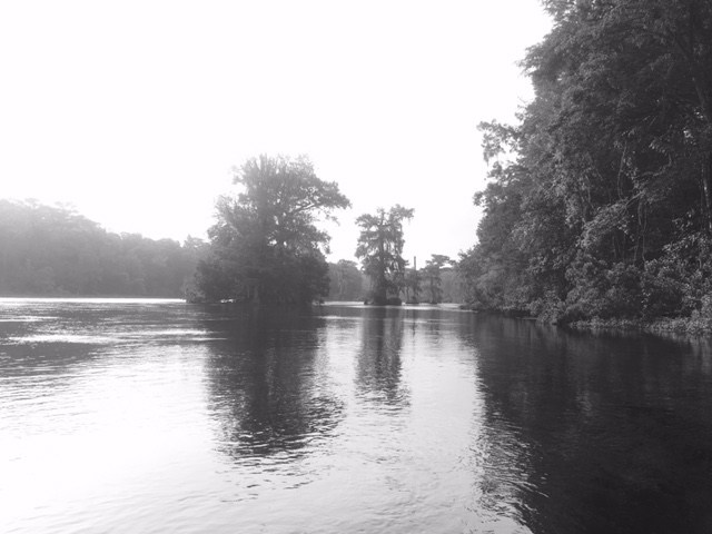
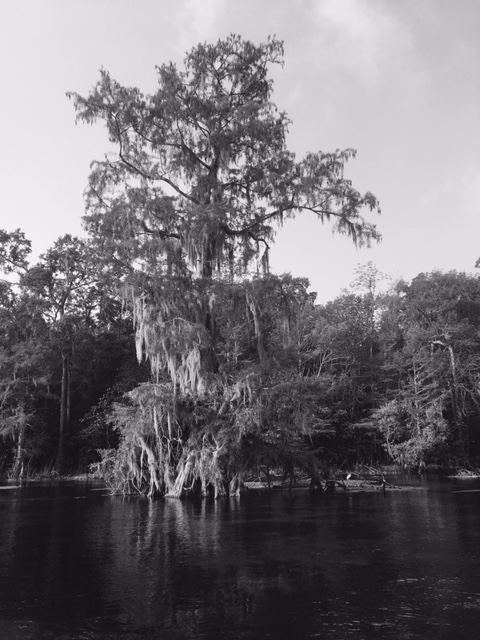
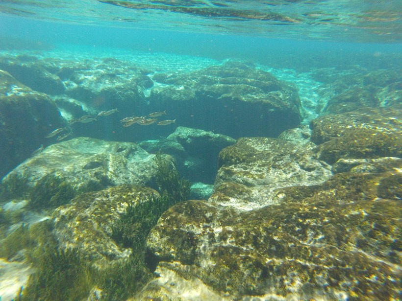
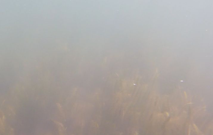
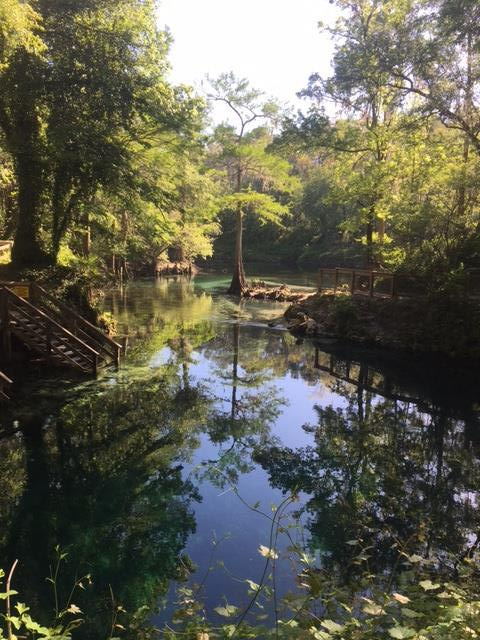
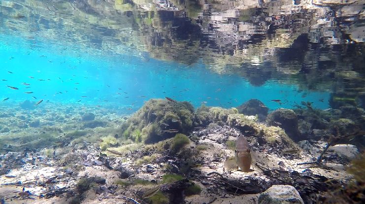
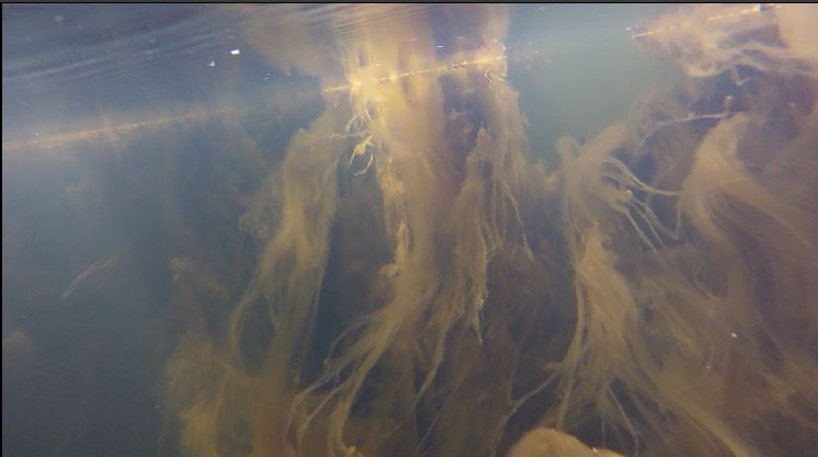
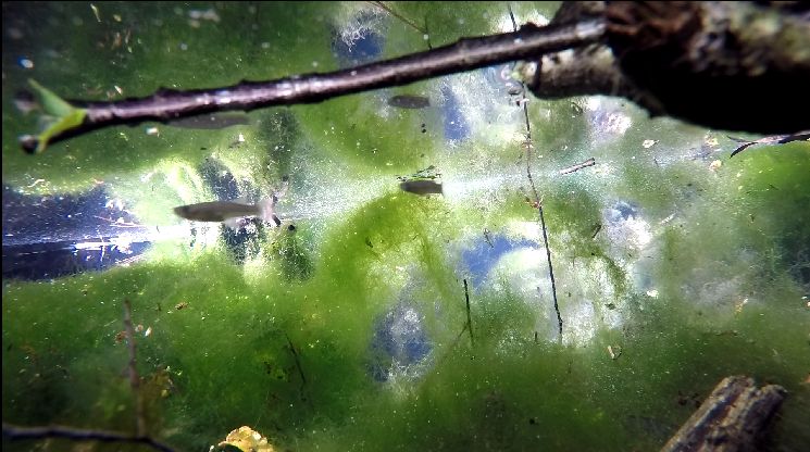
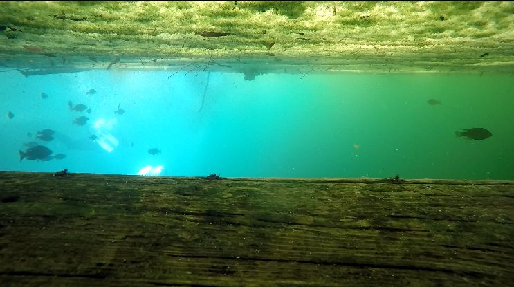
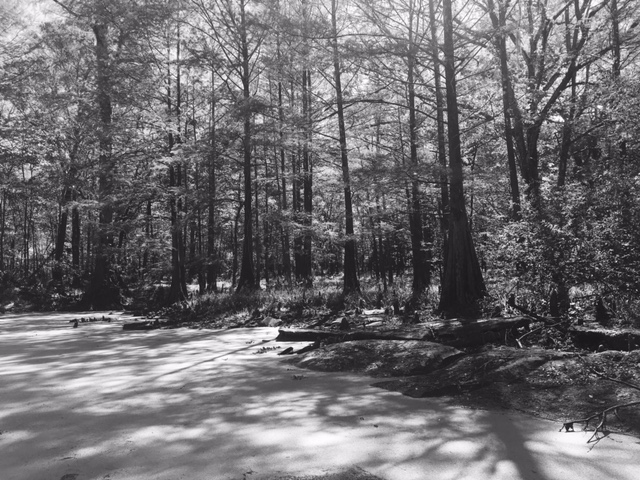
Views of the upper run of Juniper Spring.

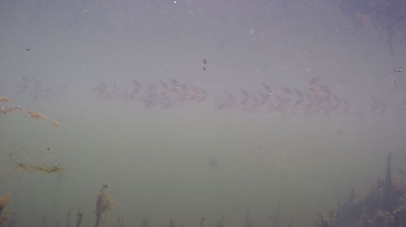
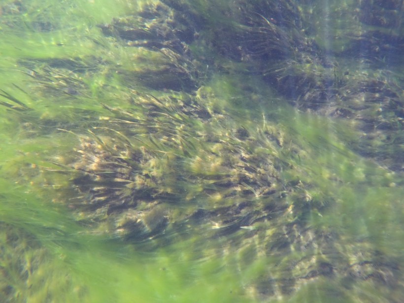
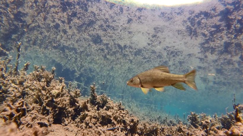
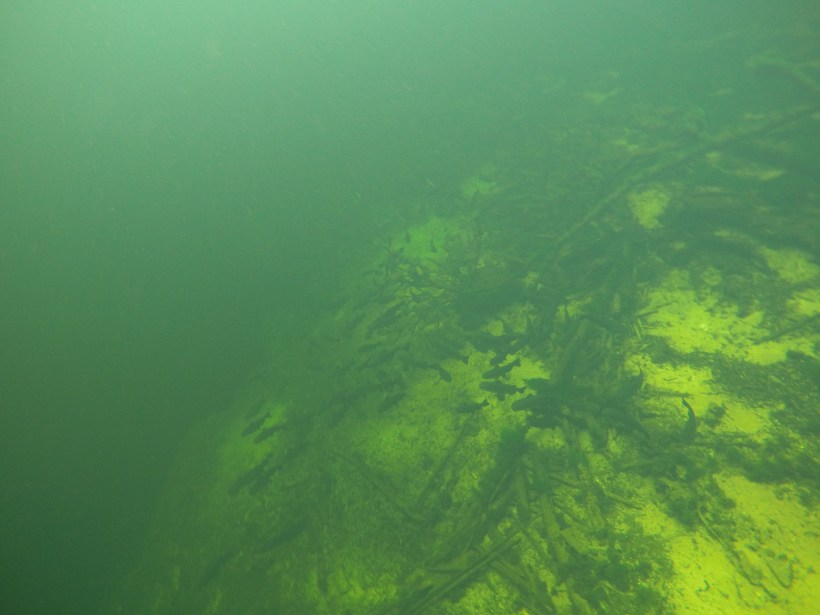
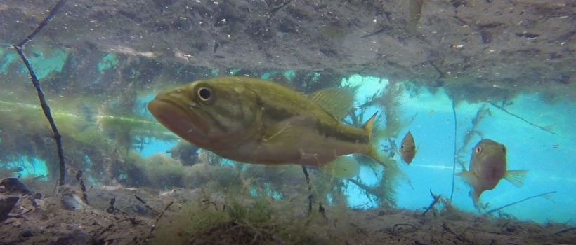
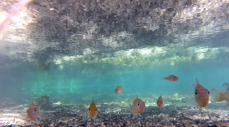
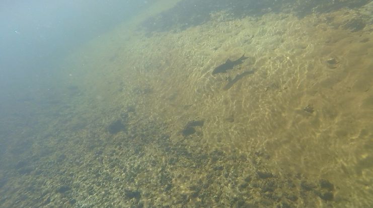
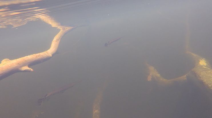
One of the things that I love about Juniper Spring is that it has loads of blackbanded darters (Percina nigrofasciata) in the upper part of the run.  I can watch them doing their darter business, planting themselves on the sand until they decide it’s time to move, then lifting up and floating downstream until they turn around and plant themselves again.

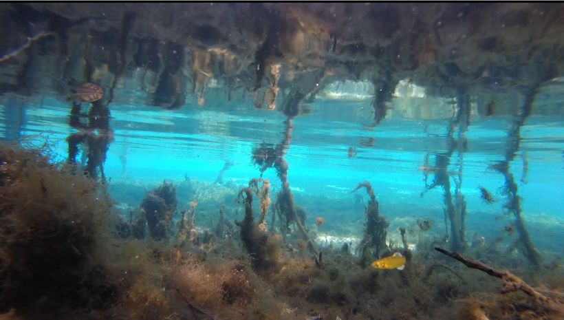
Blackbanded darters and shiners (Notropis sp.) working the flow just downstream from the put-in spot for the canoes in the upper reaches of the spring run.  In the video two darters inch their way up the run in the lower left quadrant.  Some other darters work their way across the run further back in the video.  They look like they are expending next to no energy to stay in place as they plant their pectoral fins in the sand.  By contrast the shiners are working hard with their tails to stay in the flow.

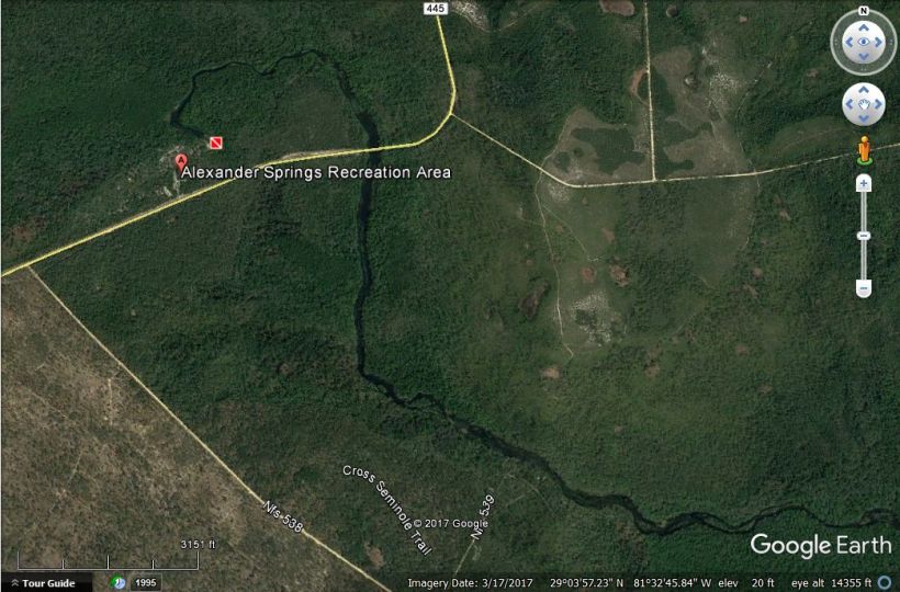
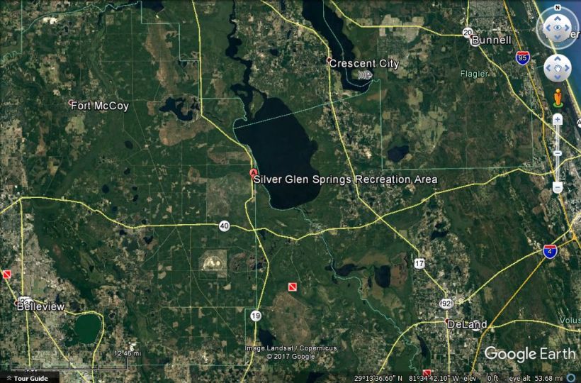
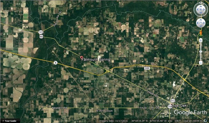
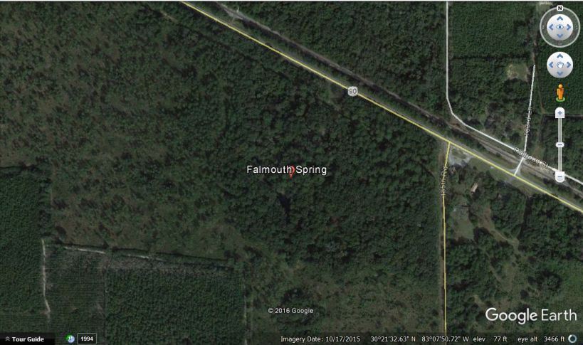
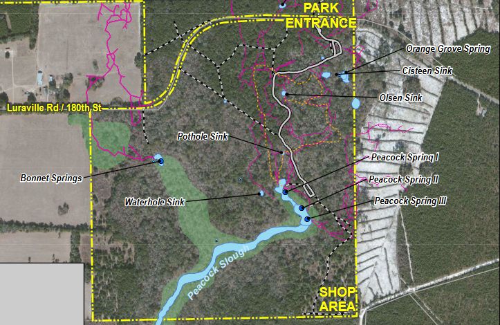
Like the other Ocala NF springs, the landscape around Juniper Spring is conservation land.  The spring run is so narrow that it is hard to see even on a closeup aerial shot.

Juniper aerial

Google Earth image of the landscape around Juniper Springs.

juniper aerial close up

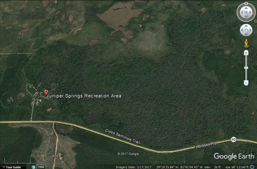
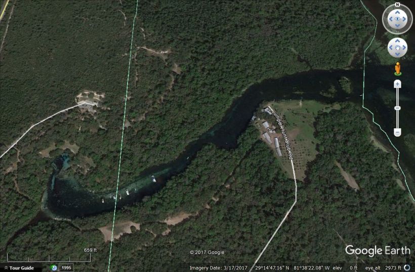
Closeup of the Juniper Springs landscape; the spring is barely visible in the upper right quadrant of the photo although it starts on the left side.  It is interesting how the tree cover appears much thicker around the spring run.

The discharge and conductivity of Juniper Spring are quite low compared to the other Ocala NF springs (dishcarge = 11 vs. 1070-5800 cfs, conductivity = 125 vs. 1070-5800 micromhos/cm).  The spring is a little colder (22oC vs. 24oC) and more oxygen-rich (7.6 vs. 2.8-6.2 m/L) than the other springs as well.  Although the high dissolved oxygen concentration is likely a function of the low surface to volume ratio (more of the water exposed to air) and the lack of large volumes of organic matter (bacteria breaking down organic matter use oxygen), oxygen dissolves more readily in colder water as well.

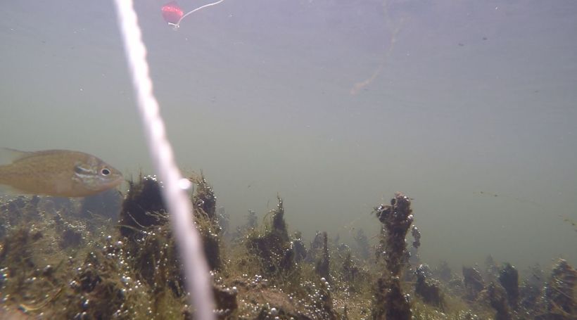
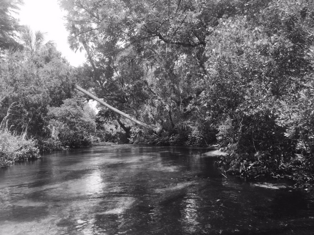
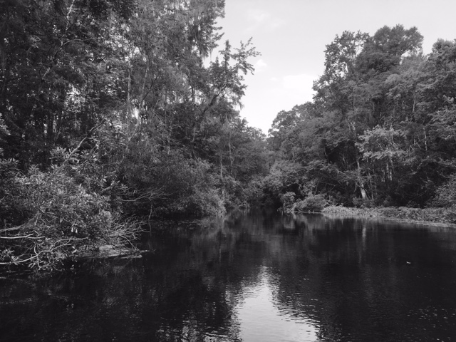
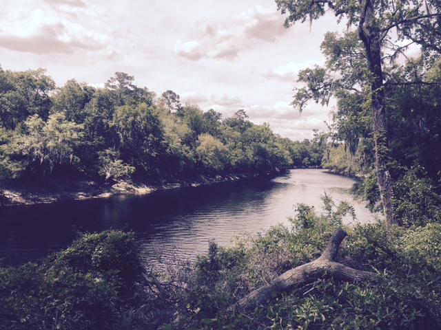
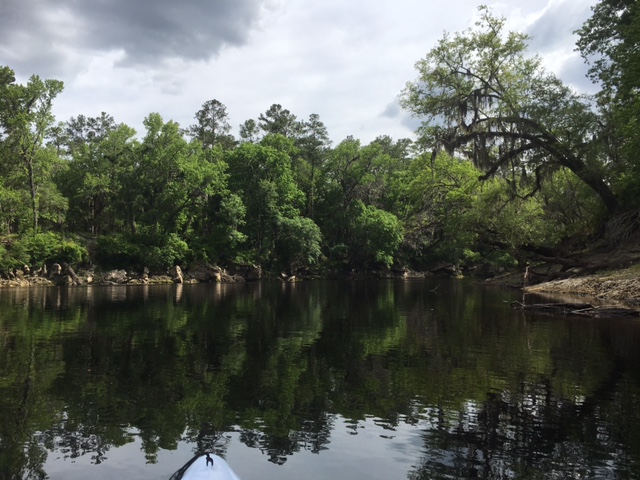
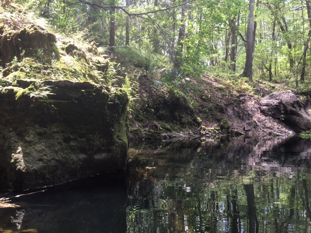
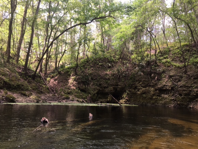
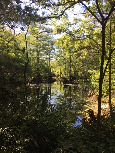
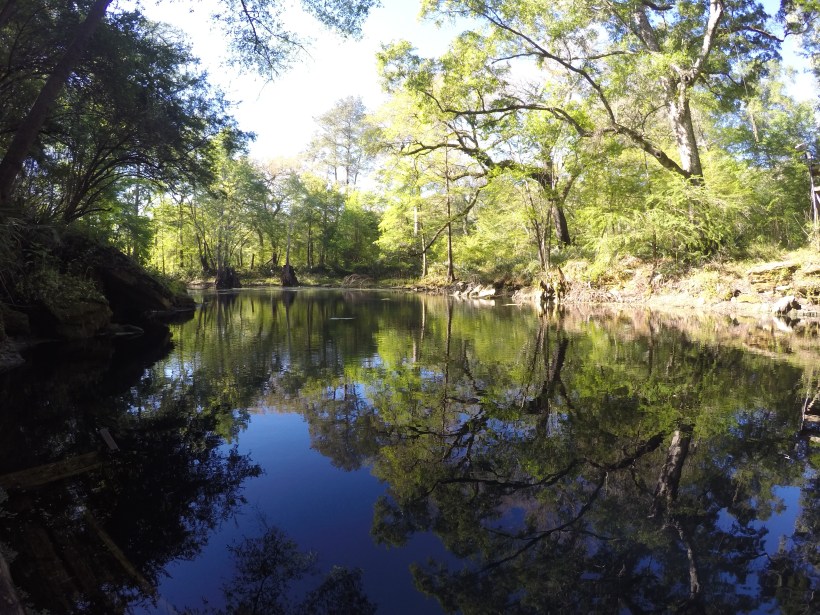
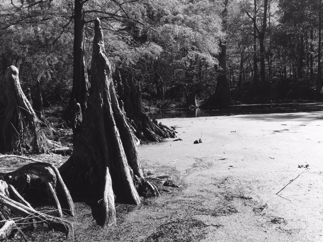
Downstream, quite a long way, the spring widens and deepens slightly.

juniper run 12juniper run 13juniper run 14

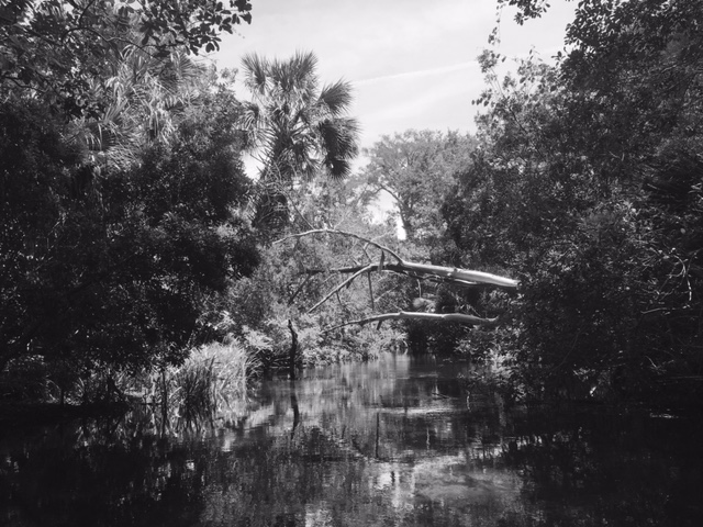
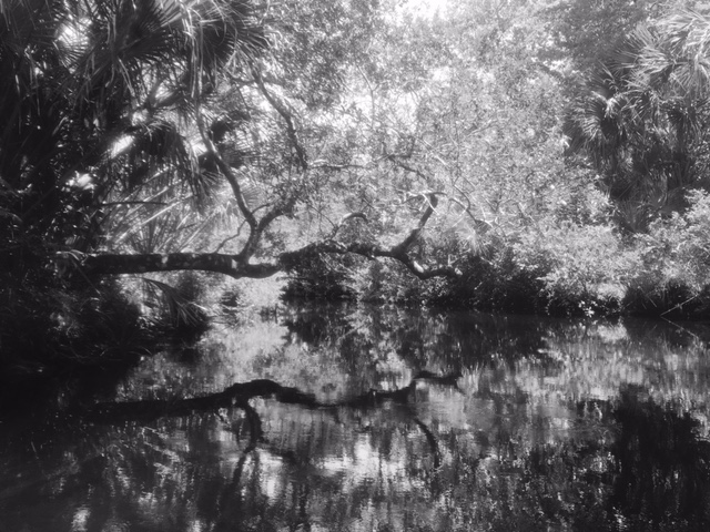
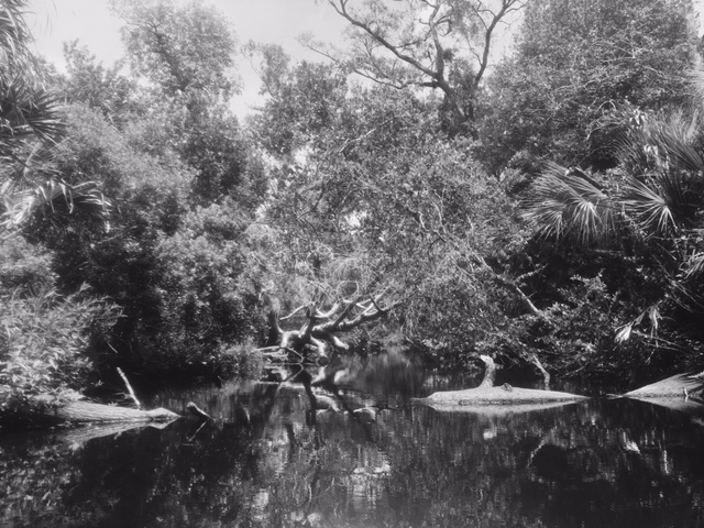
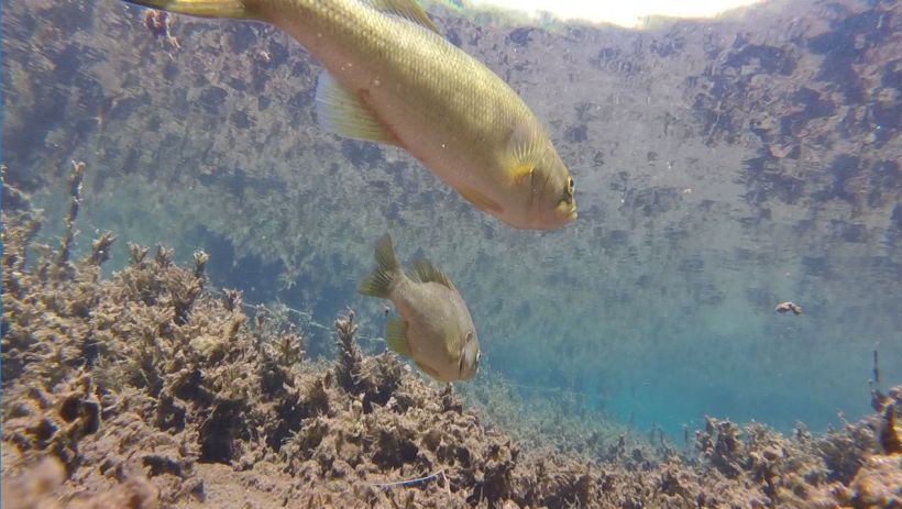
The water clarity in this area of the run is a bit lower, as is the flow.  The fish assemblage changes as well.

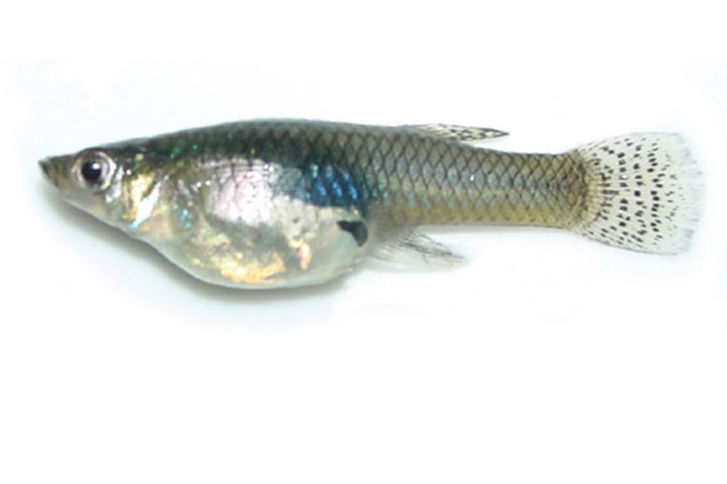
Shiners (Notropis harperi?) in the deeper and wider area of the run downstream.

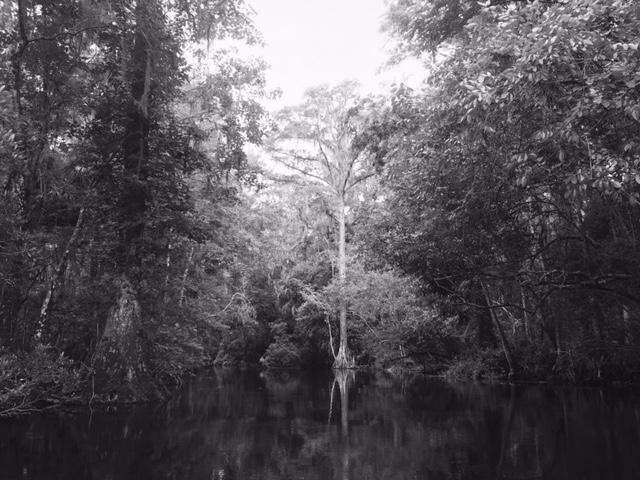
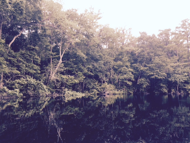
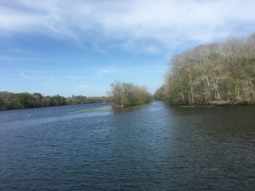
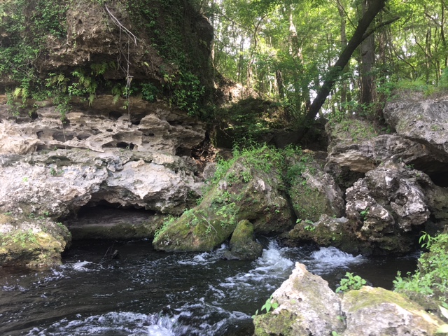
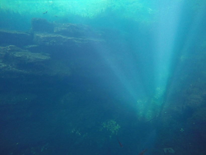
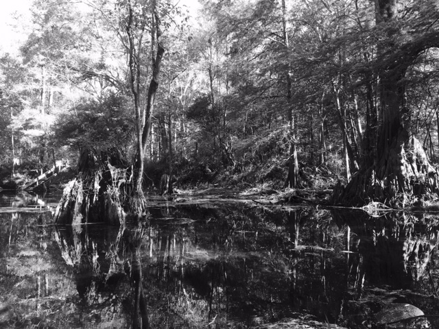
Even further downstream, the overhead canopy disappears and the run acquires some deep-ish pools.

juniper run 15juniper run 16juniper run 17

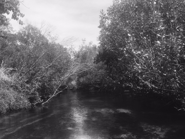
Views of Juniper Spring run.  I believe that the last photo was taken shortly before the “rapids”.  The rapids are tiny as rapids go, but still fun.

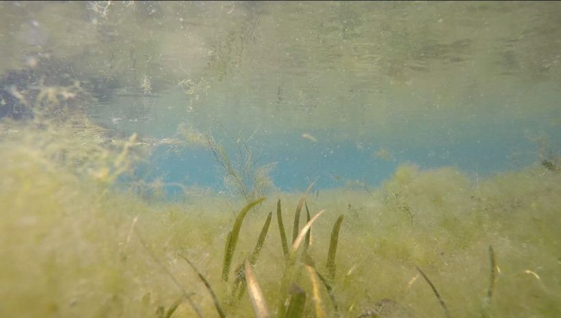
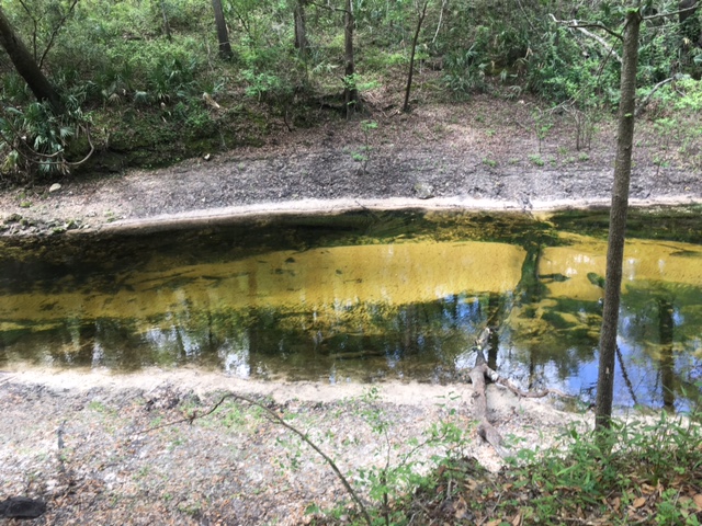
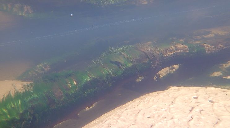
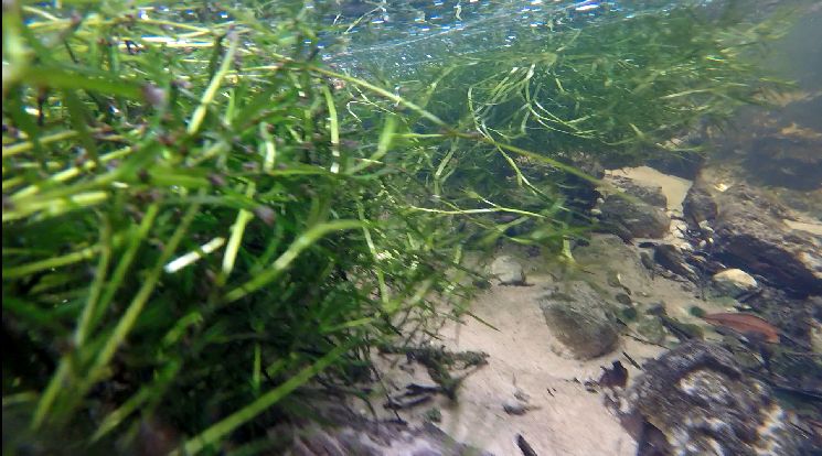
Even further downstream just past the pull-out point for canoes, eelgrass (Vallisneria americana) or Sagittaria takes over the bottom of the run.  However, I did not catch many fish on video down here.

Juniper run eelgrass

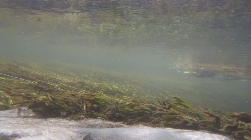
Eelgrass or Sagittaria below the canoe exit for the shuttle.

It would be interesting to paddle the whole run and get a picture of the fish assemblage further downstream!

Alexander Springs, Lake County, May 2017

Rocky and complex like a sandy underwater canyon, the Alexander Springs vent is truly lovely.  On the day that I visited, there were only a few people near the vent (and only a few people in the park): three scuba divers and a free diver.  How wonderful it is to visit these springs in the off season!

alexander boil.JPG

Above water view of the Alexander Springs vent.

GOPR1072.JPG

DCIM100GOPROGOPR1137.

Underwater views of the Alexander Springs vent.

Like Silver Glen and Salt Springs, Alexander Springs is smack in the middle of the Ocala National Forest conservation lands.  It is the southernmost of the big Ocala NF springs and its long run meanders 13,000 m through the forest before entering the St. Johns River south of Lake Dexter.

Alexander aerial

Google Earth image of the landscape around Alexander Springs.

Alexander aerial closeup

Closer Google Earth image of Alexander Springs.

The run is narrow and intimate feeling, with some slight braiding.

Alexander run

The Alexander Springs run a short way downstream from the headspring.

Like several other of the St. Johns River springs (Salt, Silver Glen, Volusia Blue, Gemini, and to some extent, DeLeon), Alexander Springs is a bit salty (conductivity = 1070, http://www.sjrwmd.com/springs/alexander.html) due to ancient sea water that was trapped in the aquifer thousands of years ago.  The conductivity would be higher if the water that discharged from the spring were only that trapped seawater, but the seawater combines with the freshwater that recharges the aquifer continuously before it discharges.  The discharge of the spring is relatively high (100 cfs) and the spring is fairly low nutrient (nitrate = 0.55 mg/L and phosphate = 0.04 mg/L).  For comparison, the nitrate concentrations of the nutrient-rich Suwannee River springs ranged from 1.8-5.7 mg/L and the phosphate concentrations ranged from 0.03-0.08 mg/L.  Nutrient enrichment of nitrate is more common than phosphate in Florida springs because nitrate travels more readily through the soil than phosphate.  With the relatively low nutrient concentrations in Alexander Springs, I was very surprised to see dense algae just below the headspring.

DCIM100GOPROGOPR1088.
Algae blanketing the bottom of the Alexander Springs run.  It is a pretty color anyway…

DCIM100GOPROGOPR1093.

Eelgrass (Vallisneria americana) poking through the filamentous algae.

The bright green algae abated downstream and gave way to abundant eelgrass, although even here the leaves were covered a thin layer of algae.  However, the eelgrass and other vegetation provided habitat for a remarkable number of fish.

DCIM100GOPROGOPR1110.

Eelgrass waving in the flow of Alexander Springs.

alexander run spadderdock

Spadderdock (Nuphar luteum) in the Alexander Springs run.  The bright yellow ball in the foreground is a spadderdock flower; the flowers do not really open like a lotus, but rather stay like a ball even when mature.

The fish species richness (total number of species) of Alexander Springs was among the highest that I measured among all the springs that I sampled (17 species vs. 25 for Volusia Blue and 19 for Gemini) and the diversity was the highest of all of the springs (2.16 vs 2.13 for Volusia Blue) despite the algae and a fair amount of silt along the banks.  There also were more of the larger fish, sunfish (Lepomis sp.), largemouth bass (Micropterus salmoides), and lake chubsuckers (Erimyzon succetta), than in any other spring that I surveyed.  At one point, there were so many fish that I had to stop the video and count frame by frame.

Largemouth bass, chubsuckers and a golden shiner or two (Notemigonus chrysoleucas) milling around in the run of Alexander Springs.

Loads of big golden shiners and a few chubsuckers in the run of Alexander Spring.

chubsucker

An otherwordly shot of a chubsucker.

It is interesting how much fish vary morphologically.  A readear sunfish (Lepomis microlophus) that looked like it was missing most of its pigment roamed through the videos.  And among all of the springs, I have regularly seen largemouth bass that are stripe-less.

bass and sunfish

Both the redear sunfish and largemouth bass in this photo look somewhat pigment-less.  What are they looking for?  Perhaps the fish exodus in the following video…

These are either some curious fish or something was behind them…


Wakulla and Sally Ward Springs, Wakulla County, April 2017

Wakulla Springs is, with Silver and Rainbow Springs, among the largest of Florida’s springs and probably among the largest freshwater springs in the world (~800 cfs).  Of the three, it felt the most remote and untouched to me, although they all have been touched and it’s probably busier in the summer.  The land that surrounds the springhead was sold to the state by Edward Ball in the 1960s.  He had owned the land since the 1930s and the lodge, which still hosts guests, was his personal guesthouse.  Besides leaving behind a lovely lodge for visitors, unique for a state park, Ed Ball required that use of the spring would be limited.  To this day, on the park’s land, people are only allowed in or on the spring at the headspring, where swimming is allowed, or on a tour boat which only goes down the run to about the first turn of the big spring.

FullSizeRender

A small portion of the Wakulla Spring headspring.

Wakulla lodge

Wakulla lodge interior2.JPG

The lodge at Edward Ball Wakulla Springs State Park.

Wakulla Springs is just south of Tallahassee, but driving up to it, it feels much more remote.  The landscape around the park is a mixture of forest, low density housing, and agriculture.

Wakulla aerial

Google Earth image of the landscape around Wakulla Springs.

Wakulla aerial closeup

A closer Google Earth image gives a better picture of the magnitude of the spring.  The tree islands are visible at this altitude, as is Sally Ward spring entering into the spring just below the headspring.

Besides a peaceful stay in a beautiful 1930s lodge with a delicious dinner and a great hike in gorgeous forest around the lodge, this trip was amazing because I was literally the only one on the water in the morning.  After the very helpful park biologist unlocked the gate to let me down to the water, I was completely alone with the big water, the trees, and the critters.

my kayak

My kayak right before I went out to work.  The platforms are part of the limited swimming area.

me at wakulla

Me, not believing my luck with the spring run stretching behind me…

Once I pushed away from the beach, I did a tour of the headspring.  I think that it was the deepest spring that I visited during my spring survey.  Unlike the other springs that I visited, I couldn’t even see the bottom of the vent on the video.

DCIM100GOPROGOPR1031.

These unidentified catfish look like they’re swimming down into an abyss in the Wakulla headspring.  I was impressed.

mullet in wakulla2

These mullet (Mugil cephalus) also look like they’re swimming into nothingness.

I did my best to record fish at the headspring of Wakulla and I was successful along the bank, but the catfish on the edge of the vent were too deep to identify.

After looping around the headspring a couple of times, I turned down the enormous run.

wakulla in the morning3

Looking down the run from the headspring.  The tour and park staff boats are visible on the right side of the photo.

The tree islands were especially beautiful and as I neared them, I discovered that they were loud with bird calls.  The park attributes the high density of birds in the park to the limited human use.  They may well be right; there were impressive numbers of birds and alligators.  I saw more alligators at Wakulla than anywhere else.

Wakulla tree islands 2

A tree island just down from the headspring.

Wakulla tree islands 3

Another view of tree islands.

Wakulla in the morning

If I remember correctly now, I took this photo at the first turn in the spring, as I was coming around the corner, so to speak.

wakulla tree and egret

The dominant impression of this photo is the lovely old cypress, but a closer inspection reveals an egret as well.  Even the wildlife, which was abundant, seemed dwarfed here.

After paddling down past the second curve in the spring, I turned around and headed back upstream to start my shallow water bank videos.  Instead of retracing my path exactly, I went on the other side of a giant tree island.  The wind had begun to kick up and the side channel was very peaceful.

wakulla side channel

The side channel near the headspring of Wakulla.

Although I didn’t get great videos of the vent at the headspring, the videos from the bank were good.

Bluefin killifish (Lucania goodei) and mosquitofish (Gambusia holbrooki) on the edge of the headspring.  Mosquitofish are literally everywhere and bluefins are right behind them.  These male bluefins were showing off their blue dorsal fins in a territorial display.

As is pretty obvious in the video above, there was algae at Wakulla, although I have definitely seen worse.  I went to Wakulla Spring in part because it has been held up as an example of how nutrient reduction can work.  The concentration of nitrate in the spring peaked at over 1 mg/L in 2000 or so and, through nutrient redirection, it is now down to 0.3-0.4 mg/L (http://www.dep.state.fl.us/water/watersheds/docs/bmap/Wakulla-BMAP.pdf), which is really remarkable.

Eelgrass (Vallisneria americana) or Sagittaria partially on the bottom of Wakulla Springs run.

I applaud the nutrient reductions and the commitment to restoration.  Hopefully, algae will decline over time…

Although this is a little out of order, I sampled Sally Ward Spring, which flows into Wakulla Spring, the evening before I surveyed Wakulla.  It’s a pretty little spring that actually seems to harbor more fish diversity than the big spring.

sally ward headspring

A view looking across the headspring of Sally Ward Spring.

sally ward run

A view looking down the Sally Ward Spring run.

DCIM100GOPROGOPR0931.

One of the vents of Sally Ward Spring.

bass in sally ward

Nice largemouth bass (Micropterus salmoides) in Sally Ward Spring.

Florida gar (Lepisosteus platyrhincus), largemouth bass, and sunfish (Lepomis sp.) in Sally Ward Spring.

Turtles freaking out at my approach in Sally Ward Spring.

Salt Springs, Marion County, April 2017

Salt Springs is a beautiful collection of small, rocky vents.  Not surprisingly, given its name, Salt Springs has the highest conductivity (kind of the freshwater version of salinity) of any of the St. Johns River springs.  In fact, its conductivity is about 50 times the conductivity of Juniper Springs and at least 10 times higher than any of the Suwannee River or Santa Fe River springs.  This conductivity is still a fraction of saltwater, so the saltiness is not perceivable by taste, but it does increase the likelihood of some salt-tolerant species occurring in the spring (think blue crabs and Atlantic stingrays).

DCIM100GOPRO

One of several Salt Springs vents at the spring head.

DCIM100GOPRO

View of another of the vents.  There were lots of juvenile striped mullet (Mugil cephalus), as in this photo, swimming around the springhead.

Salt Springs sits in the heart of the Ocala National Forest; the only human inhabitants nearby are the small town of Salt Springs.  It flows down a moderately long run to the north end of Lake George.

Salt spring aerial

Google Earth image of the landscape around Salt Springs.

Just below the springhead, the run widens out into almost a lake, although it was still shallow enough to see the eelgrass or Sagittaria covering the bottom.  Like Silver Glen, it appears that boats anchor just outside the springhead, although not in the same numbers as at Silver Glen.  Probably the length of the run reduces the number of boaters; two of the three boats that I saw that day were fishing.

looking back at salt spring

A view looking back at the springhead with a boat parked just outside the park.

salt spring wide run

The “lake” in the run of Salt Spring.  The run narrows again at the back of the photo.

The day that I went out, it was fairly windy, so after paddling hard down the run (but upwind), I eventually took refuge in a side creek that I wanted to explore.  I didn’t find many fish in the side creek, but it was lovely and peaceful.

side creek

This side creek to the main Salt Springs run seemed to have no wind at all…

salt spring side creek

Another view of the side creek of Salt Spring, just before it became impassible.  I was looking for another spring at its source, but I didn’t make it, so I never found out whether there was one.

Salt Springs also has a moderately high discharge (80 cfs), only slightly lower than Silver Glen Springs and about half of the discharge of Volusia Blue Spring.  It also has fairly good dissolved oxygen for a Florida spring (4-6 mg/L as opposed to 0.1-1.5 mg/L for Volusia Blue) and low nutrient concentrations (0.1 mg/L for nitrate and 0.02 mg/L for phosphate).  Given that some of the Suwannee River springs had nitrate concentrations on the order of 2-5 mg/L, the nutrient concentrations for Salt Springs look good.  I would predict low nutrient concentrations, given the lack of farmland or dense human development around the spring, so I was very surprised by the abundant algae and murky water in the run below the headspring.  I’m still puzzling that one out, as are most people who work on springs, I believe.

algae in salt spring

algae in salt springs2

Algae on the bottom of Salt Spring, just below the springhead.  It was so thick that the eelgrass (Valisneria americana) or Sagittaria was just barely poking out through it.  I was surprised that the plants were even still alive.

Downstream the algae abated quite a bit, but it was hard to see and there was definitely algae on the plants.  Perhaps the wind contributed to the murk.

eelgrass in murk.jpg

DCIM100GOPROGOPR0920.

Eelgrass or Sagittaria on the bottom of Salt Springs run in the “lake” area.

Despite the algae and the turbidity, the diversity of fish was high for Salt Spring.  Both the diversity and the absolute counts of fish probably would have been even higher had I been able to see better.  The St. Johns River springs, generally, have higher diversity than the Suwannee and Santa Fe River springs, by my estimation.  There are a number of possible explanations for the high diversity, the length of the springs and the high conductivity being only two possibilities.

sunfish mugging

Spotted (Lepomis punctatus) and bluegill (Lepomis macrochirus) sunfish near the springhead.

A couple of sunfish and shiners (Notropis sp.) in the run a little below the headspring.  Water clarity made fish counting a challenge on that windy day.  It’s interesting that the entire substrate of the bottom is moving through the entire video.

Salt Spring is a beautiful place, but I’m left with this mystery: why so much algae and suspended stuff creating murk?


Silver Glen Springs, Marion County, April 2017

When I visited Silver Glen Springs this past spring, I had not been there in a couple of years, I think, and I had forgotten the gorgeous blue of the headspring.  It was truly stunning.

boil above water

silver glen vent

The main vent of Silver Glen Springs.

The giant shoal of sunshine bass (Morone chrysops x saxatilis) in the main vent and the smaller shoal of sunshine and striped bass (Morone saxatilis) in the vent on the side of the headspring (in the roped off conservation area) also were magnificent.  These fish are thought to use the spring as a cool water refuge during warm periods (Jay Holder, FWC).  They do not congregate in other springs, some of which have oxygen concentrations too low to support them, so this boiling mass of fish is unique.

IMG_5752

The shoal of sunshine bass from the surface.

OLYMPUS DIGITAL CAMERA

The same shoal under water.  I have been told to ID sunshine bass by the broken line of dots that make up the stripes down their sides, among other characters.

DCIM100GOPROGOPR0827.

The shoal of bass (probably sunshine and striped) in the side vent.

Up until mid-April, the only St. Johns River springs that I had visited were Wekiwa and Rock Spring, both of which have fairly high nitrate concentrations, and Volusia Blue Spring, but all three of these springs are closer to dense human populations than the Ocala Springs.  With this trip to Silver Glen, I began to contemplate the Ocala Springs and to have a wider view of St. Johns River springs generally.  Silver Glen Springs is smack in the middle of a large conservation area, the Ocala National Forest, and probably as a result, it has the lowest nitrate concentration of any spring that I visited (0.05 mg/L, http://www.sjrwmd.com/springs/silverglen.html).  By contrast, the Suwannee River springs ranged from 1.0-5.7 mg/L; the highest concentration, in Fanning Springs, was clearly two orders of magnitude higher than Silver Glen.

silver glen aerial

Google Earth image of the landscape around Silver Glen Springs.  Much of the landscape around the spring is managed forest.

The low nitrate (and phosphate) concentrations are a little misleading, however, in the context of human impact on the spring.  The run of Silver Glen is very short and somewhat wide and it flows into Lake George.  Boaters regularly come up the spring from the lake and anchor in the middle of the run (and sit on lawn chairs in the water), producing a white sand streak down its center just below the headspring.

silver glen aerial close up.jpg

The Silver Glen Springs run.  The headspring is on the left side of the image and the confluence of the spring with Lake George is on the right side.  The light area with boats anchored is bare sand; most of the rest of the run is covered with eelgrass (Valisneria americana) or Sagittaria kurziana.

silver glen run2

Silver Glen run looking up at the headspring.  Several anchored boats are visible in the distance.

silver glen party boat2

A large pontoon boat with two skiffs anchored near shore.

silver glen confluence

The entrance of Silver Glen Springs into Lake George.

Despite the good coverage of plants over much of the run, I was surprised by the density of algae at the headspring and the blanket of algae on the plants in the run.

silver glen boil with algae

The headspring of Silver Glen was ringed by algae.  In the photo, there are swimmers in the background, free diving into the vent, and striped mullet (Mugil cephalus) feeding in the algae on the right side of the photo.

silver glen algae at boil

The algae was just as thick on the opposite side of the headspring; a lovely little male rainwater killifish (Lucania parva) stood out nicely against the algae.

Floating down Silver Glen run.  The plants look fuzzy because they were covered in algae.  The water clarity was not particularly high either, so the striped mullet in the background are hazy in the video.

The substrate near the bank was covered with material; someone suggested to me recently that it might be mineral, but it looks organic to me.  If you look at the video, the whole bottom is gently moving the entire time.  I am not sure what a thick layer of moving material does to fish; it might be disruptive or it might provide lots of invertebrates to eat.  There’s a question.

Shifting substrate along the bank of Silver Glen run.  The spotted sunfish (Lepomis punctatus) and bluegill (Lepomis macrochirus) in the area do not look distressed…

In the end, the total number of large fish that I observed in the middle of the run was the highest of any of the springs that I surveyed, due primarily to a million striped mullet (not literally).  The diversity also was fairly high, but the number of smaller fish near the bank was on the low side.  Perhaps some of the generally high diversity of the St. Johns River springs is related to their high conductivity (a measure of ion concentrations in the water, kind of like the freshwater version of salinity).  The conductivity of five of the nine St. Johns River springs that I surveyed was over 1000 micromhos/cm (www.sjrwmd.gov) as compared to 100-500 micromhos/cm for the other springs on the St. Johns River, the Suwannee River springs, and the Santa Fe springs.  The dissolved oxygen concentrations also were quite high compared to many Florida springs (~5 mg/L); the high dissolved oxygen also could contribute to the high diversity.

Above the water, the algae and moving sediment were not always obvious, so it was easy to get lost in a lovely paddle.  Surprisingly, I particularly enjoyed photographing the buoys, which I thought looked like large, red crayons.

silver glen buoysilver glen run with buoy


Madison Blue Spring, Madison County, April 2017

I should not have favorite springs, just like I don’t have favorite students, of course, but Madison Blue was one of my favorite springs.  I enjoyed all of the springs that I visited in their own ways, but Madison Blue had the perfect combination of breathtakingly blue water, an intimate feel (the vent and run were very small), and a lovely river at the end.

blue water

The headspring of Madison Blue.  The water really was that blue.

limestone and clear water

The limestone wall around the spring.  This wall was natural.

spring3.jpg

The short run of the spring into the Withlacoochee River.

withlacoochee downstream of spring

The plume of Madison Blue Spring into the Withlacoochee River.

Madison Blue Spring was cold, only 20.8C or 69F.  It was the farthest north that I ventured on this project and only Wakulla Spring was equally cold.  Given its small size (22×25 m, according to the Scott et al. 2004, Springs of Florida), the 96 cfs discharge of Madison Blue seemed high and the velocity of the water in the little run was quick.  Like the other Suwannee River springs, the average nitrate concentration was fairly high (1.65 mg/L) and the phosphate concentration was fairly low (0.04 mg/L) for 2016 (http://www.mysuwanneeriver.org/portal/springs.htm).  The dissolved oxygen was not particularly high (1-2 mg/L), but not the lowest that I measured in this study.  There was algae, certainly, but the water clarity was really good.

blue water under water

Underwater view of the headspring of Madison Blue.

There were a few fish at the headspring, mostly sunfish (Lepomis sp.) and the occasional mosquitofish (Gambusia holbrooki) or shiner (Notropis sp.), but the fish were really abundant in the tiny run.

sunfish in the run

Sunfish checking out that camera in the Madison Blue run.

shiners

Shiners milling about in a backwater area in the short run of Madison Blue Spring.  And, of course, a curious sunfish.

Fish also aggregated near the plume of the spring.

run with withlacoochee in the distance2

The transition point from spring water to Withlacoochee water.

suckers.jpg

A startled spotted sucker (Minytrema melanops) fleeing the area where the spring meets the Withlacoochee.

In the end, the number of species observed and the diversity of the fish in the spring was relatively low (only 7 species), but the density of fish was comparable to springs on the Suwannee River.

After I finished collecting data, I paddled in the Withlacoochee a bit.  It was gorgeous.

withlacoochee

Suwannee River, Suwannee County, April 2017

I finished work early one day and decided to check out Suwannee River State Park.  After wandering around the park a bit, I got up my courage to go out on the river solo.  Up until that point, I did not have the guts to venture out onto the Suwannee by myself–the water just looked so big and my boat looked so small.

IMG_3094

The Suwannee River at Manatee Springs.

suwannee at troy

The Suwannee River at Troy Spring.  It is interesting how much rockier it appears further north.

suwannee-river-at-lafayette-blue.jpg

The Suwannee River at Lafayette Blue Spring.  The river felt smaller there, but it was really windy that day.

For whatever reason, the Suwannee felt much more manageable upstream (and the weather was good), so I went exploring.  I was rewarded with beautiful scenery.

suwannee4

suwannee2

balanced rock.JPG

The Suwannee River upstream of the boat ramp at Suwannee River State Park.  I love the roots over the limestone.

As I explored, I found three tiny springs that abut the river.

Lime spring

Lime Spring (it might also have been called “Little Gem”) in Suwannee River State Park.

Ellaville spring6Ellaville spring.JPG

Ellaville Spring just south of Suwannee River State Park.  In the top photo, the spring is just barely visible on the bank (right side of photo).

For the third spring, I had to cut up the Withlacoochee (the north one) just a bit.

withlacoochee

The Withlacoochee River at its confluence with the Suwannee.

Suwanacoochee4Suwanacoochee3

Suwannacoochee Springs on the Withlacoochee, just above its confluence with the Suwannee.


Falmouth Spring, Suwannee County, April 2017

Lafayette Blue Spring was a little weird because of the limestone bridge that bisects its pool, but Falmouth Spring was truly weird.  Falmouth is strange enough that it has an entry on the Atlas Obscura website (http://www.atlasobscura.com/places/falmouth-springs), which describes itself as: “the definitive guide to the world’s wondrous and curious places”.  Falmouth Spring is not truly a spring; it feels like a giant crack in an otherwise normal forest with water flowing through it.  In reality, it is a more of an underground river with a short stretch that is exposed to the surface.  Its water, which was fairly brown when I visited, comes out of an underground vent, travels 450 feet, then disappears into a limestone wall.  The water whirls around as it funnels into the cave in the wall, producing a slightly creepy whirlpool effect.

falmouth boil

The source of the water (the “headspring”) of Falmouth Spring.  The pool was deep enough that I could not see the bottom, even with the camera, in the dark water.

falmouth run2

The Falmouth “run” as it leaves the “headspring”.  It was very shallow and fast flowing.  While I was working, an old man in swimming gear showed up and swam in this part of the run.  He swam hard without moving, the flow was that strong.

falmouth run

The Falmouth run as it enters the second pool that is drained by the cave.  Yes, that is a tiny section of rapids–so rare in Florida!

limestone cave4

The limestone wall into which the water disappeared.  The darkest spot is the cave.

limestone cave3.JPG

A closer view of the limestone wall; the cave is the opening.  I felt as if my kayak was going to get sucked in if I got too close.  Images of a scene from Willy Wonka and the Chocolate Factory were whirling around my head–only with limestone and brown water.

Falmouth Spring looks even a little weirder from aerial view because it is actually fairly far from the Suwannee River.  I found it relatively easily on Google Earth as a break in the trees on the Falmouth Spring Conservation Area.

falmouth aerial

Google Earth image of the landscape around Falmouth Spring.  The Suwannee runs through the band of green to the west.

falmouth aerial close up

Closer aerial view of Falmouth Spring.  The dark area just below the marker is the “spring”.

The average discharge of Falmouth Spring is surprisingly high.  For 2014 and 2015, the average discharge was 131 cfs, which is almost as high as Volusia Blue Spring.  Of course, it also had a period in January 2015 when its discharge was -110 cfs; the spring is  known to reverse periodically.  The nutrient concentrations also were fairly high; the nitrate concentration was 1.02 mg/L for 2016-2017 and the phosphate concentration was likely about 0.06 mg/L (it was measured less recently), according to SRWMD (http://www.mysuwanneeriver.org/portal/springs.htm).  Not surprisingly, given the underground source of the water, the relatively high nutrient concentrations, the spring reversals, and the abundant dead algae in the upstream end, dissolved oxygen concentrations were quite low (0.36-1.18 mg/L).

dead algae on tree

Dead algae on a downed tree in the “headspring”.  If you look closely, there is a fish swimming away from the tree.  There were a lot of fish congregating around this tree, which fell across halfway across the “headspring”.

The run looked a bit healthier; it supported live algae as well as large plants (probably Potamogeton sp.).

plants and algae in run2

Live algae and plants over sand substrate in the Falmouth run.

I was surprised to find any fish in this spring other than mosquitofish (Gambusia holbrooki), given the lack of above ground connections, but I observed least killifish (Heterandria formosa), shiners (Notropis sp.), two species of sunfish (Lepomis sp.), and two longnose gar (Lepisosteus osseus) in addition to mosquitofish.  Did all of these fish travel underground to Falmouth???  I observed all of these fish in the “headspring” and in the run; I did not see any fish in the last pool.  Did any fish that ventured down there get sucked into the cave?????

gar in springhead

Two longnose gar in the “headspring” of Falmouth Spring.

Although I did not find any fish in the last pool, I found snails on the plants at the top of the pool (the bottom of the run).

snails

Plants at the bottom of the fast flowing run, just before the deep pool that leads to the cave.  The dark brown dots all over the plants are snails.

Definitely among the weirder places that I’ve been in my life.

Wes Skiles Peacock Springs, Suwannee County, April 2017

Peacock Springs was renamed in honor of the famous explorer and cave diver, Wes Skiles.  I understood the reason for the name change intellectually before visiting the spring, but it became much clearer why they chose that particular spring to rename after I visited it.  Some of the springs at the park are connected above ground (Peacock I, II, and III), and periodically these three springs are connected through the Peacock Slough to the Suwannee River.  On the day that I visited the park, that connection had dwindled to a trickle (it is a seasonal connection).  However, there are other sinks (holes that represent breaks in the limestone) that lead down to the massive cave system that underlies the park that is extremely popular with cave divers.  In fact, the park does not allow surface divers or swimmers.  I took all of my video from the bank.  To give the park visitors perspective, the trail that starts (or ends?) at Peacock I indicates, with signs, what part of the cave system is under your feet where you stand as you walk the trail.  Very cool.

park map closeup

Close up of the park map from the park’s unit management plan (http://www.dep.state.fl.us/lands/ARC/Meetings/2013/DEC/ITEM5_Peacock_Springs.pdf).  The pink lines represent the underground cave system with the above ground trail overlaid (the yellow dotted line).

peacock-down-the-length-color.jpg

The Peacock spring run.  The photo was taken from just above Peacock I; the run narrows after this first spring, widens again at Peacock II and III, and narrows again after these springs.

DCIM100GOPROGOPR0675.

Peacock I (with stairs) looking down toward Peacock II and III.

Peacock III

The Peacock II vent.

drying run color

The mostly dry run below Peacock III.

cave sign

This sign shows the cave system and a photo of one of the caves under the trail.

pothole2

“The Pothole” described in the sign above.  This tiny watery hole is one of the sinks that are linked to the cave system below.

pothole

A close up of “The Pothole”.

There are many sinks on the property; The Pothole was just one of the closest to the spring.  At the entrance of the park, a much larger sink, Orange Grove, provides divers with another access point to the cave system (The Pothole is too small!).

limestone wall

The limestone wall of the Orange Grove sink.  Looking at the wall gives a better picture of the porous stone that breaks to form a sink.

diver hole in the duckweed

The Orange Grove sink was covered in duckweed; the surface only cleared when divers were coming up and their bubbles pushed the duckweed to the side.

The park sits in a pocket of managed pine forest, which makes the drive into the park especially lovely.  However, the larger landscape matrix incorporates a lot of agriculture and the system is not without nutrient enrichment.  I have not yet found concrete numbers, but the unit management plan for the park indicated that nutrient enrichment was a problem http://www.dep.state.fl.us/parks/planning/parkplans/PeacockSpringsStatePark.pdf).  I suspect the extensive duckweed coverage is a result of nutrient enrichment.

peacock aerial

Google Earth image of the landscape around Peacock Springs.

Despite the periodic connections to the Suwannee River, I measured only slightly lower species richness (total number of species) and densities of fish and comparable diversity (a measure of how evenly fish are distributed among the species) than for some of the springs that are more persistently connected to the river.  Most of these fish were small, like mosquitofish (Gambusia holbrooki) and bluefin killifish (Lucania parva), but there also were a lot of sunfish (Lepomis sp.) and some quite nice largemouth bass (Micropterus salmoides).  Not surprisingly, some of the most mobile species, like mullet (Mugil cephalus), were absent from the spring.

largemouth

Largemouth bass on the edge of Peacock II.

bluefin and shiners

A bluefin killifish (with the orange tail) in the foreground with large golden shiners (Notemigonus crysoleucas), bass, and sunfish in the background.

Interestingly, I also observed fish in three of the sinks on the property.  There is literally no overland connection between these sinks and the spring, so it would appear that these fish would have to travel through the cave system to get to them?

first sink

Mosquitofish in the small sink closest to Peacock I.  I was not surprised that the fish in this sink were all mosquitofish–the most vagile and tolerant fish in Florida.

pothole underwater

A largemouth bass in “The Pothole” sink.  I was surprised when I saw this fish and other fairly large species (sunfish, Lepomis sp., and a chubsucker, Erimyzon sucetta) in this conduit to the cave system.

sunfish and divers in orange grove

A view of sunfish and divers, peeking over the stair, in Orange Grove sink.  The sunfish got a lot more active when the bubbles started coming up from the divers.  I liked the contrast of the blue where the divers’ bubbles removed the duckweed and the green where the duckweed coverage was intact.  The divers are visible in the background.

I used the color photos above because the color gives a better sense of place.  However, I liked the way some of the black and white photos turned out.  In the spots where the water was covered in duckweed, I think that the duckweed was reminiscent of snow.

peacock BW

Peacock Spring run looking down from Peacock I.

cypress stump bw

Peacock Spring run looking back up towards Peacock I.  The stairs are just barely visible in the background.

peacock run bw

Peacock Spring run.

cypress roots and duckweed

Cypress knees in duckweed, just below Peacock III.

duckweed and riparian forest

Riparian forest and duckweed on the pool just below Peacock III.


Lafayette Blue Spring, Lafayette County, April 2017

Each of the springs of Florida seems to have its own character and Lafayette Blue Spring seems even more exceptional than most.  It is one of a host of short-run springs on the Suwannee River, but it is further north than the springs that I had visited previously (Manatee, Fanning, Troy, Otter, Hart).  Two characteristics make it different than the other springs: it has a natural limestone bridge that divides the spring on the surface into two pools and discharge that is so variable that the average for 2015 was negative (-13 cfs, the range was -179 to 138 cfs, http://www.mysuwanneeriver.org/portal/springs.htm).  Not knowing the discharge at the time of my visit, what struck me first was the limestone bridge, which looked as if it had been smoothed out to accommodate visitors.

lafayette-blue-overview.jpg

Lafayette Blue Spring from the boardwalk overlook.  The natural limestone bridge is about halfway down the short run.

lafayette blue bridge

The limestone bridge of Lafayette Blue.  I was surprised by how wide and flat it was.  Water travels under the bridge from the pool on the right to the pool on the left.

GOPR1458.JPG
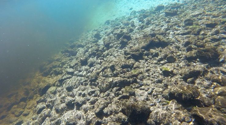
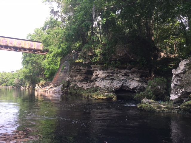
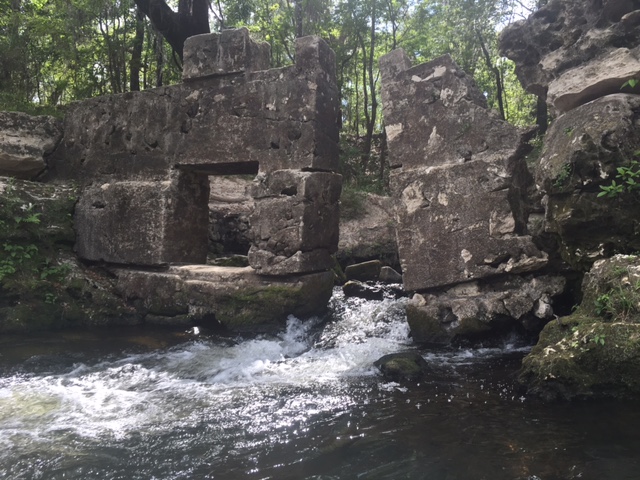
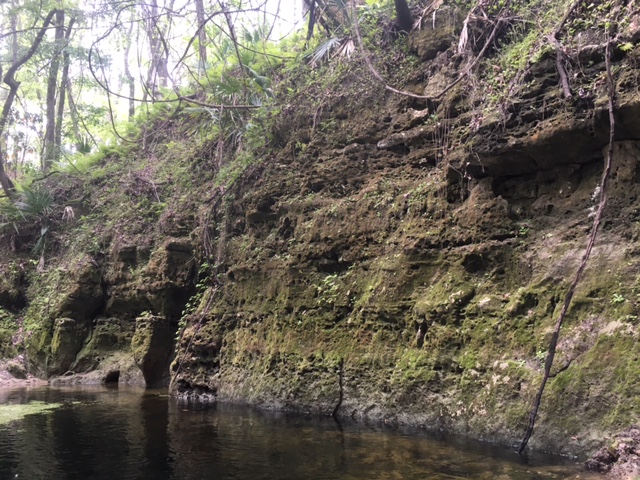
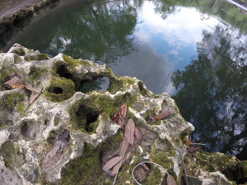
A close-up of the limestone that makes up the bridge.  Limestone is a very soft rock that erodes relatively easily in even very slightly acidic water.

The website “Florida’s Springs” describes Lafayette Blue in this way: “Lafayette Blue Springs is one of the 33 first-magnitude springs in Florida and discharges at a very variable rate, ranging from approximately 13 million to 168 million gallons per day. When the Suwannee River floods the spring vent, which happens fairly frequently, it can become a siphon”  (http://www.floridasprings.org/visit/map/lafayette%20blue%20springs/).  This siphon phenomenon occurs because the aquifer is shallow and unconfined in this portion of Florida (http://www.dep.state.fl.us/parks/planning/parkplans/LaFayetteBlueSpringsStatePark.pdf).  An aquifer is considered confined if it has a layer of relatively impenetrable clay above it.  This clay layer keeps this water separate from the surface water, so without the clay layer, the aquifer water in the vicinity of Lafayette Blue Spring may be more vulnerable to intrusion from the river.  An unconfined aquifer also would be more vulnerable to pollution from surface water.  It appears that the reversal of the Lafayette Blue Spring is a dry season phenomenon, but there were more negative values in 2015 than in any previous year.  I am not sure of the discharge on the day that I was there, but it definitely appeared discharging (rather than siphoning) due to the flow downstream.  At the mouth of the spring where it gets quite shallow, the water velocity was actually somewhat strong, and I had to paddle hard to keep myself from floating out into the river.  Usually, I like to go out into the river, but on that particular day, it was very windy and there were whitecaps out in the Suwannee, so I decided to keep my little boat in the protected valley of the spring.

Video of water rushing out of Lafayette Blue Spring.

Like the other springs that I visited on the Suwannee River, Lafayette Blue had high nitrate concentrations (2.88 mg/L) and moderate phosphate concentrations (0.05 mg/L).  Perhaps as a result of both the nutrient concentrations and the recent rain, the water clarity was not super high and my fish videos were not great.  Lafayette Blue is in a similar type of area, in terms of landuse, as the other Suwannee Springs and its nitrate and phosphate concentrations were comparable to these other springs, but its oxygen concentrations were the lowest of any spring that I have visited to date.  The highest dissolved oxygen concentration that I measured in the spring was 1.12 mg/L on the bank of the first pool in the algae.  Oddly, the oxygen was even lower in the second pool (0.66-0.83 mg/L).  By comparison, the dissolved oxygen  in Rainbow Springs ranged from 6.25 mg/L to 8.11 mg/L in January (during the slow growing season for plants and algae) and the measurements in Salt Springs ranged 3.16 mg/L to 9.98 mg/L in April.  Lafayette Blue Spring oxygen concentrations were an order of magnitude lower than these springs and the oxygen stress showed in the fish behavior.

lafayette aerial

Google Earth image of the landscape around Lafayette Blue Spring.  Like the other Suwannee Springs, Lafayette Blue sits in a landscape matrix of green corridor along the river surrounded by agricultural fields.  A large green space sits to the west of the spring, but I don’t know the size or shape of the springshed, nor do I know the pattern of flow in that springshed, other than its more superficial connection to surface water than in areas with a confined aquifer.

fish at surface

Juvenile sunfish (Lepomis sp.) breathing at the air-water interface of the first pool of Lafayette Blue Spring.  Small fish like mosquitofish (Gambusia holbrooki) often perform this behavior in low oxygen conditions, but I had not seen sunfish breathing at the surface this way.  Mosquitofish are better suited anatomically for this behavior because the top of their heads are flat.

mosquitofish

Female mosquitofish–photo by Missy Gibbs.

sunfish in second pool

Not all of the fish appeared so stressed.  This juvenile sunfish was clearly not gulping air at the surface.  The bubbles on the algae are supersaturated oxygen.  The water cannot absorb the oxygen as fast as the algae are producing it.  The string and float help me find my camera; I usually try to keep them out of the videos…

Overall, the density of fish at Lafayette Blue Spring was comparable to other springs that I visited, even with my probable low estimate due to the poor water clarity.  However, the diversity of fish was lower than any other spring that I have visited.  My diversity estimate is probably artificially low because of the water clarity issue, but I think that the diversity honestly was really low in this spring.  Low diversity would not be surprising given the low oxygen concentrations; many fish would not be able to persist at concentrations that low.

Despite the low oxygen and poor water clarity, my visit to Lafayette Blue Spring was lovely.  I stayed in one of the cabins on the property (which are very nice!) and I was able to experience the spring at dawn and dusk.  I had not realized the full extent of how peaceful a spring can be until I went down there at dawn and dusk.  I was told that the spring can get quite crowded in the summer and the reinforced wall on the side of the second pool was like an echo of summer crowds.  In a way, it made my time there all the more peaceful.

lafayette bridge

A retaining wall on the bank of the second pool keeps the many summer visitors from causing the bank to cave in.

The Suwannee River at dusk and dawn was amazing, too.

suwannee river

The Suwannee River upstream of Lafayette Blue Spring just before dusk.  I was playing with the color filters on the camera.

suwannee river at dawn

The Suwannee River downstream of the spring at dawn.  The float line represents the edge of the swimming area for the spring.